Map size in jpg-format: 27.3194MiB
Click to open in high resolution (open in new tab).
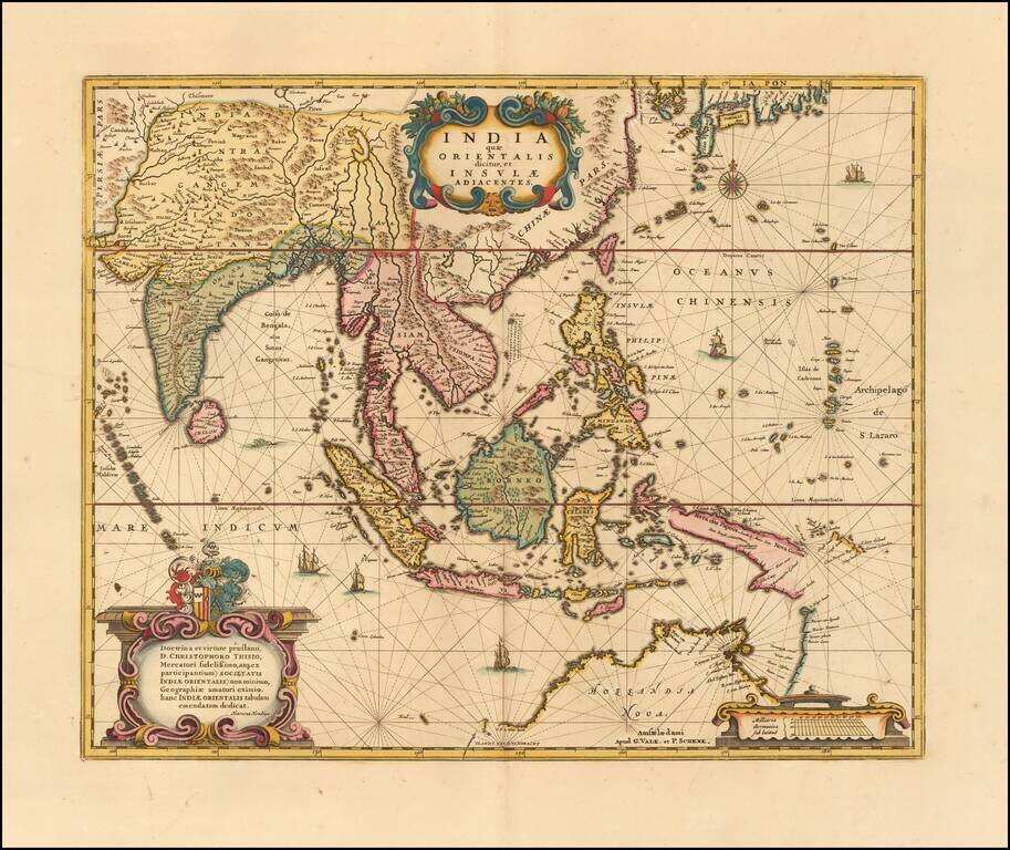
Gorgeous example Valk & Schenk's edition of Hondius' map of Southeast Asia, based upon Blaeu's map of 1635.
An important Dutch map of South East Asia, noteworthy for being the second map to include the discoveries made in New Guinea and northern Queensland, Australia by the Dutch vessel Duyfken in 1605-06. Under the command of Willem Janszoon, the Duyfken explored the eastern shore of the Gulf of Carpentaria, just below the Cape York Peninsula, a venture which was famously the first recorded European contact with Australia.
The map includes South East Asia in general with all of Malaysia, the East Indies, the Philippines, Indonesia, Indochina and southern China with the Pearl River Delta, Taiwan, and part of Japan. Richly embellished with 3 cartouches, coats of arms, 2 compass roses, a sea monster and 6 sailing vessels.
This edition is scarce on the market, this being the first example we have offered.
If you are a student, write to us in telegram: @antiquemaps and indicate what material you need and for what work you need a map in high detail. We are ready to provide material on special terms. For students only!
![[Signed Political Satire Artwork] Vietnam ... Vietnam ... Vietnam ...](/map/small/68726.jpg)
![[Martin Behaim Globe / Book] Pars Globi terrestris Ao. 1492 a Martino Behaim Equite Lusitano Norimbergae confecti Delineavit Christoph. Theoph de Murr 1778 (bound with:) Diplomatische Geschichte des Portugesischen berühmten Ritters Martin Behaims](/map/small/68828.jpg)
![Il Disegno Della Terza Parte Dell' Asia [Gastaldi's Wall Map of SE Asia with extra panels!]](/map/small/30554hbp.jpg)