Map size in jpg-format: 65.1027MiB
Click to open in high resolution (open in new tab).
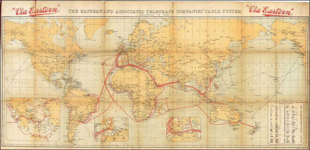
Tracing the Expansion of the Global Telecommunications Network.
Fascinating color-lithographed map, showing the coverage of the extensive submarine cable network of the Eastern and Associated Telegraphy Companies in 1926.
That company can trace its origins to the beginning of submarine cable communications in the 1860s. In 1872, the Eastern Telegraph Company was founded. In the 15 years after its creation, the company's cable length expanded from 8,860 miles to 22,400 miles. The company steadily took over a number of companies founded to connect the West Indies and South America, among them the Eastern Extension Australasia and China Telegraph Company, leading to a name change to The Eastern and Associated Telegraph Companies in 1902. Today the company is the London Stock Exchange-listed Cable & Wireless plc.
See Rumsey 8368 for the May 1922 edition, and Rumsey 13134 for the September 1914 edition. It is particularly interesting to view this map in relationship with other editions, to study the way in which cable routes expanded over time, what were the priorities of the cable companies, etc.
If you are a student, write to us in telegram: @antiquemaps and indicate what material you need and for what work you need a map in high detail. We are ready to provide material on special terms. For students only!


