
Map size in jpg-format: 92.9769MiB
Click to open in high resolution (open in new tab).
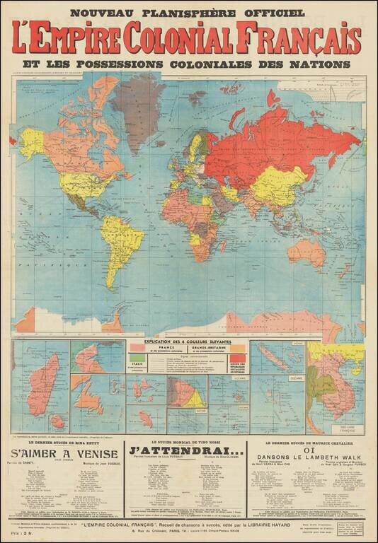
Interesting broadside map of European colonial possessions around the world. The map was published in Paris, circa 1935, as a map of the French colonial empire, but it shows all shows the colonial possessions of Great Britain, Italy, and lists the Soviet Union in the same context.
Perhaps intentionally the map represents the British colonies with almost exactly the same graphic coloration as the French colonies making it difficult to differentiate between the two - French colonies are red striped and British colonies are red striped with faint yellow stripes.
The map shows large claims in Antarctica as well as inset maps of Madagascar, La Reunion, St. Pierre et Miquelon (and surroundings), Djibouti (French Somalia), Guadeloupe, Martinique, French Guyana, Oceania (five maps showing different parts of French Polynesia), and French Indochina.
The map was available for 2 francs and contains ads for songs at the bottom of the front and on the back.
If you are a student, write to us in telegram: @antiquemaps and indicate what material you need and for what work you need a map in high detail. We are ready to provide material on special terms. For students only!


