logo

1943. Anthropogeographische Gliederung Der Erde Nach Der Kulturlandschaft (Anthropogeographic Outline of the Earth After the Cultural Landscape)

  • Anthropogeographische Gliederung Der Erde Nach Der Kulturlandschaft  (Anthropogeographic Outline of the Earth After the Cultural Landscape)

Anthropogeographische Gliederung Der Erde Nach Der Kulturlandschaft (Anthropogeographic Outline of the Earth After the Cultural Landscape) information:

Year of creation: 
Resolution size (pixels): 
 15243x10599 px
Disk Size: 
 20.6804MiB
Number of pages: 
 1
Place: 
 Gotha

Print information. Print size (Width x height in inches):
Printing at 72 dpi 
  211.71 х 147.21
Printing at 150 dpi 
 101.62 х 70.66
Printing at 300 dpi 
 50.81 х 35.33

An example of detailing the file of this map of in a printable high-resolution:

Click to open in high resolution (open in new tab).
Attention! this is just the central piece (central area 960x960 px) of the map file!
This is an example, so that you can see and study the level of detail of a given map. The entire Map will be fully available after payment!

Anthropogeographische Gliederung Der Erde Nach Der Kulturlandschaft  (Anthropogeographic Outline of the Earth After the Cultural Landscape)

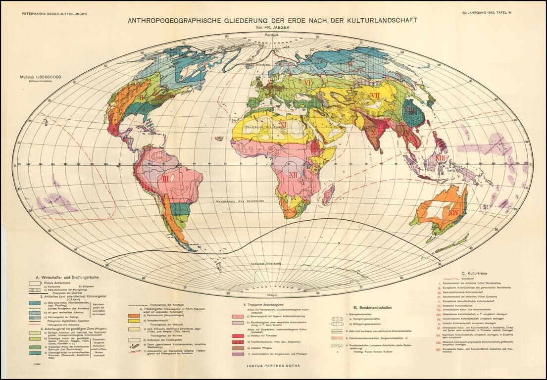
Fritz Jaeger's Anthropogeographic Outline of the Earth After the Cultural Landscape.

The world is illustrated in 3 major groups:

  • Economic and Sectarian
  • Special Landscapes -- Regions conducive to manufacturing, mining, etc.
  • Cultural Landscapes

Special conditions for students!

If you are a student, write to us in telegram: @antiquemaps and indicate what material you need and for what work you need a map in high detail. We are ready to provide material on special terms. For students only!

Item information:

Year of creation:
Size:
15243x10599 px
Disk:
20.6804MiB
Number of pages:
1
Place:
Gotha
Author:
Augustus Herman Petermann.
$14.99

Related item