

Map size in jpg-format: 8.95127MiB
Click to open in high resolution (open in new tab).

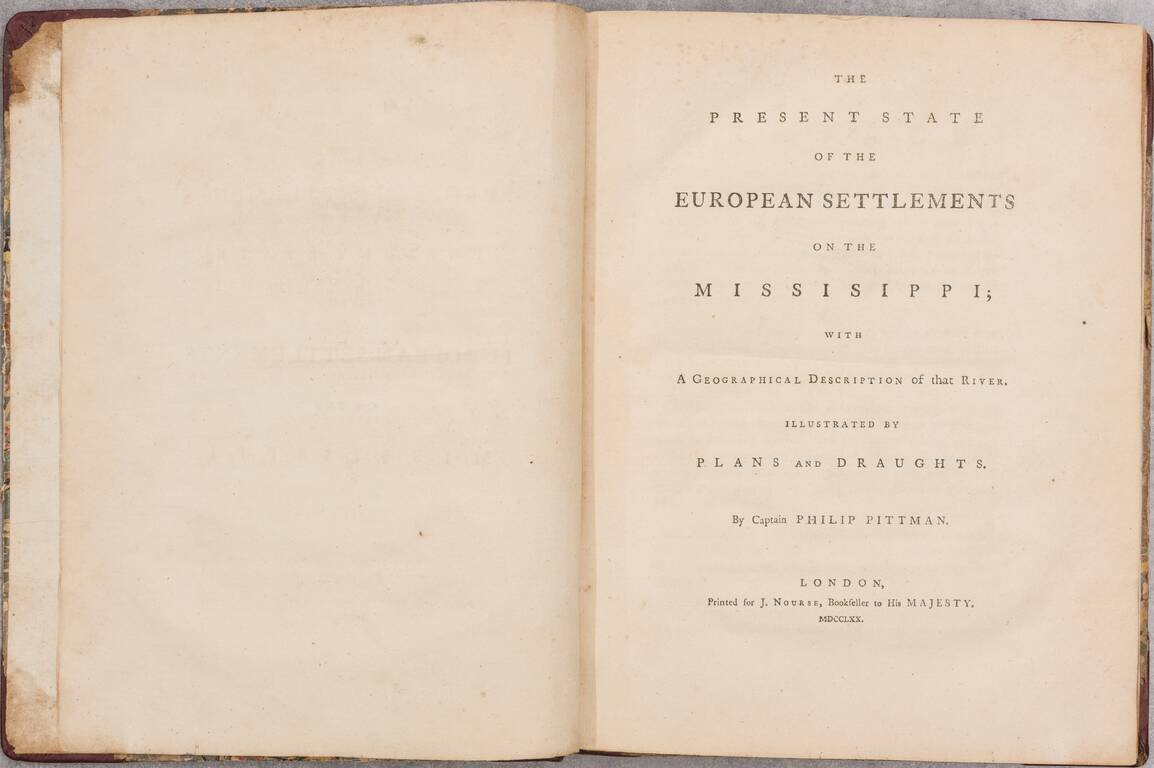
8 engraved maps (including the three sheets of the "Draught of the River Missisippi"). viii (including title and half-title), 99 pages. (Complete.)
Quarto. Half red leather over contemporary boards, rebacked and recornered.
An Exceptional Example of Pittman's Treatise on 18th-Century European Colonization of the Mississippi River.
"An unusual crisp copy of the very rare First Edition of the earliest English account of the Mississippi settlements, with eh maps and plans in immaculate condition. This work is esteemed as a source of the highest authority in early western history. The half-title is present in this copy." -- Anderson Galleries' description of this particular example of the book when it was offered for sale as lot 308 in the Library of Mr. Samuel L. Kingan, 1928.
Siebert sale: "Pittman’s book was the first English publication on the topography, settlements, and inhabitants of the Illinois country. Captain Pittman was a British army engineer who made surveying expeditions in West Florida and along the Mississippi from 1764 to 1768."
Complement of Maps
The engraved maps included in the book are detailed, authoritative, and rare; indeed, AMPR records not one of the maps as having been offered separately.
Text
Pittman's book begins with a preface, an introduction, and then proceeds in concise chapters covering locations along the Mississippi: New Orleans; River Ibbeville; Description of Massaic, Part of the River Amit, And the River Ibbeville; Pointe Coupee; Tonicas; Pelousas; Natches; Post of Arcansas; Cascasquias; La Praire de Roches; Fort Chartres; Saint Philippe; Kaoquias; Saint Louis, or Paincourt; Sainte Genevieuve, or Misere; Of the Country of the Illinois; Of the Government of the Country of Illinois When belonging to the French; Of the Inhabitants; L'Arret de la Cour Superieure de la Province; Arret of the Superior Council of the Province;
Provenance:
Pencil inscription on front pastedown reads: "Cost me $42.00 Jan 8-98-- S. L. Kingan".
Samuel L. Kingan of Tucson, Arizona, was an lawyer, artist and early Arizona patron of the arts. He was likely one of the earliest serious American book collectors in Arizona Territory. Kingan formed his collection in the late 19th and early 20th Centuries. His collection was sold in 1928 by Anderson Galleries in a single collector, multi Day Sale, with the catalog title Americana From The Library of Mr. Samuel L. Kingan, Tucson Arizona. The present example of the Pittman book was offered as Lot 308 in the 1928 Anderson Galleries sale.
Samuel Latta Kingan was born in Pittsburgh, PA in 1869 . He was a graduate of the University of Michigan School of Law, Ann Arbor. From 1894 until his death in 1943, he lived and practiced law in Tucson, Arizona.. In October 1910, he was one of five members from Pima County, Arizona, who served on the constitutional convention which drew up the state constitution under which Arizona was admitted to the Union. In addition to being a practicing lawyer, Kingan was a painter of desert, ranch, and nocturnal landscapes. In 1917 he was elected the founding president of the Tucson Art Association. In 1920 his book, The Nature of Landscape, was privately published. The March 1, 1937 edition of The Art Digest makes mention of him in an article titled "The Southwest the Tourist Seldom Sees." Samuel Latta Kingan's house, at 325 W. Franklin Street in Tucson, was built circa 1902 by Holmes and Holmes, architects. The building later served as the home of The Tucson Art Center. The Samuel Kingan Scholarship for Artistic Achievement is awarded annually to a deserving University of Arizona art program major.
If you are a student, write to us in telegram: @antiquemaps and indicate what material you need and for what work you need a map in high detail. We are ready to provide material on special terms. For students only!
![[Blaeu Atlas of America] America, Quae Est Geographiae Blavianae Pars Quinta Liber Unus Volumen Undecimum](/map/small/66852.jpg)