Map size in jpg-format: 11.1257MiB
Click to open in high resolution (open in new tab).
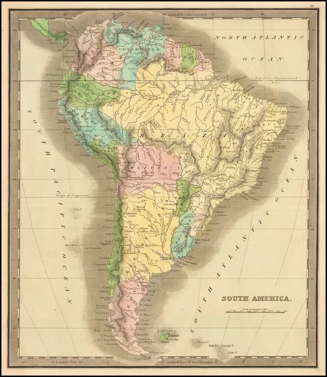
Elegantly colored map of South America, from one of the most interesting early 19th century American map publishers.
South America is depicted at the end of its Revolutionary Period, with the Spanish presence now ended. The territorial divisions include Columbia, Guiana, Portuguese Guiana extending nearly to the Pacific, Brazil, Bolivia, Peru, Paraguay, United Provinces, Chili and Patagonia. Ecuador, Venezuela and Uruguay are not yet created.
A marvelous and very attractive map.
If you are a student, write to us in telegram: @antiquemaps and indicate what material you need and for what work you need a map in high detail. We are ready to provide material on special terms. For students only!


![[Signed Political Satire Artwork] Vietnam ... Vietnam ... Vietnam ...](/map/small/68726.jpg)