Map size in jpg-format: 23.5527MiB
Click to open in high resolution (open in new tab).
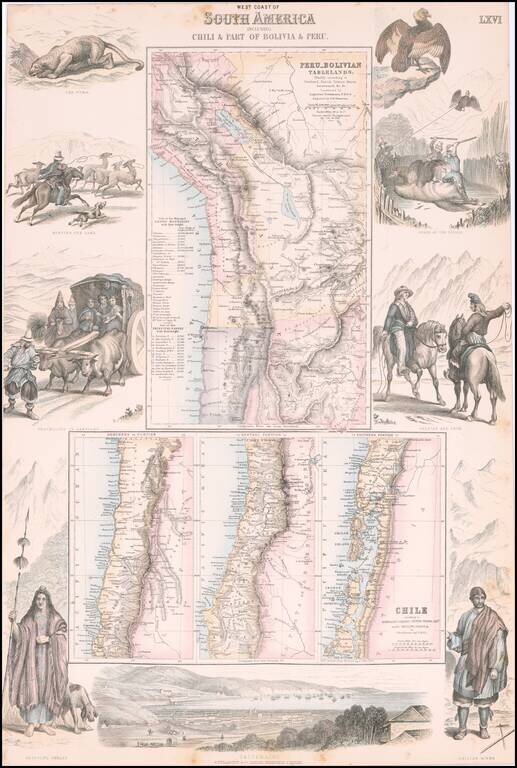
Decorative regional map of South America, which consists of 4 maps (the upper map showing Peru and the Bolivian Table Lands and the lower 3 maps showing Chile, each in excellent detail).
Includes a birdseye view of Valparaiso at the bottom and costumed figures and vignettes on the sides.
If you are a student, write to us in telegram: @antiquemaps and indicate what material you need and for what work you need a map in high detail. We are ready to provide material on special terms. For students only!


![[Signed Political Satire Artwork] Vietnam ... Vietnam ... Vietnam ...](/map/small/68726.jpg)