logo

1857. Nouvelle Carte Illustree De L'Amerique Du Sud Indiquant Les Grandes Divisions Physiques, La Distribution Geographique Des Vegetaux Et Mineraux . . . 1857

  • Nouvelle Carte Illustree De L'Amerique Du Sud Indiquant Les Grandes Divisions Physiques, La Distribution Geographique Des Vegetaux Et Mineraux . . . 1857

Nouvelle Carte Illustree De L'Amerique Du Sud Indiquant Les Grandes Divisions Physiques, La Distribution Geographique Des Vegetaux Et Mineraux . . . 1857 information:

Year of creation: 
Resolution size (pixels): 
 3139x2318 px
Disk Size: 
 1.73721MiB
Number of pages: 
 1
Place: 
 Paris
Author: 

Print information. Print size (Width x height in inches):
Printing at 72 dpi 
  43.6 х 32.19
Printing at 150 dpi 
 20.93 х 15.45
Printing at 300 dpi 
 10.46 х 7.73

An example of detailing the file of this map of in a printable high-resolution:

Click to open in high resolution (open in new tab).
Attention! this is just the central piece (central area 960x960 px) of the map file!
This is an example, so that you can see and study the level of detail of a given map. The entire Map will be fully available after payment!

Nouvelle Carte Illustree De L'Amerique Du Sud Indiquant Les Grandes Divisions Physiques, La Distribution Geographique Des Vegetaux Et Mineraux . . . 1857

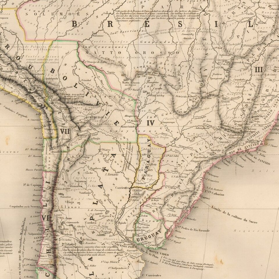
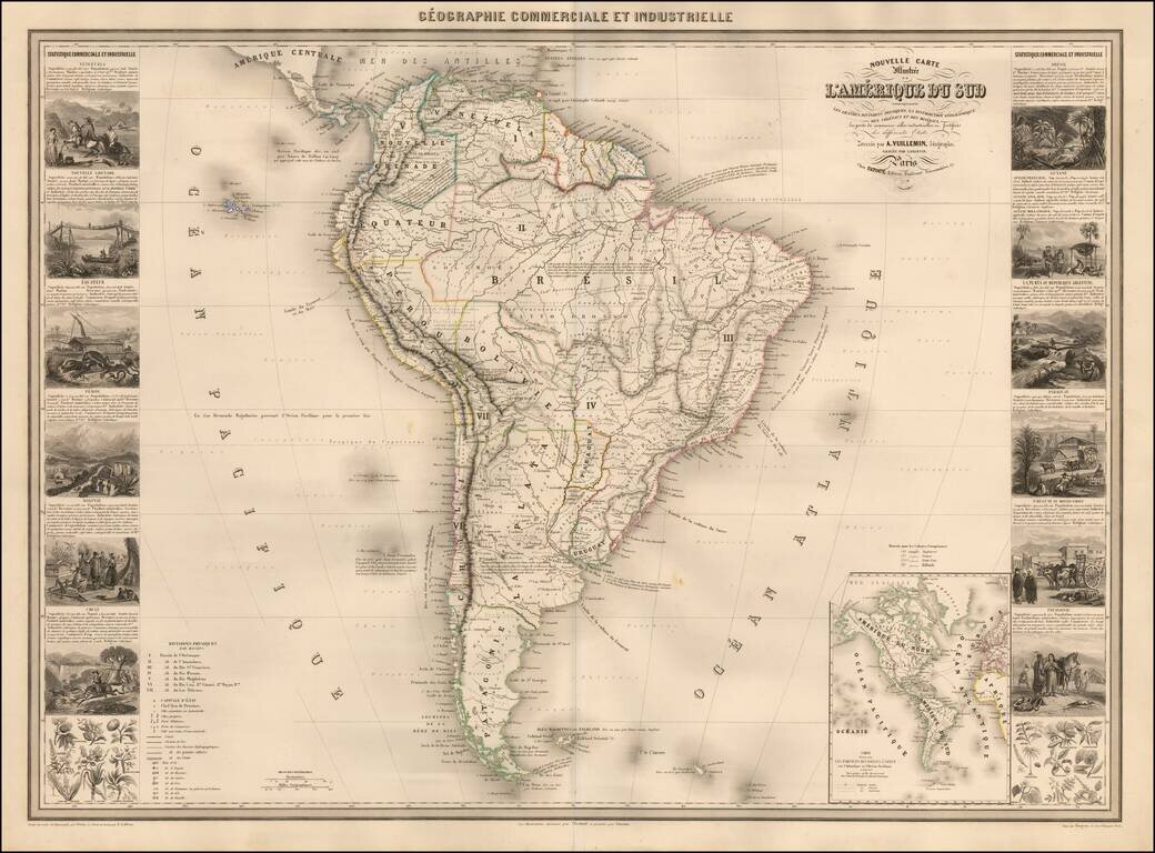
Scarce decorative map of South America, published in Paris by Vuillemin.

The map includes 14 decorative side panel vignettes showing indigenous scenes in America, flora and fauna.

The map provides a fine large format depiction of South America in the middle of the 19th Century.


Special conditions for students!

If you are a student, write to us in telegram: @antiquemaps and indicate what material you need and for what work you need a map in high detail. We are ready to provide material on special terms. For students only!

Item information:

Year of creation:
Size:
3139x2318 px
Disk:
1.73721MiB
Number of pages:
1
Place:
Paris
Author:
Alexandre Vuillemin.
$14.99

Related item