Map size in jpg-format: 69.8045MiB
Click to open in high resolution (open in new tab).
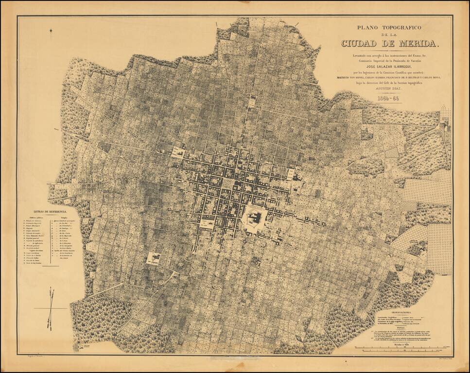
Fine photo-lithographic reproduction of Augustin Diaz's rare plan of Merida, originally published in Paris in 1865 for the Comision Cientifica.
The map notes at the bottom center (obliterated on this copy) that it was reproduced by the Engineer Enrique A. Cervantes in 1945. Cervantes (1898-1953) was and engineer, historian, bibliophile, editor, draftsman, photographer, restorer and art researcher. The present map was almost certainly created in conjunction with his Bosquejos sobre el desarrollo de las ciudad de Mérida, issued in 1945, published shortly after the quadricentennial of the founding of Merida.
If you are a student, write to us in telegram: @antiquemaps and indicate what material you need and for what work you need a map in high detail. We are ready to provide material on special terms. For students only!


![Map of Mexico, Central America, and the West Indies [Insets of Bermuda, Sandwich Islands, Jamaica and Panama Railroad]](/map/small/69133.jpg)