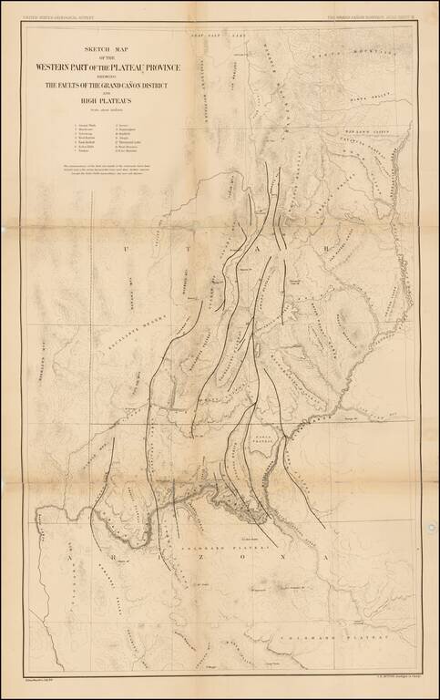
Finely detailed map of parts of Arizona and Utah, which appeared in the United States Geological Survey's At las To Accompany The Monograph On The Tertiary History Of The Grand Canon District By Capt. Clarence E. Dutton. The map provides a finely...
Finely detailed map of parts of Arizona and Utah, which appeared in the United States Geological Survey's At las To Accompany The Monograph On The Tertiary History Of The Grand Canon District By Capt. Clarence E. Dutton. The map provides a finely...
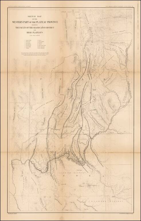
Scarce regional map of the region extending from Yuma and the Colorado River to Oatman Flat, which at the time was the site of a proposed reservoir. The map was prepared by the Citizens Executive Committee on a proposed reservoir and irrigation of Yuma...
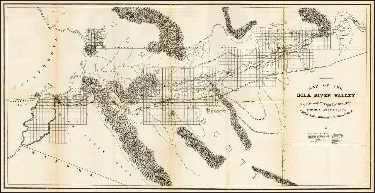
Scarce map of the Golden Rule Mine, located in the Eureka Mining District, one of the most active mining regions of the period. The map was prepared by T.J. Read, who was working both in the private trade and as deputy surveyor for the United States.
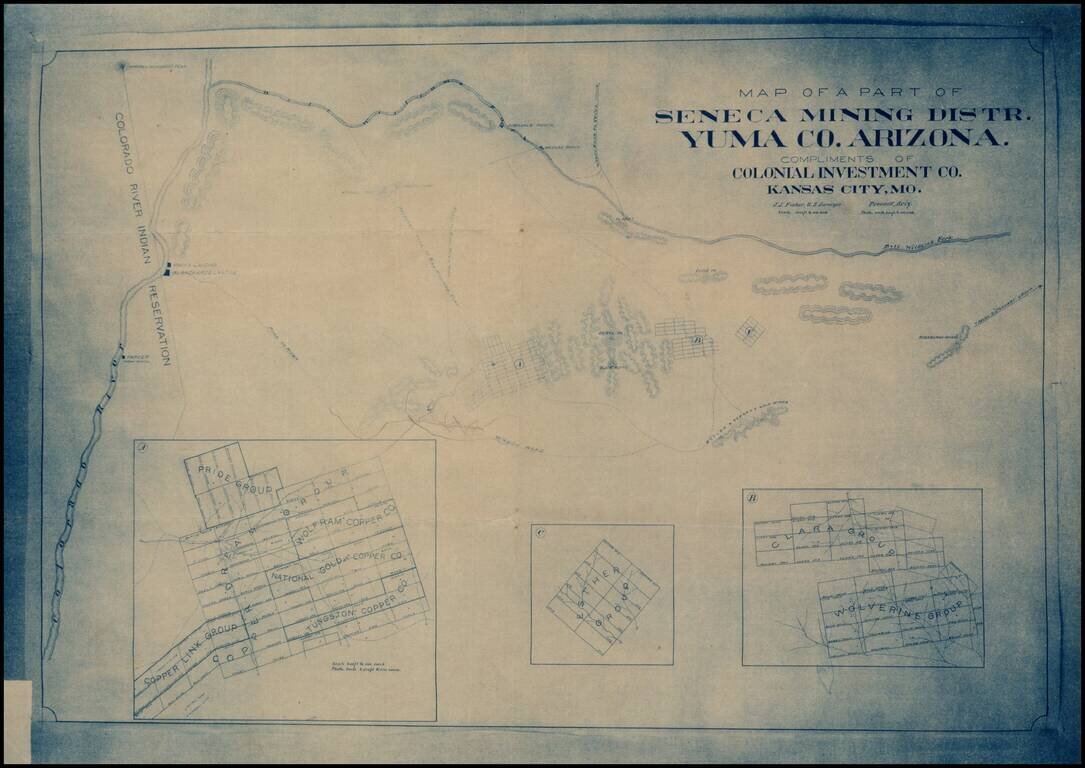
Early blueprint copy of part of the Seneca Mining District in Yuma County, showing the lands south of the Bill Williams Fork and east of the Colorado River.
![[Maricopa County, Arizona Territory] Mineral Survey No. 1568 -- Gila Land District -- Plat of the Claim of I. Parker Lawton . . . In Superstition Mining District, Maricopa Counbty Arizona . . . 1902 [2 sheets]](/map/small/16562.jpg)
Two sheet plat map showing Lawton's claims located in the Fairstake, Sun Set, Black Hawk, May Day, and Queen Lil, in Maricopa County, Arizona Territory. Includes notes on the dates the original mining claims were established, details on the number of...
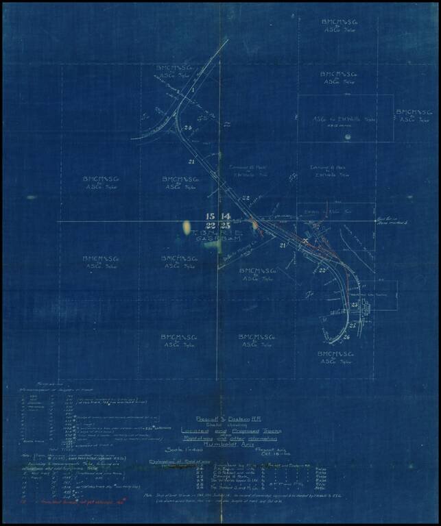
Internal working Sketch map showing the existing and proposed routes of the Prescott & Eastern Railroad in the vicinity of Humboldt, Arizona, prepared on October 18, 1905. Most of the land in the areas is showns as being owned by E.W. Wells and...
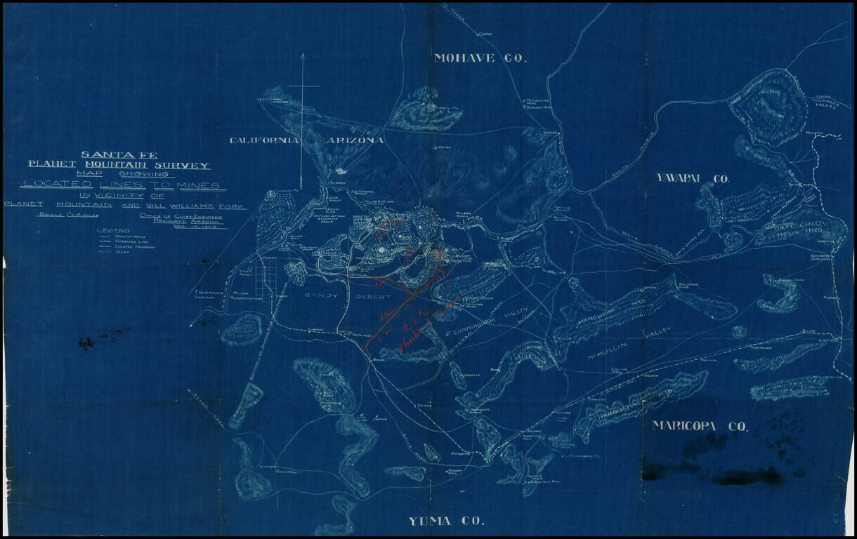
Detailed blue print map of southwestern Arizona, focusing in on the lines of transportation to the mining regions around Planet Mountain and Bill Williams Fork, prepared by the Atchison Topeka & Santa Fe Railroad in 1908. The map includes parts of...
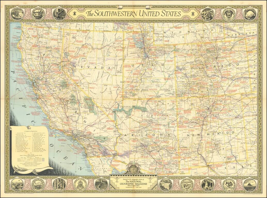
Nice vintage pictorial map of the American Southwest issued by the National Geographic Magazine in 1940. The map itself is filled with an immense amount of information, including historical notes in red. The borders feature important scenes from the...
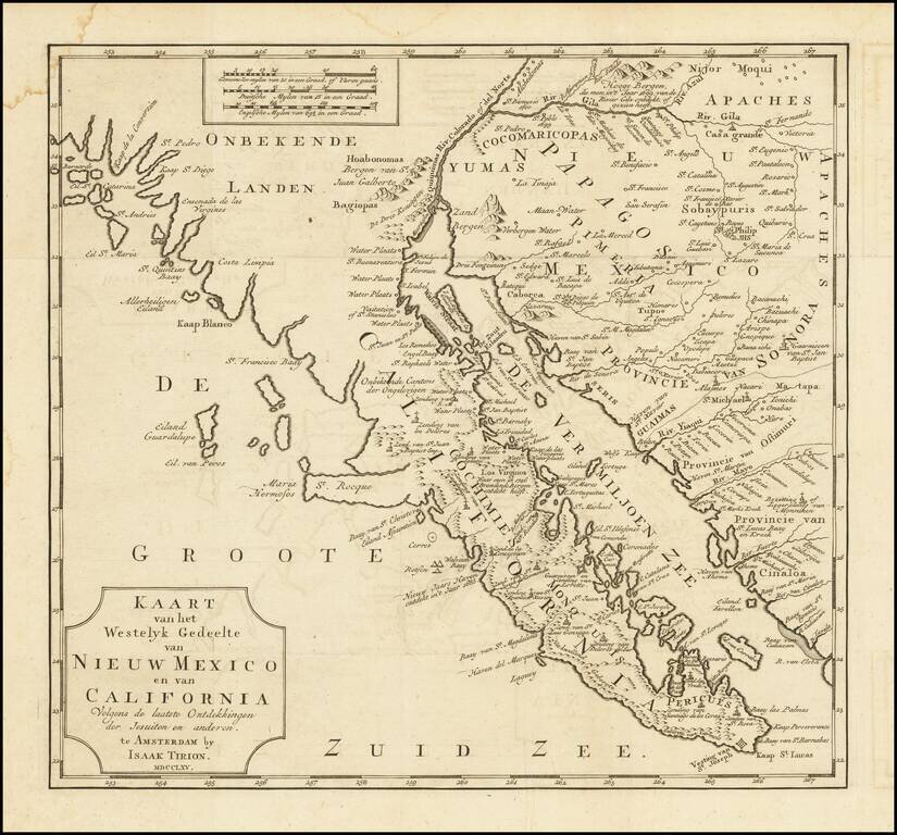
One of the Earliest Obtainable Maps of Southern California and Baja California Fine old color example of this early map of Baja California and parts of Alta California, Arizona and Sonora. Isaac Tirion's map of Baja California is one of the best...
![[Southern California, Arizona, Baja & Sonora] Amer. Sep. No. 53 Partie De La Vielle Californie](/map/small/47400.jpg)
Early mapping of Southern California, southwestern Arizona, northern Baja California and Sonora, published in Brussels. The California Coastline is shown from San Juan Capistrano in the north to the Bay of San Francisco in Baja Norte, centered on San...
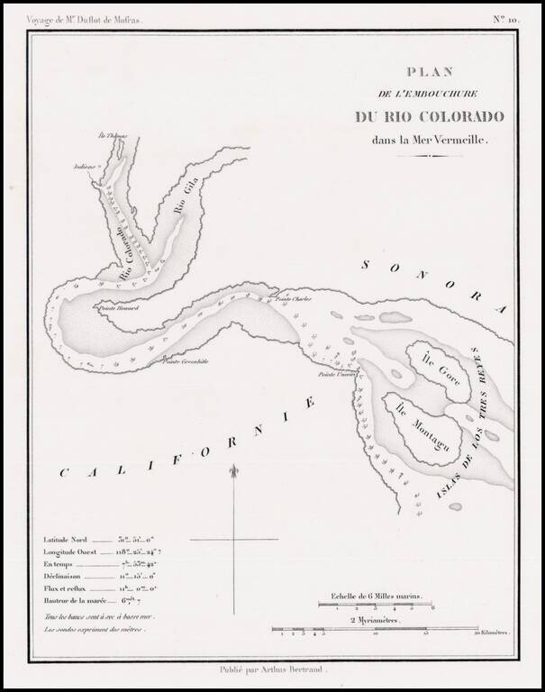
Rare early map showing the confluence of the Gila River and the Colorado River, along with the Northern tip of the Gulf of California, then also known as the Red Sea, because of the color of the water which flowed from the Rio Colorado (Red River) into...

The Second Issue of Fremont's Map of the West--Issued Following the Discovery of Gold in California Nice example of Fremont's seminal map of the West, which focuses on California, Arizona, Utah and Nevada. Wheat dedicates 13 pages and 2...
A cornerstone map, exceptionally detailed and showing many routes and places of interest in the settlement of the American West. This map was published several times from the mid-1850s through the 1870s. This map shows Fremont's 1844 and 1845 routes,...
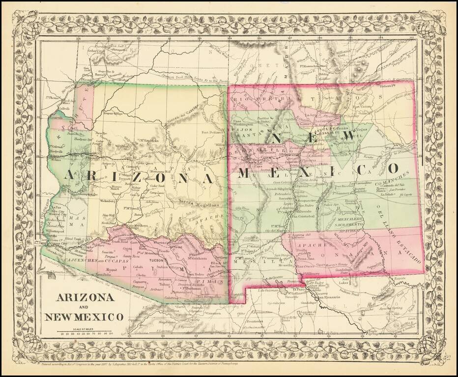
Attractive regional map of New Mexico and Arizona, colored by counties with beautiful decorative border. Shows towns, roads, railroads and rivers. This is a period when western county and state borders were rapidly evolving, such that each year holds...
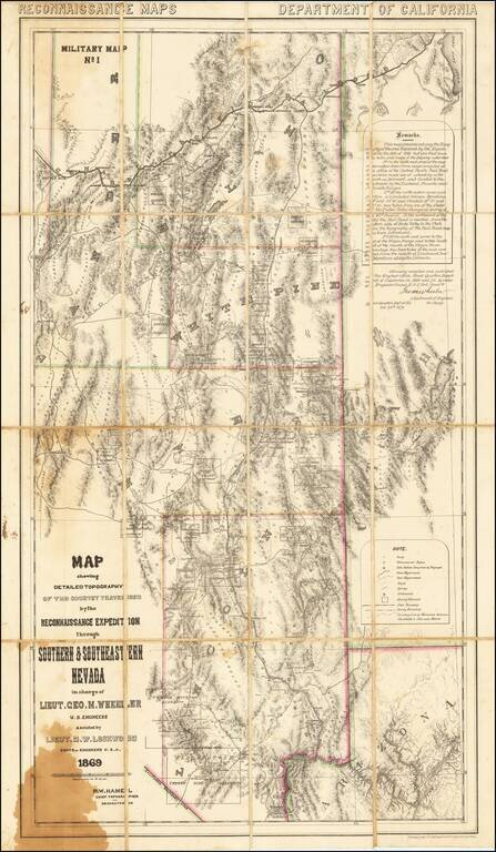
A Nevada & Grand Canyon Rarity -- The Foundation Map for Southern Nevada A remarkable map of the Eastern Half of Nevada, including Las Vegas, the Grand Canyon, Great Salt Lake and Sevier Lake (then called Preuss Lake), being the first scientific...