logo

1905. Prescott and Eastern R.R. Sketch showing Located and Proposed Tracks also Right of way and other information. Humboldt, Ariz. . . .

  • Prescott and Eastern R.R. Sketch showing Located and Proposed Tracks also Right of way and other information.  Humboldt, Ariz. . . .

Prescott and Eastern R.R. Sketch showing Located and Proposed Tracks also Right of way and other information. Humboldt, Ariz. . . . information:

Year of creation: 
Resolution size (pixels): 
 3688x4406 px
Disk Size: 
 2.18098MiB
Number of pages: 
 1
Place: 
 Prescott, AZ
Author: 

Print information. Print size (Width x height in inches):
Printing at 72 dpi 
  51.22 х 61.19
Printing at 150 dpi 
 24.59 х 29.37
Printing at 300 dpi 
 12.29 х 14.69

An example of detailing the file of this map of in a printable high-resolution:

Click to open in high resolution (open in new tab).
Attention! this is just the central piece (central area 960x960 px) of the map file!
This is an example, so that you can see and study the level of detail of a given map. The entire Map will be fully available after payment!

Prescott and Eastern R.R. Sketch showing Located and Proposed Tracks also Right of way and other information.  Humboldt, Ariz. . . .

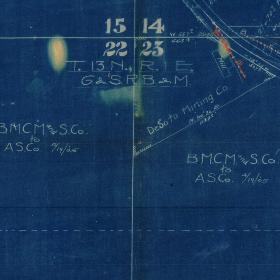
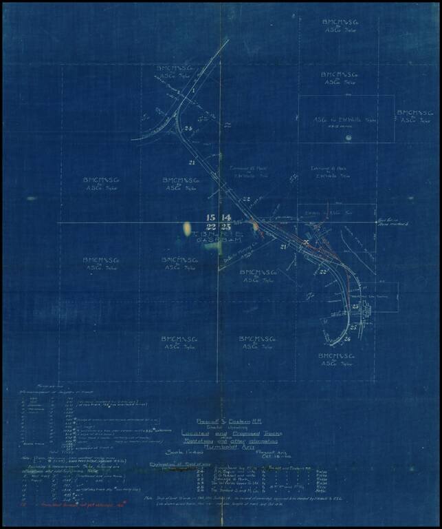
Internal working Sketch map showing the existing and proposed routes of the Prescott & Eastern Railroad in the vicinity of Humboldt, Arizona, prepared on October 18, 1905.

Most of the land in the areas is showns as being owned by E.W. Wells and the AS Co. The Wells Mill Site is located, as is an abandoned trunk of rail near the Agua Fria River.

The lands of the De Soto MIning Co. are also shown.


Special conditions for students!

If you are a student, write to us in telegram: @antiquemaps and indicate what material you need and for what work you need a map in high detail. We are ready to provide material on special terms. For students only!

Item information:

Year of creation:
Size:
3688x4406 px
Disk:
2.18098MiB
Number of pages:
1
Place:
Prescott, AZ
Author:
Santa Fe Railroad.
$14.99

Related item