Map size in jpg-format: 2.82272MiB
Click to open in high resolution (open in new tab).
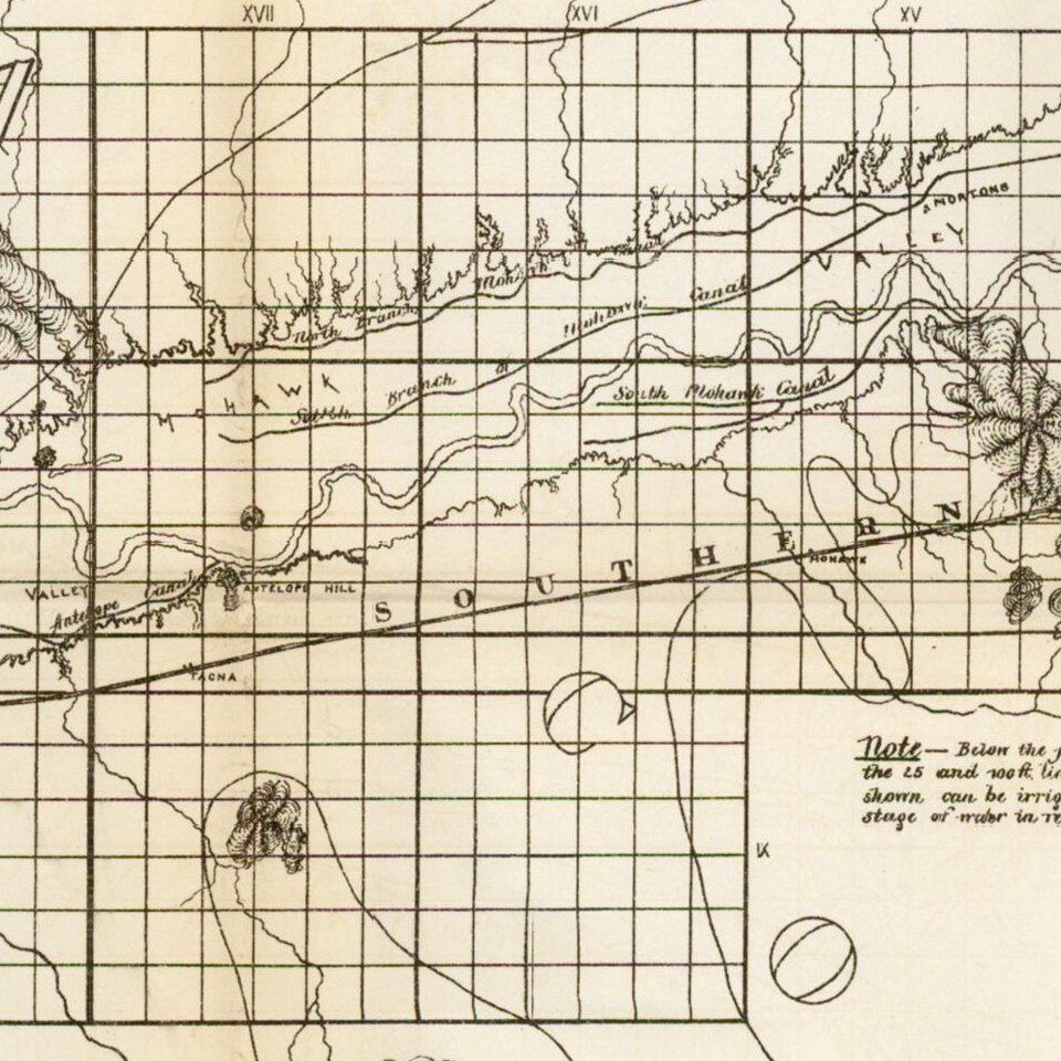
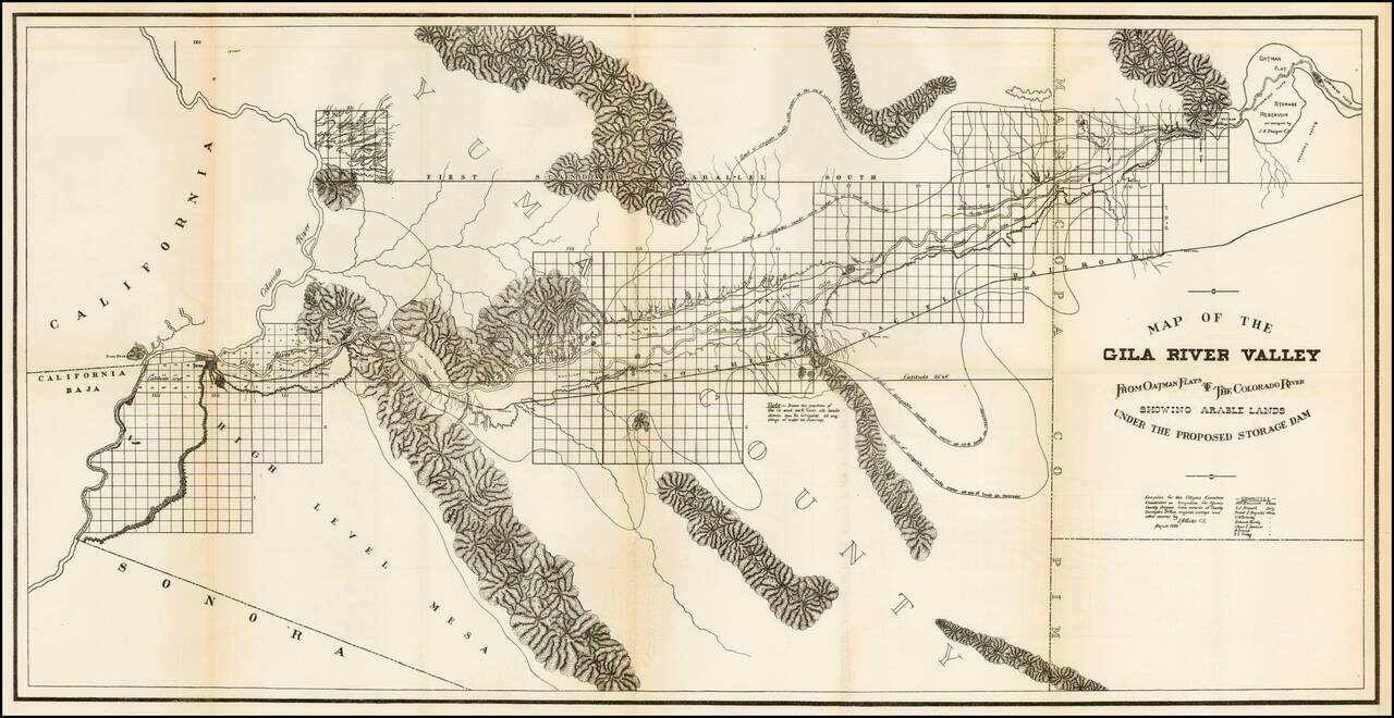
Scarce regional map of the region extending from Yuma and the Colorado River to Oatman Flat, which at the time was the site of a proposed reservoir.
The map was prepared by the Citizens Executive Committee on a proposed reservoir and irrigation of Yuma County, in August, 1889. Terrific detail along the Gila River including surveyed townships and topography. Lines show the limits of irrigated lands at different water levels in the proposed reservoir.
A rare and fascinating piece of Arizona history.
If you are a student, write to us in telegram: @antiquemaps and indicate what material you need and for what work you need a map in high detail. We are ready to provide material on special terms. For students only!
![Carte Du Mexique et de la Floride des Terres Angloises et des Isles Antilles du Cours et des Environs de la Riviere Mississipi . . . Rue Des Canettes . . . 1703 [1st State]](/map/small/66307op.jpg)