Map size in jpg-format: 3.6532MiB
Click to open in high resolution (open in new tab).
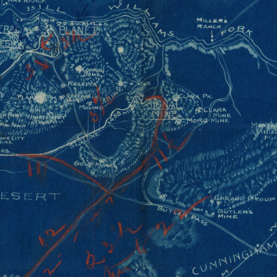
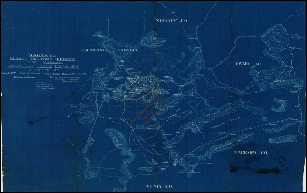
Detailed blue print map of southwestern Arizona, focusing in on the lines of transportation to the mining regions around Planet Mountain and Bill Williams Fork, prepared by the Atchison Topeka & Santa Fe Railroad in 1908.
The map includes parts of Mojave County, Yuma County, Yavapai County & Maricopa County, focusing on topographical details, mines, wagon roads, existing and proposed railroad lines, reservoirs, ranches and local Indian Reservations. The map extends from the Colorado River and Parker, Arizona in the west to the area just west of Prescott and Phoenix.
The map was produced at the height of the Copper Mining boom in the region. In both Mohave and Yuma counties, there are rich deposits of copper. In the Bill Williams Fork district, the Planet mine produced a significant amount of copper ore. At the time, the Santa Fe Railroad was actively adding lines to the region to support the mining boom.
Bill Williams Fork is named for the legendary western trapper, guide and trader Bill Williams, who made several expeditions down the River in the 1830s from Colorado.
If you are a student, write to us in telegram: @antiquemaps and indicate what material you need and for what work you need a map in high detail. We are ready to provide material on special terms. For students only!
![Carte Du Mexique et de la Floride des Terres Angloises et des Isles Antilles du Cours et des Environs de la Riviere Mississipi . . . Rue Des Canettes . . . 1703 [1st State]](/map/small/66307op.jpg)