
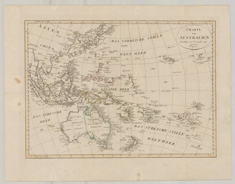
Rare Separately Issued Example of the Entrecasteaux-eautemps-Beaupre Chart of Australia, New Zealand, etc. Remarkable sea chart of Australia, New Zealand and contiguous regions, extending to Borneo, Mindanao and the Straits of Malacca. Unlike most...
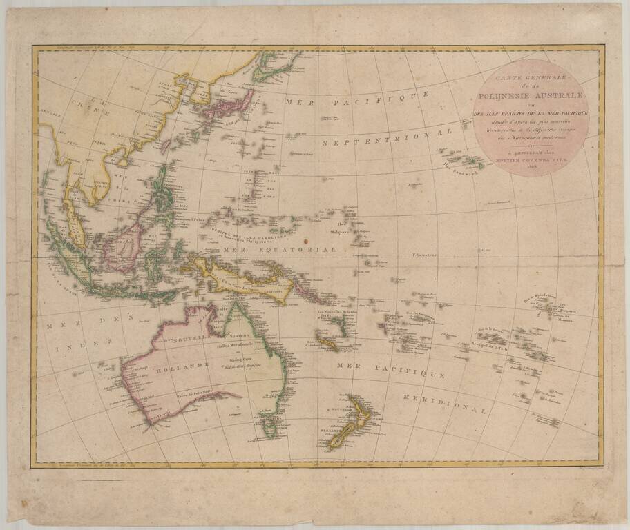
Scarce chart of the Western Pacific Ocean, published by Mortier, Covens & Fils. The map is based on Johann Matthias Christoph Reinecke's 1801 map of the region, which was the first German map to depict Tasmania as a separate island. The Mortier...
Fine map of Oceana, issued shortly after Krusenstern's voyage to the region. Includes a reference to Australia as Ulimaroa and many other early annotations and place names. Australia is shown as divided between New South Wales and New Holland. The...
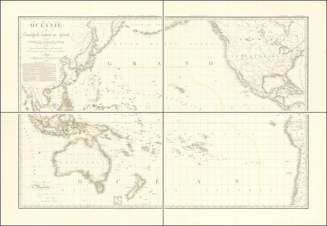
Stunning, Large-Format Map of the Pacific, the Origin of the Toponym Oceania Fine example of A.H. Brué's four-sheet map of the Pacific Ocean, first published in Paris in 1814 and here updated to 1817. The title in the upper left corner indicates...
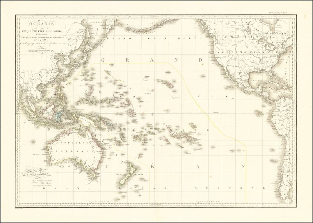
Striking Map of the Pacific, the Origin of the Toponym Oceania Fine example of A.H. Brué's distinctive map of the Pacific Ocean, first published in Paris in 1814 and here updated to 1816. The title in the upper left corner indicates that this map...
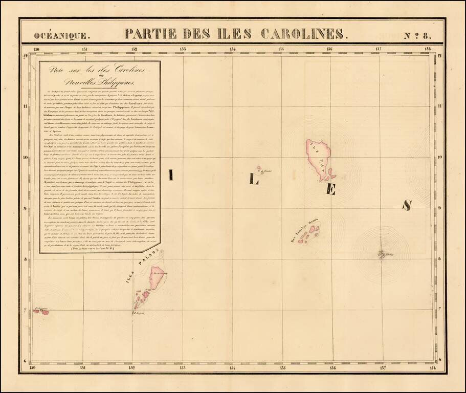
Highly detailed map showing Yap, Palao and neighboring islands. A rare map to focus on this region. A nice example of this early and highly detailed regional map. From Vandermaelen's remarkable 6 volume atlas, which if combined as globe gores forms...
![[Okeania] (Greek)](/map/small/41765.jpg)
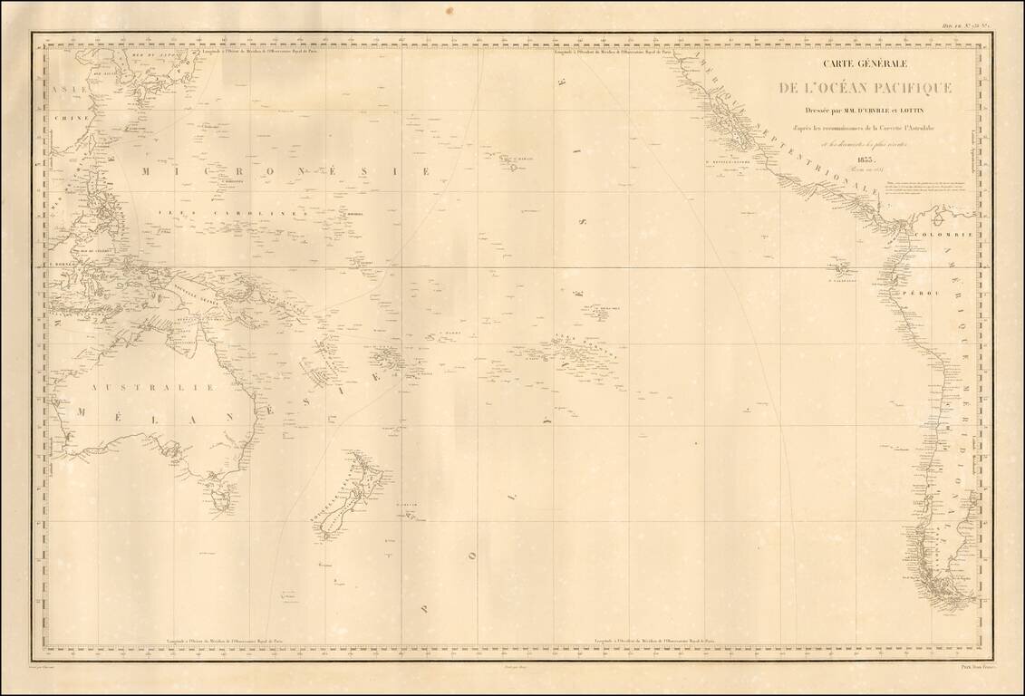
Fine separately published example of Dumont D'Urville's fine map of the Pacific, based upon his explorations. The map details the regions explored by the Astrolabe, under Dumont D'Urville's command. Rear Admiral Jules Sébastien César Dumont...
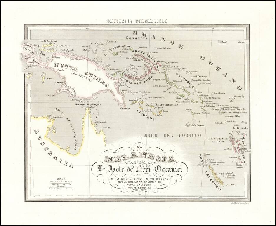
Rare map of New Guinea, the Solomon Islands, New Caledonia, the New Hebrides and the Gulf of Carpentaria, from Marmocchi's rare Geografia Commerciale.
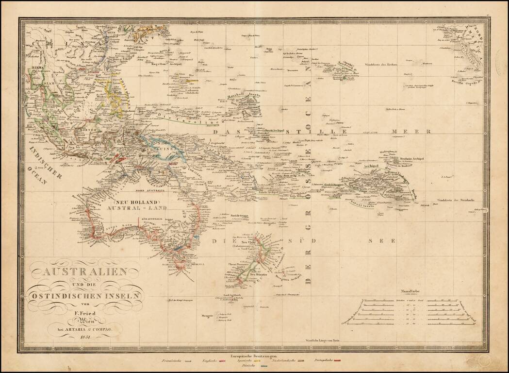
Rare regional map of Oceana, published in Vienna. The map identifies the various colonial possessions of the French, English, Spanish, Dutch, Portugese and Danish in Southeast Asia and the Pacific.
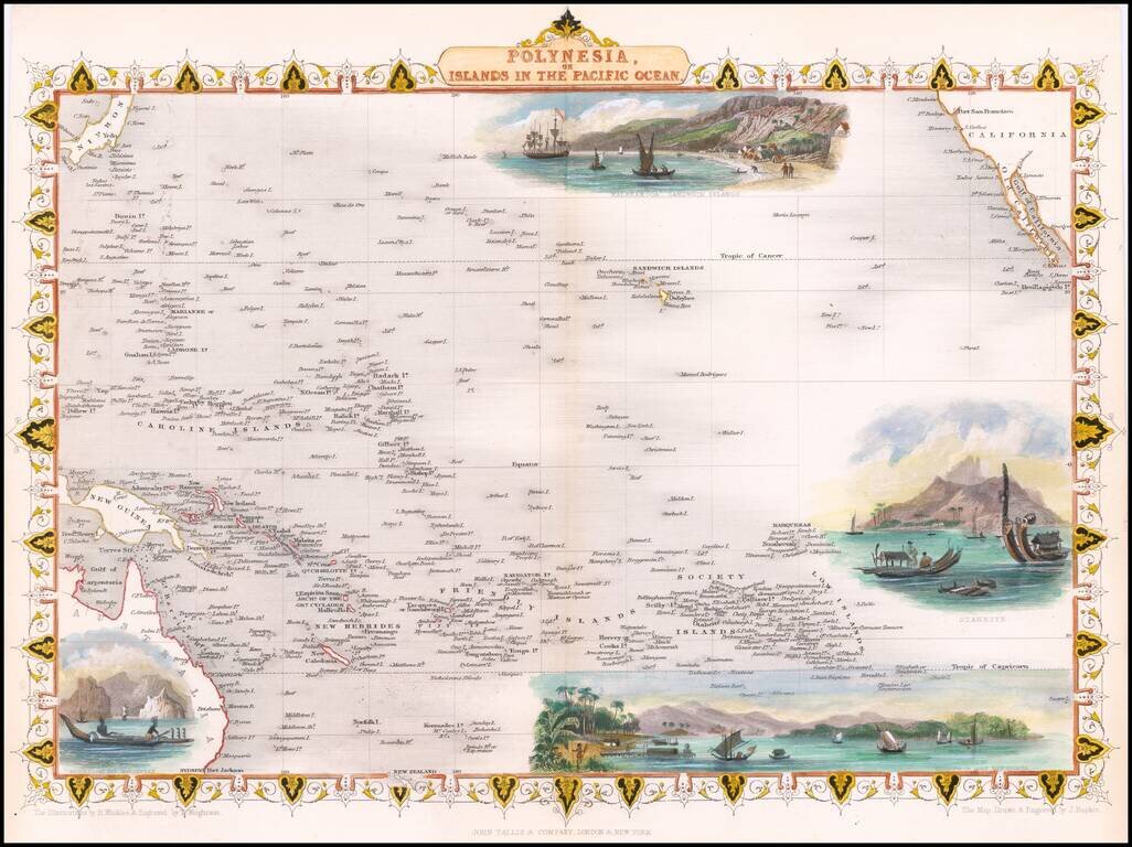
Nice full color example of John Tallis' map of the South Pacific. The map includes large vignettes of Kalakakooa Sandwich Islands, Otaheite, the Harbour of Dory in New Guinea and Resolution Bay, Marquesas. Engraved for R. Montgomery Martin's...
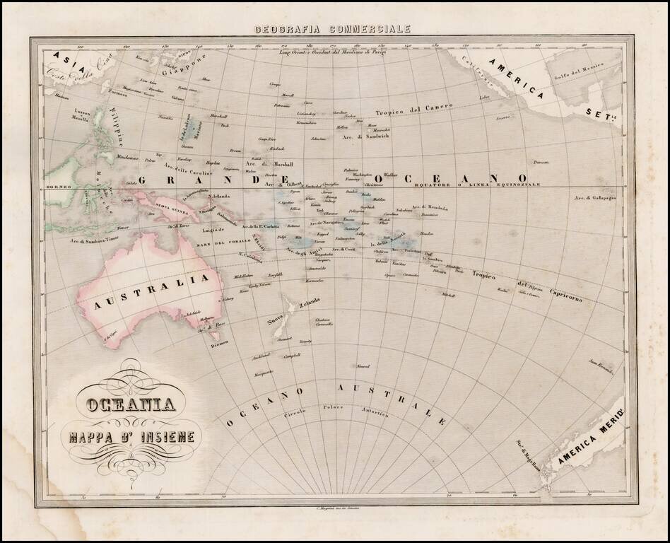
Interesting map of Oceana and the South Pacific, from Marmocchi's scarce Geografia Commerciale. The south polar of Antarctic is just beginning to be discovered. A very unique map.
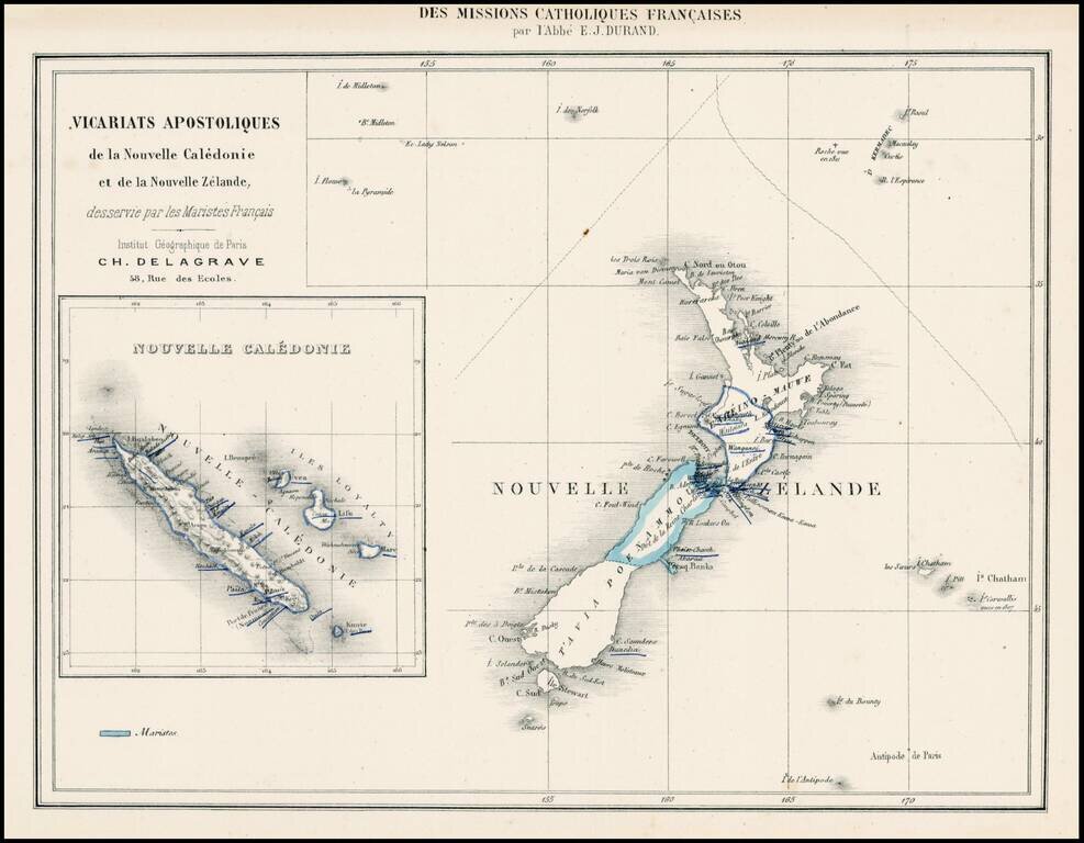
Rare map showing the Franch Marist Missionaries activities in New Zealand and New Caledonia.
![Map of Mexico, Central America, and the West Indies [Insets of Bermuda, Sandwich Islands, Jamaica and Panama Railroad]](/map/small/69133.jpg)
Attractive map of Mexico, the Caribbean and the Gulf Coast, published by SA Mitchell Jr. Includes large insets of Cuba, Bermuda, Jamaica, and the Isthmus of Panama and a small inset of Jamaica. Shows shipping routes from New Orleans to points...
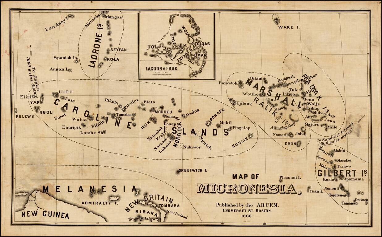
Rare map of Micronesia, published by the American Board of Commissioners for Foreign Missions in Boston. The American Board of Commissioners for Foreign Missions (ABCFM) was the first American Christian missionary organization. It was created in 1810...

Rare map showing the Catholic Missions on New Zealand, the Hawaiian Islands, Tahiti, Samoa, Tonga, New Caledonia, New Hebrides, Fijian Islands, the Marquesas, and a number of other islands, with a general map in the center, published as a Supplement to...