Map size in jpg-format: 3.89052MiB
Click to open in high resolution (open in new tab).
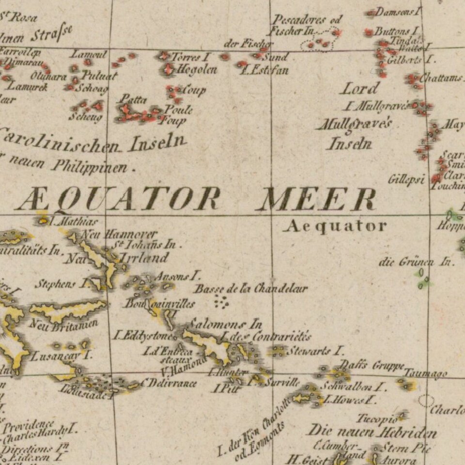
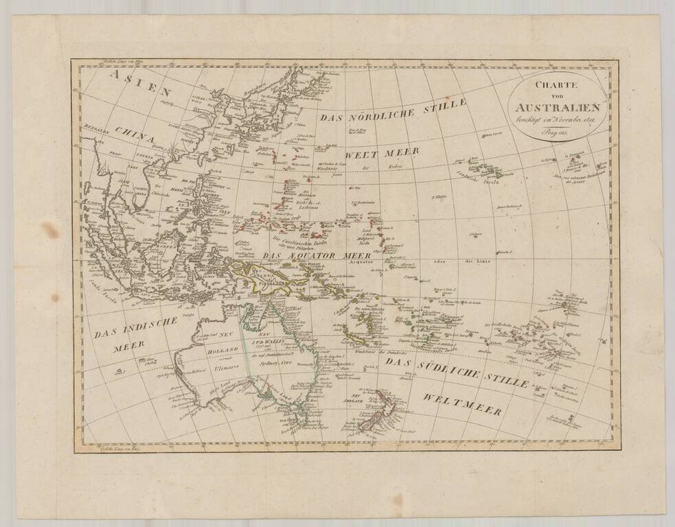
Fine map of Oceana, issued shortly after Krusenstern's voyage to the region.
Includes a reference to Australia as Ulimaroa and many other early annotations and place names.
Australia is shown as divided between New South Wales and New Holland.
The name Ulimaroa for Australia was first used by Djurberg, in his Cosmographie samt Beskriftning om Jorden i Allma¨nhet ('Cosmography and General Description of the Earth'), Djurberg provides the following explanation for using the name Ulimaroa for Australia:
On page 436 of Hawkesworth's account of Cook's first voyage, Ulimaroa is mentioned as the biggest island in the world. I should give a reason for this name. This land is called New Holland in a lot of maps, but for what reason I do not know; there is no similarity between Holland in Europe and this land, neither in size nor in the area's character. You find in the account of the famous English sailor Cook's journeys that when he was on the northern coast of New Zealand, he asked the inhabitants there if they knew any other country, to which they replied that to the north-west of their home, a quite large land was located, which they called Ulimaroa. I have decided to maintain this name as given to this land by its neighbours; besides it is better than New Holland.
Johann Christoph Matthias Reinecke (1768-1818) was a German scientist. He worked in a variety of fields, most notably cartography and paleontology. A true polymath, he spoke eight languages and also wrote poems and songs. He produced a variety of maps in his career, including a series for the Geographical Institute in Weimar.
If you are a student, write to us in telegram: @antiquemaps and indicate what material you need and for what work you need a map in high detail. We are ready to provide material on special terms. For students only!
![[Martin Behaim Globe / Book] Pars Globi terrestris Ao. 1492 a Martino Behaim Equite Lusitano Norimbergae confecti Delineavit Christoph. Theoph de Murr 1778 (bound with:) Diplomatische Geschichte des Portugesischen berühmten Ritters Martin Behaims](/map/small/68828.jpg)
