![[Allegorical Map of Love!] Representation Symbolique et ingenieuse projettée en Siege et en Bombardement, comme il faut empecher prudemment les attaques de L'amour.](/map/small/64005.jpg)
Famous hand-colored engraved allegorical map, representing the battle for the heart. This is a wonderful and scarce allegorical map representing the trials and tribulations of romantic entanglement, published by one of Germany's greatest mapmakers of...
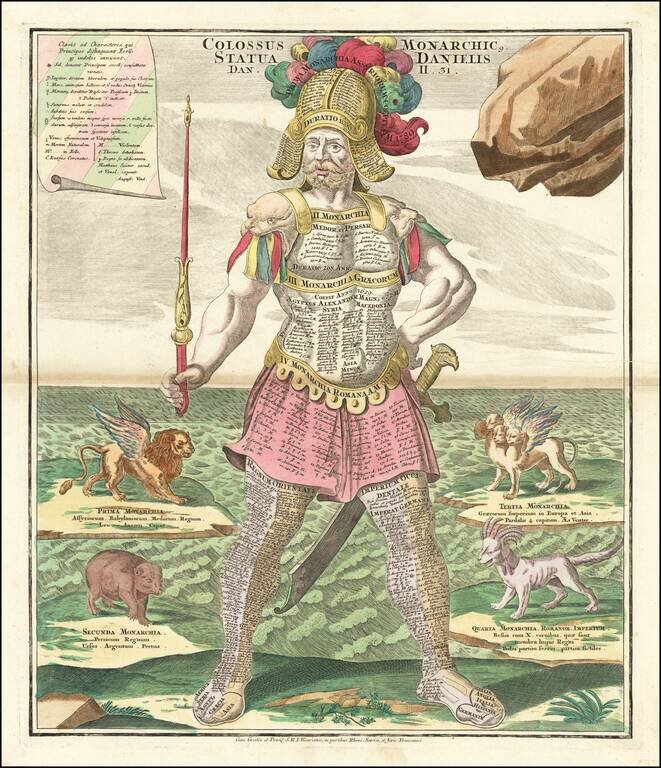
Striking example of Seutter's figure of Colossus, with sword and scepter, representing Daniel's interpretation of King Nebuchadnezzar's dream (Dan. 2:39-40). History's great empires are engraved on the breastplate; Oriental empires on the left leg,...

This is an unusual thematic chart shows the traveling distances from various European cities in a style that is still used today. Several similar charts were made during this time, but this one gives a very large number of combinations, some nearly...
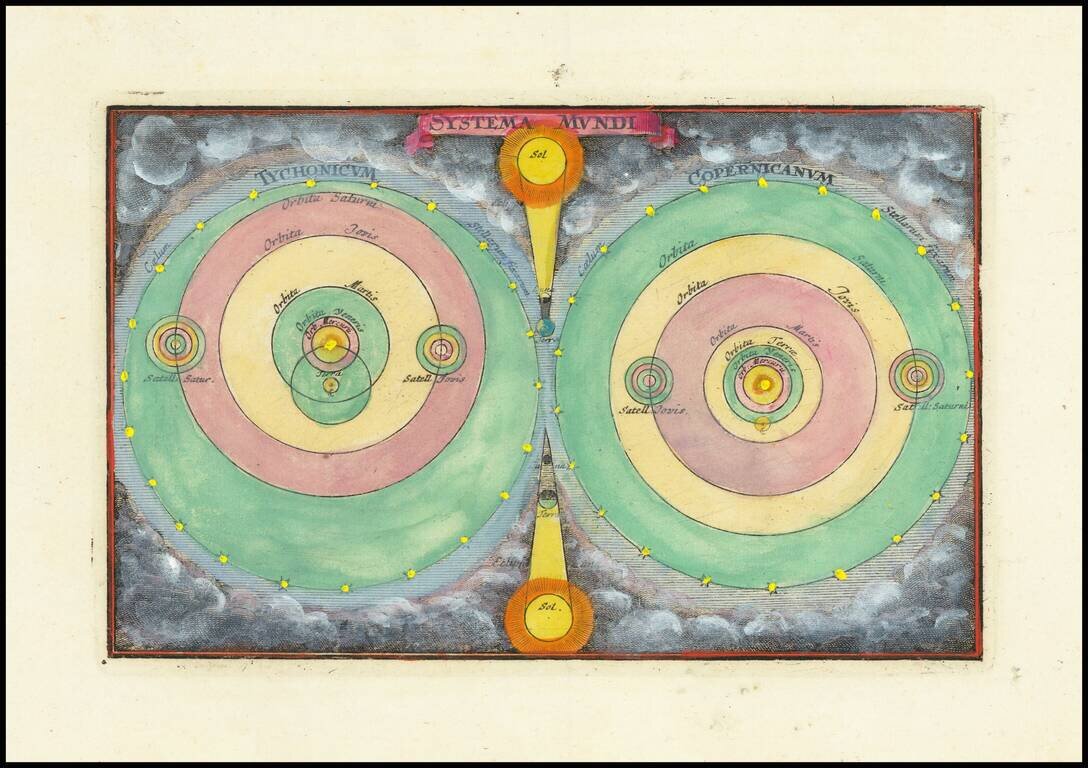
Finely colored example of Zurner's models of the Solar System. A fascinating pair of maps of the solar system, based upon the models of Copernicus and Tycho Brahe.
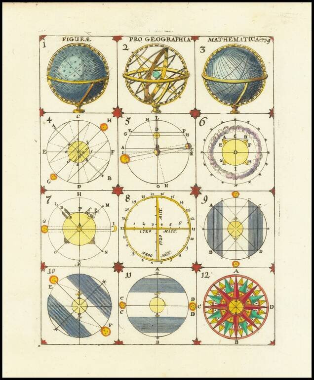
Interesting set of 12 models, ilustrating the construction of celestial and terrestrial models of the globe and solar system, from an anonymous source. An interesting set of images.
![[Arabian Peninsula, Red Sea, Nile River and Gulf of Aden] L'Afrique . . . 1740](/map/small/59382.jpg)
Title cartouche section of the Le Rouge wall map of Africa, published in Paris in 1740. The map includes a decorative cartouche showing Europeans trading gold and slaves with local African leaders.
![[Hand Drawn Prussian Military Encampment at Opole, Poland] Special Grund-Riss Des Kaeyserl Feldl Lagers bey Oppeln in Ober Schlesien](/map/small/59726.jpg)
Rare Manuscript Plan of a Prussian Military Encampment Mid-eighteenth-century plan of a Prussian military camp located near Opole, made at a time when the Prussian army was one of the strongest in the world. This document is a rare survival and...
![[Solar Eclipse of July 25, 1748] Die versinsterte Erdkugel d. i. Geographische Vorstellung der Sonnen od Erd-Finsternis den 25ten. Iulii Ao. 1748 . . . | le Monde Eclipse ou Representation Geographique de L'Eclipse de la Terre ou du Soleil qui arrivera](/map/small/69214.jpg)
Fascinating set of maps and projections illustrating the predicted path of a solar eclipse on July 25, 1748, based on calculations by Leonhard Euler, a renowned mathematician and astronomer. The map sheet includes three hemisphere projections...
![[Title Page] Atlas Portatif . . . 1748](/map/small/70389.jpg)
Decorative title page from De Vaugondy's Atlas Portatif.
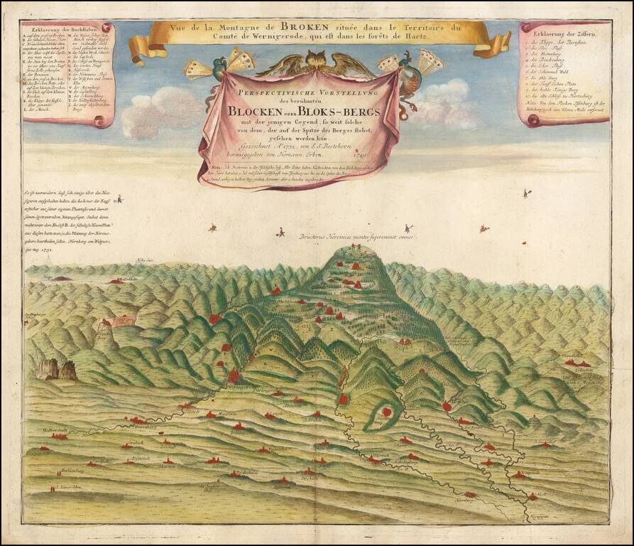
The Legendary Home of Witches and Devils This is a rare and very unusual map of Blocksberg mountain, the highest of Germany's Harz Mountains. The chart illustrates the Walpurgis Night (Walpurgisnacht) celebration. Walpurgisnacht is an ancient...
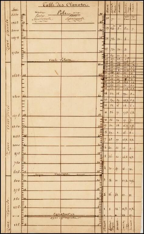
An interesting 18th-century French manuscript climate-parallel chart. This inteseting piece charts the range of latitudes from the Equator to the Poles, and relates the various parallels to climatic conditions and notes the distances between the...
![[Naval Flags of the World] les Pavillons des Mer du Mond Nouvellement Corriges](/map/small/60259.jpg)
Rare sheet with about 184 maritime flags of nations and provinces. Includes many interesting flags, like the one of Mallorca, Corsaires, Constantinople, Ragusa, West Frise, Isle of Man, a few with curious titles like "Portuguese discovery of the New...
![Orange [Vauban Style Fortress]](/map/small/62043.jpg)
Refined Plan of a Star Fort and Walled Settlement in Orange, France. Manuscript plan outlining the fortress at Orange complete with moat, bastions, inner and outer walls, and several building outlines. The plan is finely wrought, showing similarities...
![[Tycho Brahe Celestial Model & Time Clock]](/map/small/33354.jpg)
A Celestial / Scientific Rarity Fascinating illustration showing a model of the Solar System, based upon Tycho Brahe's theories on the face of a clock, engraved in Prague in 1751. The image consists of an astronomical clock depicting a Tychonic solar...
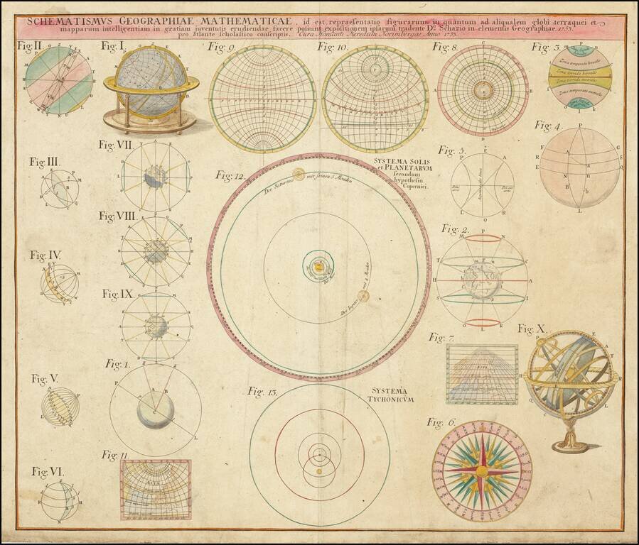
An interesting series of twenty-two figures describing celestial motion and globular projections. These include a celestial globe (Figure 1), a projection of Asia (Figure 7), a rendition of a spherical astrolabe (Figure X) and a climatic model of the...
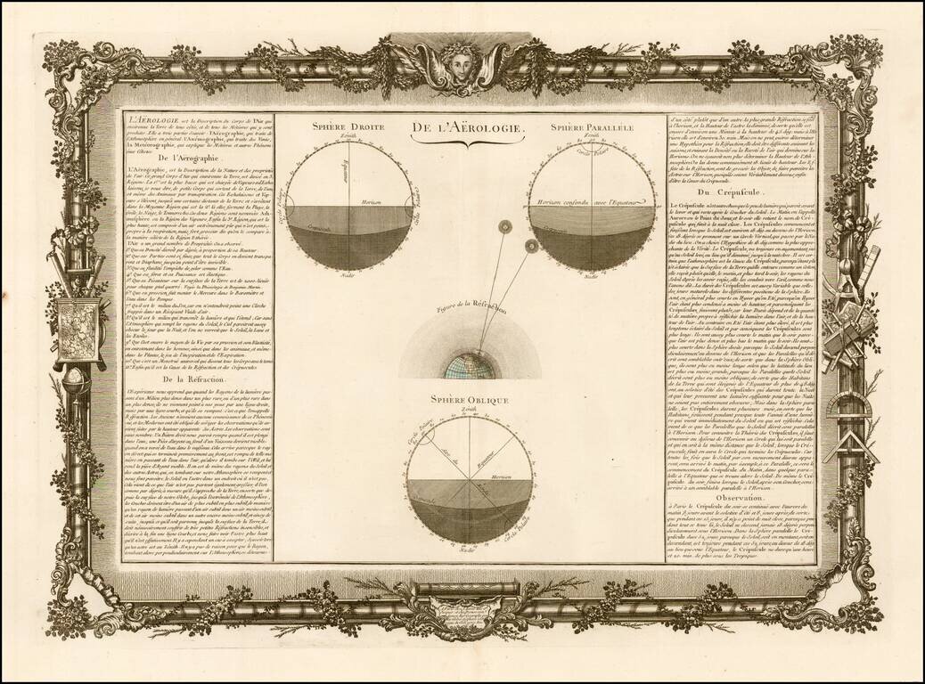
Decorative chart showing various celestial models. Includes remarkable decorative borders found only in the deluxe edition of Buy De Mornas' Atlas Methodique et Elementaire de Goegraphie et l'Histoire.