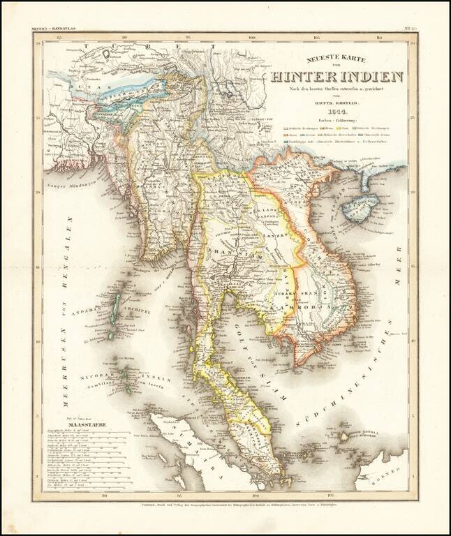
Detailed regional map of the Malay Peninsula, Vietnam, Cambodia, etc. extending from the Straits of Malacca and Singapore north to Hainan and the Gulf of Tonquin. From Meyer's Hand-Atlas. A bit toned and soiled. Extremely detailed regional map. A...
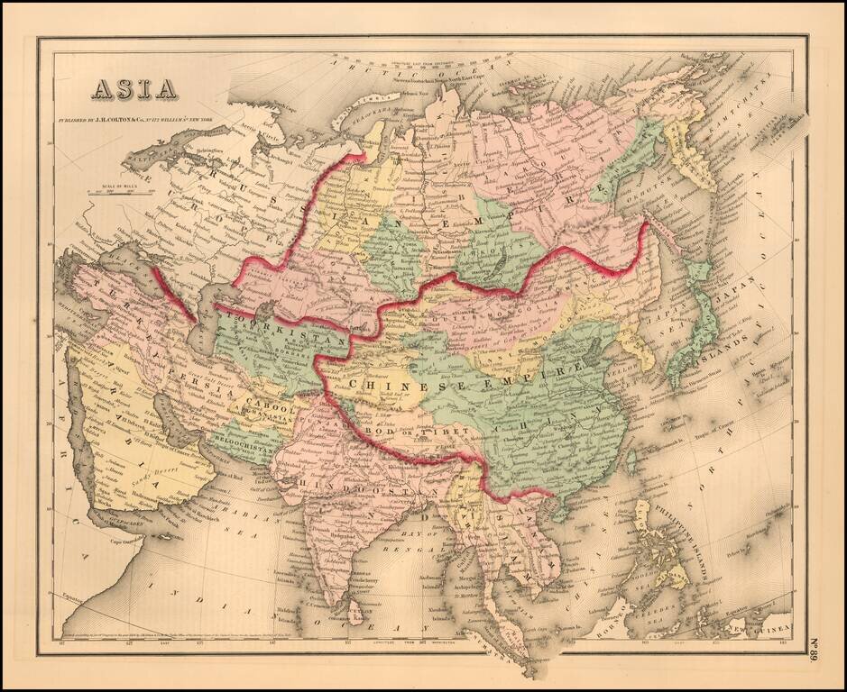
Detailed map of the Continent, colored by countries and provinces. Shows cities, rivers, islands, lakes, mountains, the Great Wall, etc. A terrific regional map, from JH Colton, one of the most prolific American mapmakers of the mid-19th Century.

Decorative and unusual trading card map from this famous series. Map is surrounded by decorative vignette, showing indigenous scenes.
![Patriarchatus Antiocheni Geographica Descriptio . . . [shows Cyprus]](/map/small/54177.jpg)
The Cradle of Civilization Rare and highly decorative map of the region bounded by Cyprus and the Holy Land in the west and Sinus Persicus and Susiana in the east. Toward the center is the confluence of the Tigris and Euphrates rivers.
![[Sinai Peninsula] (Ottoman Turkish Language Sinai and Palestine Campaign Map)](/map/small/54465.jpg)
Ottoman Map Showing A Portion of the Sinai and Palestine Campain and Battle for the Suez Canal During the World War I Rare separately published Ottoman Turkish map of the Sinai Peninsula, illustrating the battles fought during the Sinai Campaign....
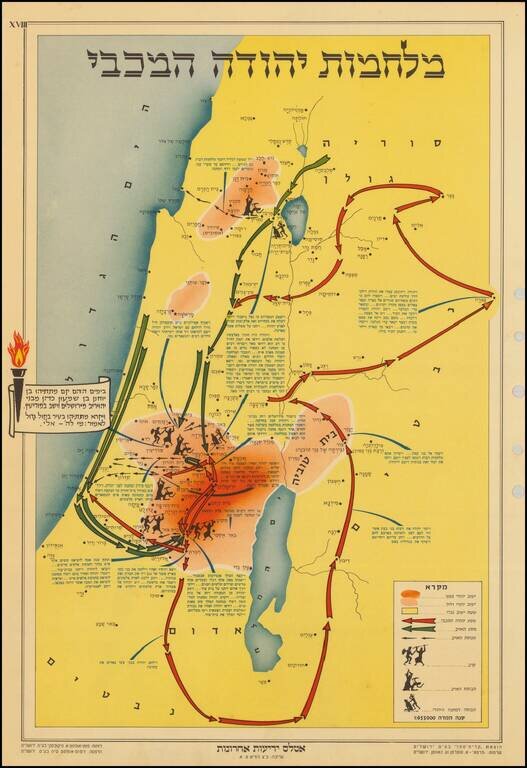
The map describes the story of Chanukah and the battles that the Maccabees fought to gain back their freedom. The Maccabees and the militants attacked each other from various hidden positions in the forests and hills of the region. The key at the...
![[Untitled Map Africa, Red Sea and Saudi Peninsula]](/map/small/48522.jpg)
Upside Down Africa by Ramusio Nice example of Ramusio's (Mezzo Di) map of Africa (extending south to the Tropic of Capricorn and Madagascar). Giovanni Baptista Ramusio was Secretary to the Council of Ten in Venice for 43 years. His collection of...

The Earliest Obtainable Map To Show Houtman's Crossing of the Indian Ocean to the Java, Opening The Spice Trade to The Dutch in 1597. Finely engraved map, showing the route of first Dutch fleet from Zuider Zee to Java in 1596-97, under the command of...

Striking map of the Kingdom of Prester John, reduced from Blaeu's map. The map is embellished with elephants, monkeys, ostriches, etc., and includes a decorative title cartouche.

Rare map of the Kingdom of Prester John, which appeared in Picart's Tresor des carte Geographiques, published in Paris. Picart's map is based upon Jansson's map, published in his Atlas Minor in 1628. The first French version of the map was published...

Rare first state of this decorative map of Africa, published by Frederick De Wit in Amsterdam. The map includes decorative panels showing birdseye views of Alcair, Alexandria, Alger, Tunis, Tanger and Ceuta across the top and 8 costumed figures along...
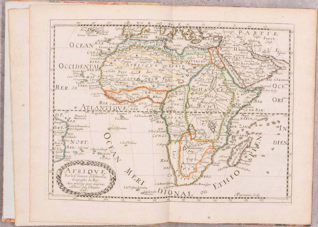
A beautiful example of the second edition of Sanson's atlas of Africa, one of the best atlases dedicated to the continent from the 17th century. The first edition of this atlas was published in 1656 as the third volume in Sanson's series of four...

Rare Luneberg edition of this 17th Century map of Africa, which appeared in a German edition of Cluverius' Introductionis in Universam Geographicam.
![The West Part of Barbary... [on sheet with:] The East Part of Barbary...](/map/small/52496.jpg)
A nice example of Herman Moll's 1729 miniature engraved map of North Africa in two images on the same sheet, from his Atlas minor. Hand-colored by kingdom. Includes an inset of the harbor of Oran.
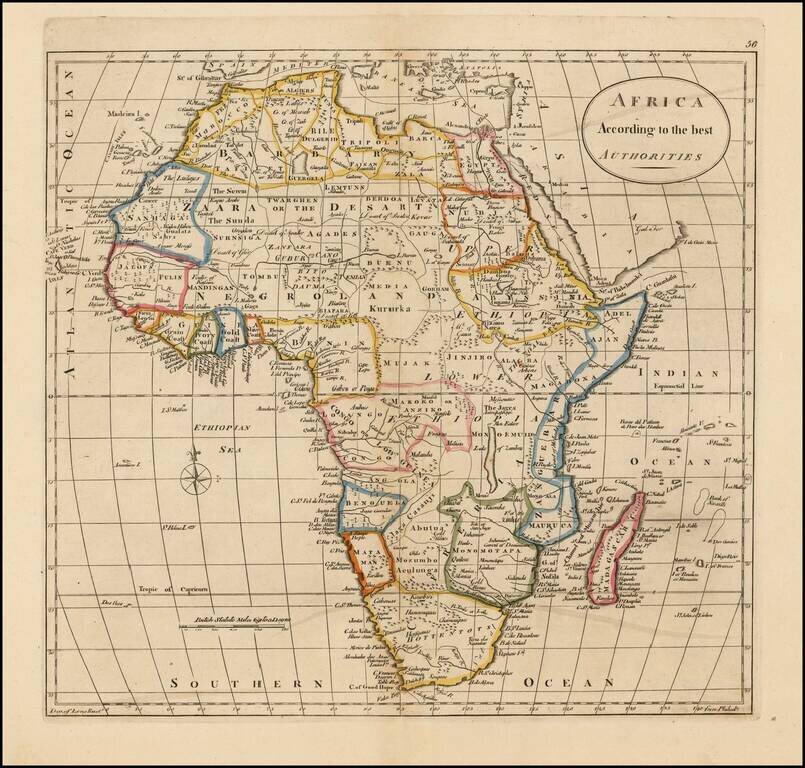
Detailed map of Africa, divided by kingdoms and colonies, many of which are fictional in nature.

Nice wash color example of Africa, colored by regions and kingdoms. The map still includes the fantastical Mountains of the Moon and Mountains of Kong.