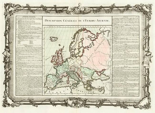
Decorative map of the continent. Includes remarkable decorative borders found only in the deluxe edition of Buy De Mornas' Atlas Methodique et Elementaire de Goegraphie et l'Histoire.
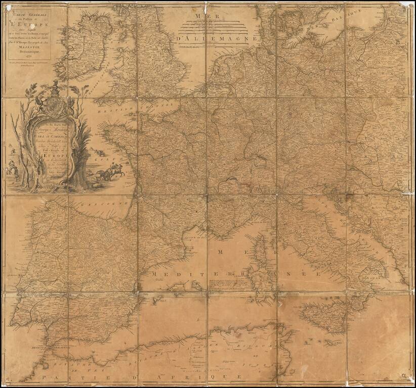
Somewhat warn example of John Rocque's map of the Post Roads of Europe, published by Robert Sayer in London, in 1773. The first state of the map appeared in 1758. The present map is the second printing in 1771, with the Sayer imprint, replacing the...
![[Martin Behaim Globe / Book] Pars Globi terrestris Ao. 1492 a Martino Behaim Equite Lusitano Norimbergae confecti Delineavit Christoph. Theoph de Murr 1778 (bound with:) Diplomatische Geschichte des Portugesischen berühmten Ritters Martin Behaims](/map/small/68828.jpg)
Behaim's Discovery of America -- Engraved Map Depicting a Section of Martin Behaim's Globe of 1492, Oldest Globe in the World -- Bound With Book on Martin Behaim Extremely rare map illustrating the "western" section of Martin Behaim's globe of 1492,...

Scarce 18th-century American map of Scandinavia, from Mathew Carey's General Atlas. Engraved by Samuel Hill in Boston.

Rare 2 sheet broadside showing the political history of Europe between 1783 and 1818. G. Wilkins, later G. Wilkins & Son, operated as a bookseller in Derby in the early part of the 19th Century. We note imprints for G. Wilkins (Queen Street)...
![Europe No. 16. Partie De La Russie D'Europe [Tambow, Woroniege, Saratow and Territoire De La Milice De Don, etc.]](/map/small/19823.jpg)
Regional map of part of Russia and the Ukraine. Shows towns, roads, rivers, mountains, and a host of other details. From Vandermaelen's remarkable 6 volume atlas, which if combined as globe gores forms an immense globe.
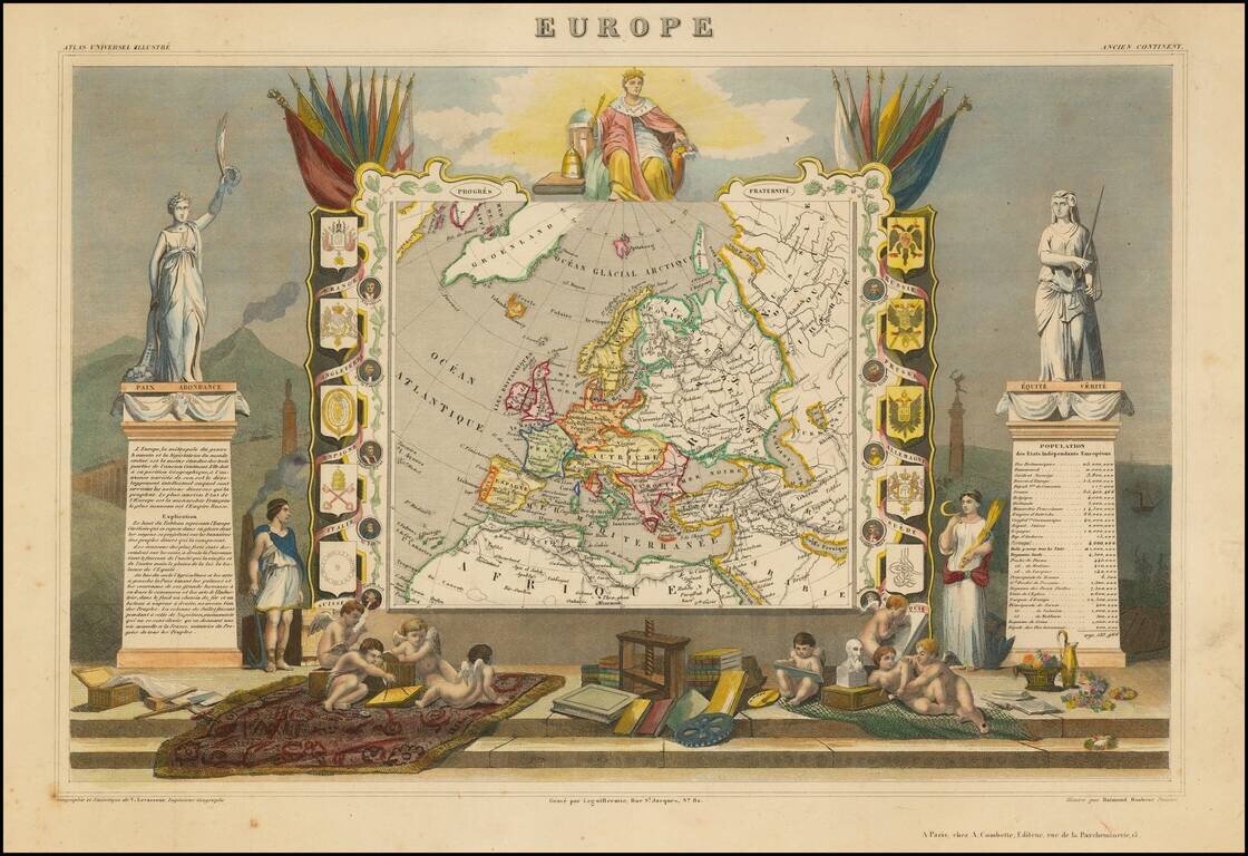
Decorative map of Europe surrounded by allegorical vignettes. Engraved by Raimond Bonheur, father of the famous French artist Rosa Bonheur.
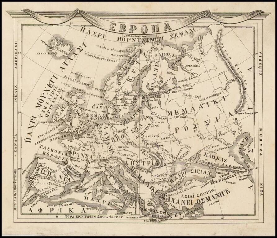
Rare 19th Century map of Europe printed in Athens with Greek text. This attractive map embraces all of Europe Dionysios Pyrros's Atlas neoteros (1845) and Athanasios A. Sakellarios's A tlas geographikos (1870).

This is a fabulous town plan of Rome, including a description and location of many of the important features of the city. This map was accompanied by a Plan of Ancient Rome, which showed the city stripped of much of the development seen here. The map...

Detailed map of the Greek Islands, showing towns, mountains, rivers, roads, lakes, gulfs, bays, etc. Decorative border. A terrific regional map, from JH Colton, one of the most prolific American mapmakers of the mid-19th Century.


![[Europe: Air Mail Routes] Carte des lignes postales aeriennes internes et internationales Europe pubilee par le Bureau International de l'Union postale universelle Berne, Avril 1937](/map/small/41144.jpg)
Postal map of Europe, showing the various domestic and international air postal routes. Includes German, Belgian, British, French, Dutch and Polish postal lines.
![Il Disegno Della Terza Parte Dell' Asia [Gastaldi's Wall Map of SE Asia with extra panels!]](/map/small/30554hbp.jpg)
Final State of the Gastaldi's Wall Map of East Asia -- The First Great Wall Map of East Asia Fine example of Giacomo Gastaldi's rare 4-sheet wall map of Southeast Asia, China and India, perhaps the single most influential map of the region published...
![Chinae, olim Sinarum regionis nova descriptio. auctore Ludouico Georgio. [English Edition!]](/map/small/71123.jpg)
Very Rare English-Language Edition of the Ortelius Map of China. Fine example of Abraham Ortelius's map of China, from the exceedingly rare English edition of his Theatrum, published only in one year - 1606. Ortelius' map of China is taken directly...

Fine dark impression of Guiseppe Rosaccio's map of Asia.. The map shows a fascinating early depiction of Asia, with many place names. China is shown, including the Wall. No sign of Korea. Very early appearance of the Philippines (Filipine and...