
The Greatest Early American Map of Africa. Rare American imprint copying Arrowsmith's important wall map, the latter of which was originally published in 1802. "One of the greatest maps ever published. Arrowsmith simply stripped away centuries of...
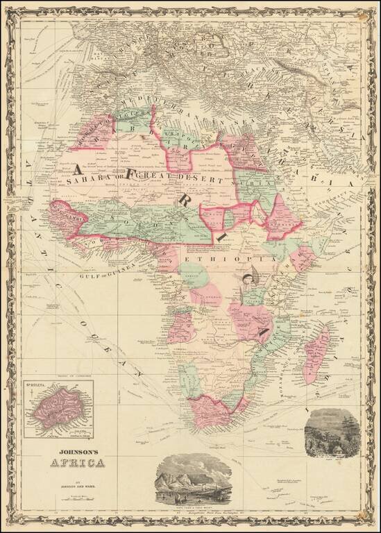
Attractive map of Africa with large vignettes of Cape Town and Port Natal and insets of St. Helena Island. Colored by countries and colonies and showing towns, mountains, ports, islands, explorers routes and similar details. Decorative border.
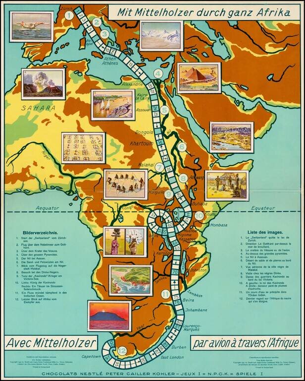
Rare commemorative game board map of Africa for a promotional game published for the Nestle Company, for tracking the trip of Walter Mittelholzer across Africa. Walter Mittelholzer (1894 - 1937) was a Swiss aviation pioneer. He was active as a pilot,...

Whimsical map depicting the route of the USS Independence, from Norfolk to the Arabian Sea. On November 19, 1980, the USS Independence deployed to the Indian Ocean along with the Harry E. Yarnell (CG-17) and was on watch along with the Ranger on...

Ortelius' Map of Southeast Asia, from the World's First Atlas Nice example of Ortelius' map of Southeast Asia, Japan, and the Philippines, etc., including a small section of the west coast of California. The map featured in Ortelius' Theatrum Orbis...
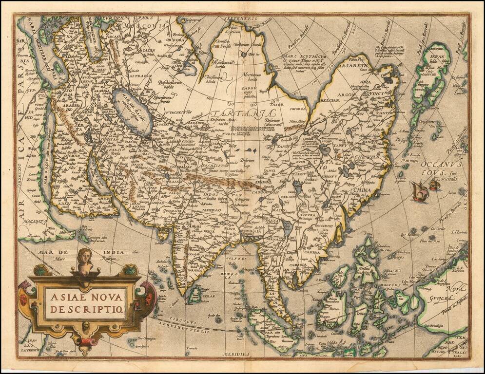
Nice old color example of Ortelius' map of Asia, from Ortelius' Theatrum Orbis Terrarum, the first modern world atlas. A marvelous misprojection of Japan and Southeast Asia. Very distinct Northeast Passage. Includes sailing ships and other...
![Pascaart vertoonende de zeecusten van Chili, Peru, Hispania Nova, Nova Granada, en California…. [Early New Zealand Inset]](/map/small/65168.jpg)
Fine Golden Age Dutch Chart with the Island of California and an Early Mapping of New Zealand Scarce early sea chart by Doncker, showing the West Coast of the Pacific Ocean, which extends from the island of California to Chile, with noteworthy insets...
Fine old colored example of first state of De Wit's map of the Pacific Ocean, featuring California as an Island and important early projections of Australia and New Zealand. The finely engraved sea chart was first published in De Wit's Orbis Maritimus...
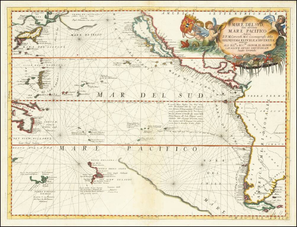
Striking Coronelli Map of the South Seas Showing the Latest Dutch Discoveries Nice example of Coronelli's map of the Pacific Ocean, published in Venice. The map depicts the west-coast of America south to Tierra del Fuego. To the east, it shows...

Antique Map of the Old World Nice full color example of Covens & Mortier's map of the Eastern Hemisphere, showing Africa to Japan and down to Australia. Nice interesting treatment of Australia.
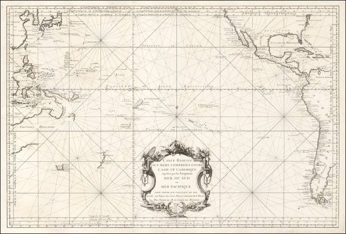
French Chart of the Pacific Ocean on the Eve of the Great Voyages of Discoveries Fascinating sea chart, depicting the Pacific Ocean immediately before the wave of exploration that occurred from the 1760s to the 1790s. This fine chart, issued by the...
Cook's First Tracks In The South Pacific First edition of the first decorative map to show Cook's tracks in the Pacific, one of the most sought after early maps to depict Cook's Voyage to New Zealand, Australia and the South Pacific. The map records...
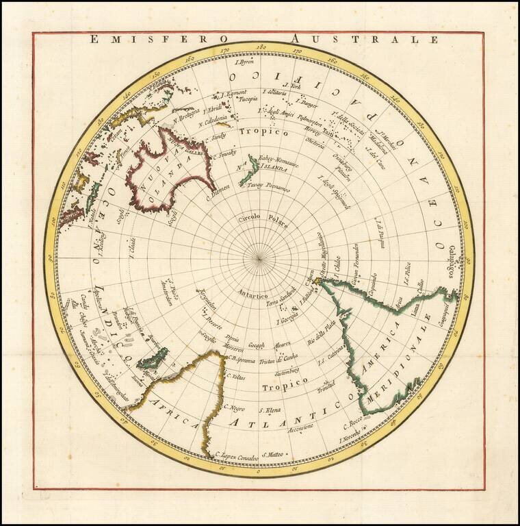
Rare map of the south polar regions, published in Italian, The map shows the Southern Hemisphere prior to the first discoveries in Antarctica, but shortly after the Voyages of Captain James Cook established a more accurately known coastline for New...
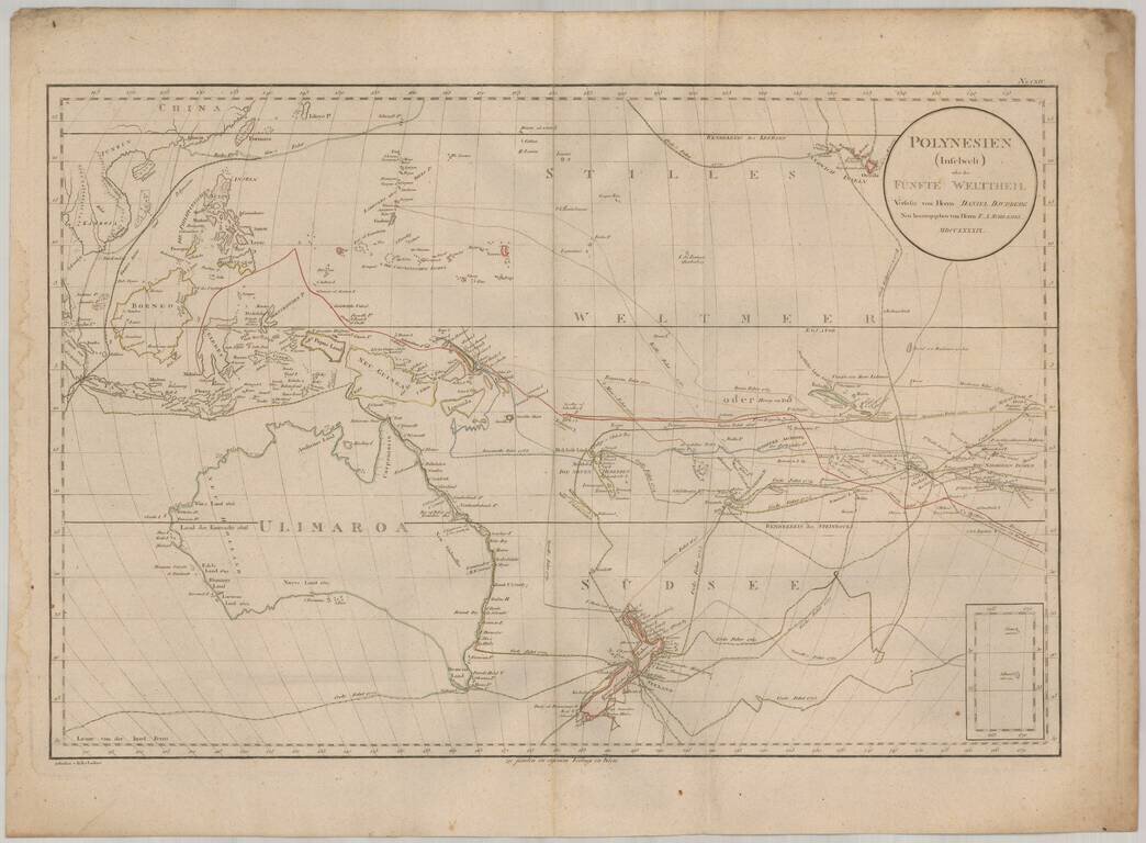
Rare map of the South Pacific, from Australia (Ulimaroa) to Hawaii. The map is one of the only maps to refer to Australia by its native name (Ulimaroa) and is also noteworthy for its fine treatment of New Zealand and extensive depiction of the routes...
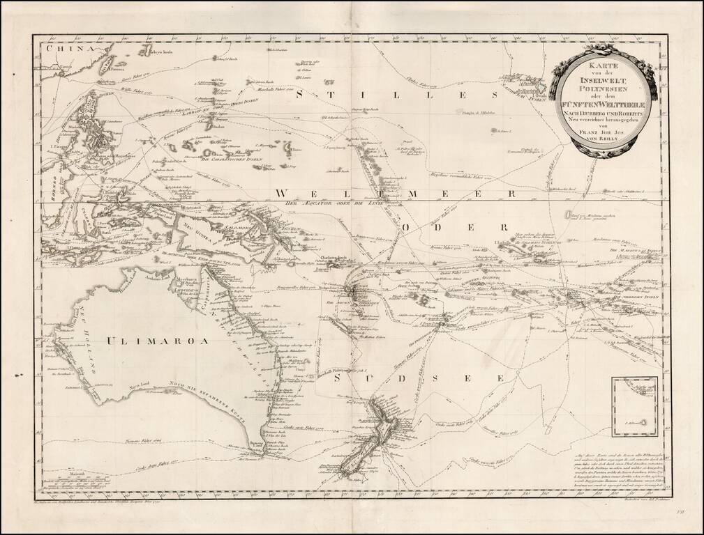
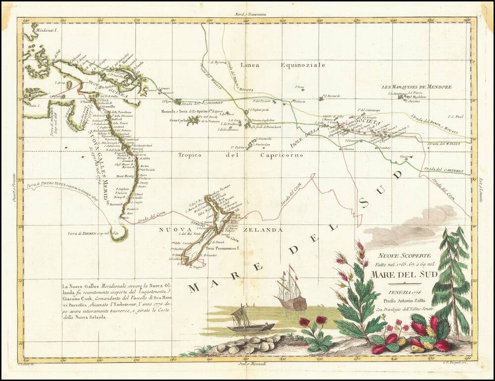
Detailed map of Oceania, published by Von Reilly in Vienna. The map provides the tracks of a number of early explorers, including Tasman, Cook, Surville, Marshall, Schoten, Quiros, Mendana, Bougainville, Magellan, Mulgrave, Byron, Roggeveen and...
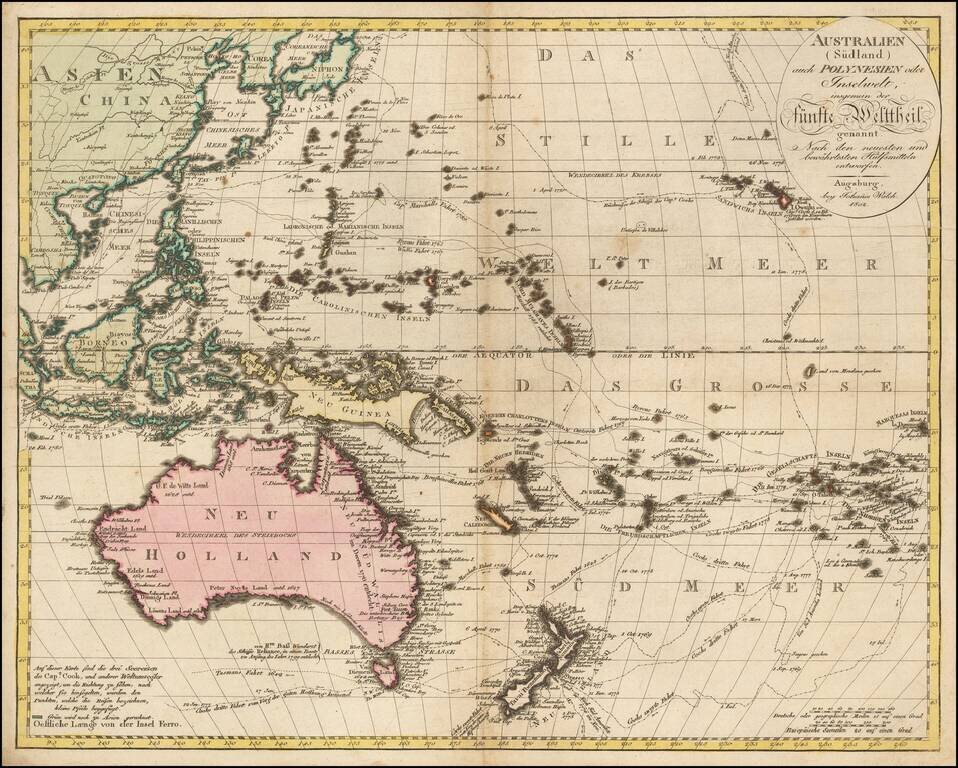
Exquisitely-Detailed Map of Australasia and the South Pacific -- Sea of Korea Fine example of Walch's map of the Western Pacific and Southeast Asia, first published in Augsburg in 1802. It celebrates the routes and encounters of the recent European...