
One of the Earliest Maps to Show and Name the Philippines Rich, dark impression of Matthias Quad's map of Asia. The map shows the entire continent, from the east coast of Africa to the subcontinent to Japan. The land is covered with toponyms; small...

Nice full color example of Ortelius' miniature map of Asia, from the first edition of Ortelius Epitome published by Giovanni Battista Vrients. J.B. Vrients purchased the rights and plates for Ortelius' Theatrum Orbis Terrarum and Epitome at the...

A Map of Persia From the Golden Age of Dutch Cartography Finely hand-colored example of Willem Janszoon Blaeu's map of Kingdom of Persia. The map extends from the Eastern Mediterranean to Tacalistan and the Indus River and the Dalanguer Mountains and...
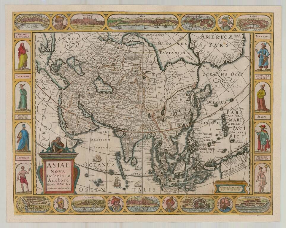
Rare separately issued Carte-a-figures map of Asia, published by Claes Jansson Visscher. The map includes 8 costumed figures in side-borders, 10 bird's-eye-views of cities in upper and lower borders. The map is a later issue of Petrus Kaerius's map...
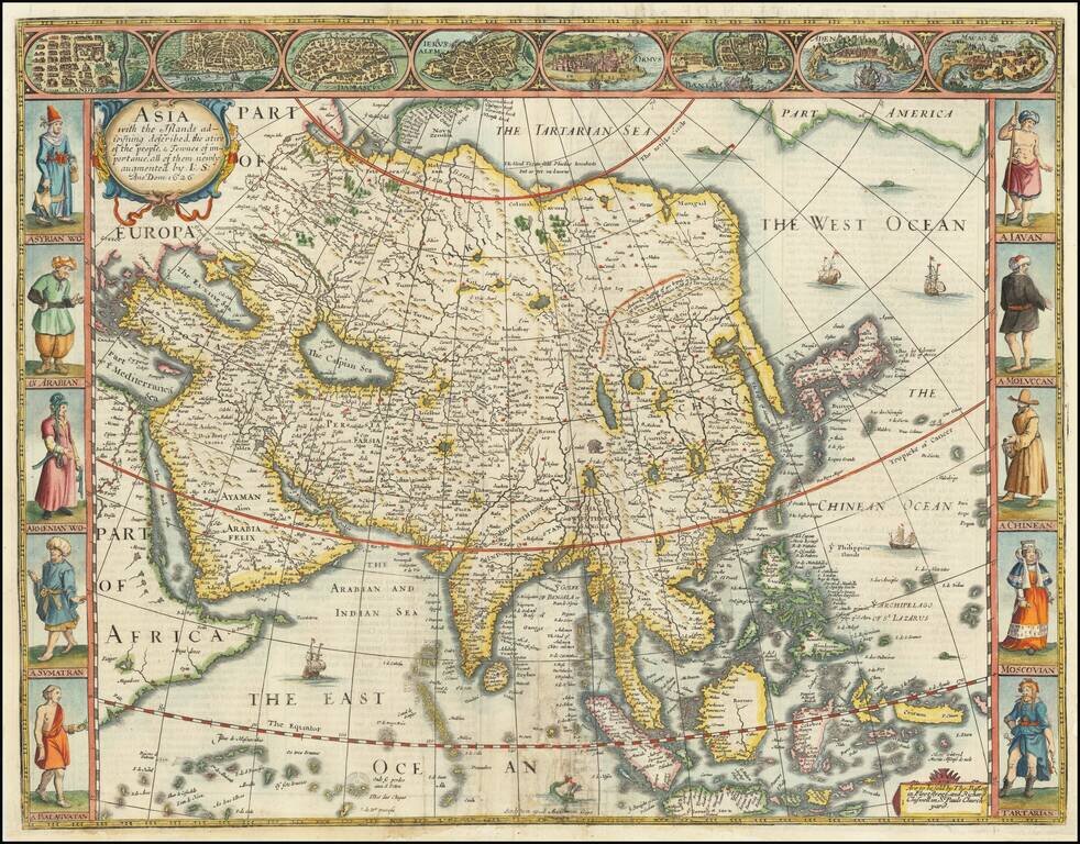
John Speed's Map of Asia This is a fantastic map of Asia, bearing all the aesthetic strengths for which Speed's maps are prized. Asia is shown in full, with many interesting and mysterious geographical features. Eight important Asian cities line the...
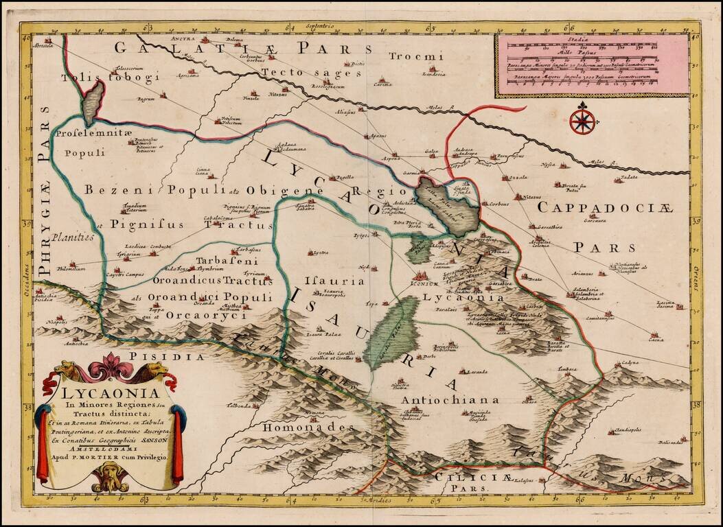
Scarce map of Central Turkey, with Ancyra (Ancora) in the upper left of the map and showing the early Roman and other road through the region. The map appeared in Mortier's Atlas Antiquus, based upon the work of Nicolas Sanson.
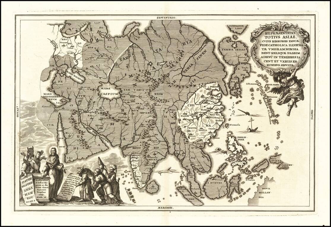
A striking and scarce map of Asia by Heinrich Scherer. The unshaded areas show where Catholocism has spread in Asia (China, Philippines, the western coast of India). Christ appears in the lower-left corner with stereotyped Asians praying to him.

Detailed regional map of the mouth of the Ganges and neighboring regions in the Bay of Bengal, illustrating the narrative of Nino da Cunha. Includes decorative cartouche and vignette. The map offered here was used by Vander Aa to illustrate a Dutch...
Striking example of Scherer's map of Asia. Includes a marvelous depiction of Japan, the Philippines and a hint of Australia, with a curiously undersized Korea.

Detailed map of the Holy Land, colored according to the lands of the 12 tribes, with two large cartouches.
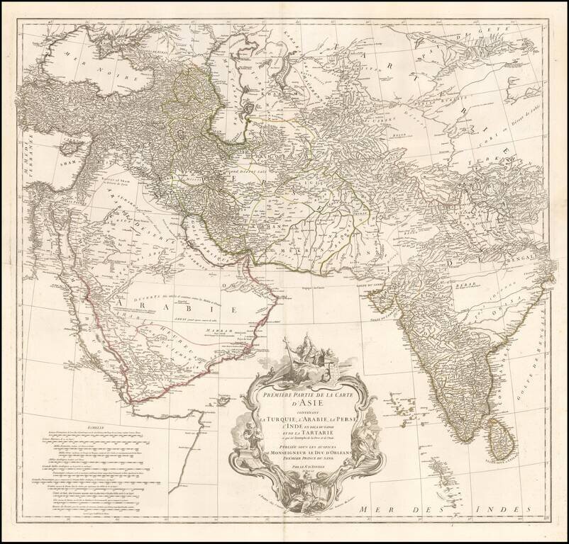
Striking 2-sheet map of the western half of Asia, published by D'Anville. Includes details from Turkey through the Black and Caspian Seas to Tibet and south to include the Arabian peninsula and all of India. Fine detail throughout including the Maldive...
![Carte des parties Nord et Est de L'Asie qui comprend Les Costes De Russie Asiatique Le Kamschatka, Le Iesso et Les Isles Japon…[insets of Alaska, West, AZ and Conibas]](/map/small/70673rd.jpg)
Marvelous depiction of the Northeast Passage, from Norway and Spitsberg Island to the Straits of Anian and Cape Schalaginskoy north of Kamschatka, covering the NE Coast of Asia to south of Japan and Korea. The primary focus of the map is Asiatic...
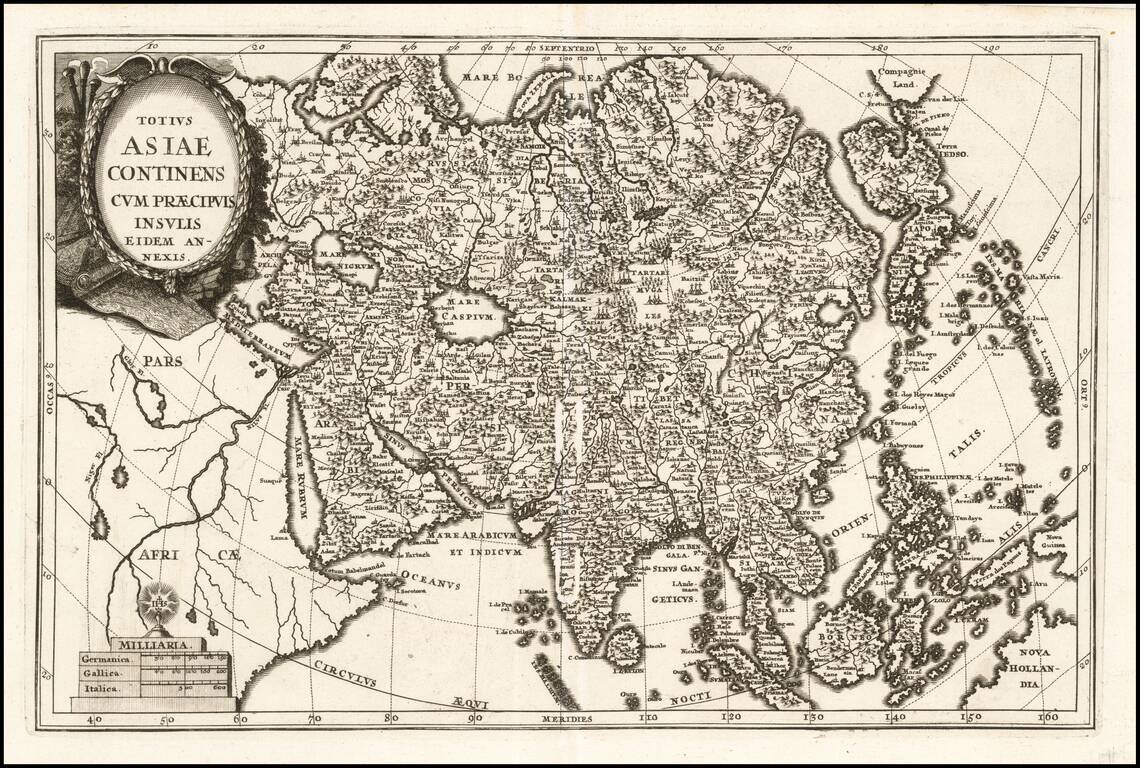
Extremely rare map of Asia, published in Mainz by W.C. Rucker. The printing and shading on the map is quite bold and unusual. We have never seem a map by this mapmaker.
![Northern Hindostan [with] Nepaul [with] Cabul](/map/small/62805.jpg)
Fascinating regional map of Northern India, colored by regions and showing the lands controlled by the British, Nabob of Oude, Berar Rajah, Nizam, Nysore Rajah, Mahrattas, Travancore, and King of Candy. Large insets of Cabul and Nepal. The map of...
![[Asia] (Title in Greek-Turkish Hybrid)](/map/small/41721.jpg)
Scarce map of Asia. The lettering is in Greek, but the word is Turkic.