Map size in jpg-format: 16.388MiB
Click to open in high resolution (open in new tab).
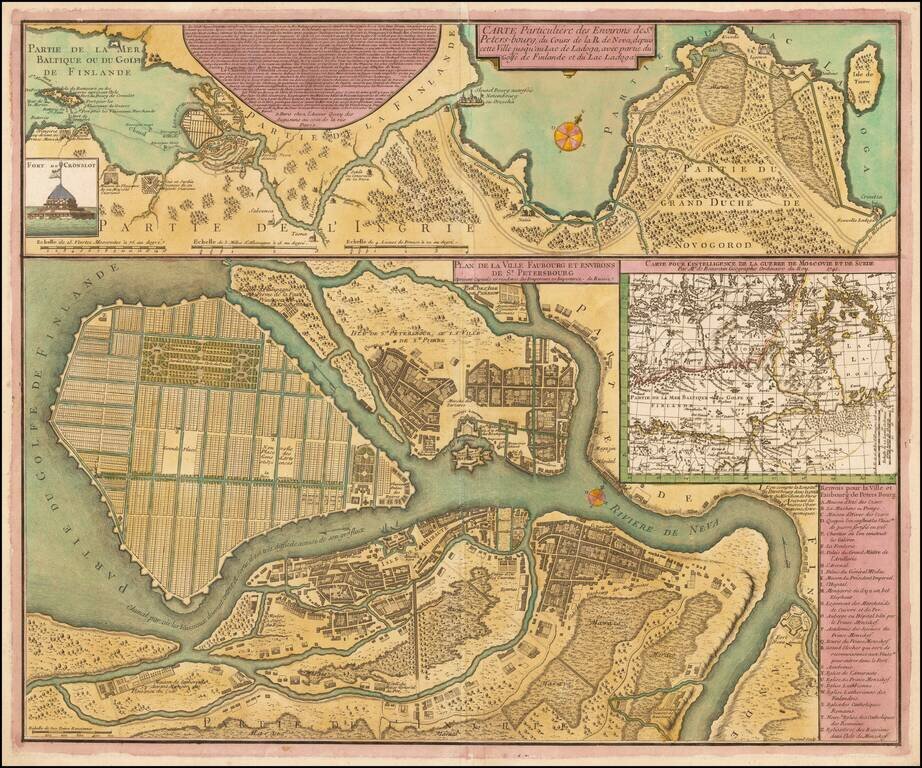
Rare early plan of St. Petersburg, engraved by Durand and published in Paris by Jean de Beaurain.
This fine plan shows St. Petersburg as it was planned to be built while it was still in the process of construction. In 1703, the site, at the head of the Gulf of Finland, was selected by Czar Peter the Great to be the place on which a new capital city for the Russian Empire was to be built. Peter pressed a massive labor force of serfs to build the city, and no expense was spared. Leading architects and artisans from across Europe were offered large salaries to dedicate themselves to the task. The overall project came to be overseen by the French landscape architect, Jean-Baptiste Alexandre Le Blonde, who had previously served Louis XIV, who was ably assisted by the Swiss architect Domenico Trezzini.
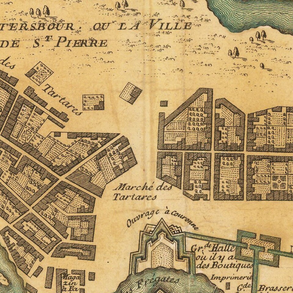
As shown on the main map, most of the city was planned to be built on Vasilyevsky Island, that lay within the mouth of the Neva River. As shown, the island was to be divided by a series of canals and streets that were to follow a rational grid, which in places were to contain massive squares. On the south bank was the Admiralty district and on an island on the north bank, above Vasilyevsky Island, was the St. Peter & Paul Fortress. One might remark that much of the city resembles a series of gardens, and this is, in good part, due to the fact that Le Blonde's signature passion was designing gardens.
In spite of the massive resources thrown at the project, the original plan was greatly altered as work progressed. Vasilyevsky Island was proven to be too low-lying and prone to flooding to permit the creation of the canals, nor was it viewed appropriate as the site of the main town. While the area would eventually be built-up (later in the 18th century) with streets largely following the lines of the proposed grid of canals, the main part of the city was built in the area which lay to the south of the Neva. Text running along the left side of the map identifies 28 different sites throughout the city.
An inset contains a view of 'Cron Sloss', or Kronstadt, the fortified island in the Gulf of Finland that guarded the maritime approaches to the city.
The first printed map to depict a version of the Le Blonde-Trezzini plan was Nicolas De Fer's Plan de la Nouvelle Ville de Petersbourg (Paris, 1717).
If you are a student, write to us in telegram: @antiquemaps and indicate what material you need and for what work you need a map in high detail. We are ready to provide material on special terms. For students only!
![[Signed Political Satire Artwork] Vietnam ... Vietnam ... Vietnam ...](/map/small/68726.jpg)

