Map size in jpg-format: 44.9214MiB
Click to open in high resolution (open in new tab).
Fine Old Color Example
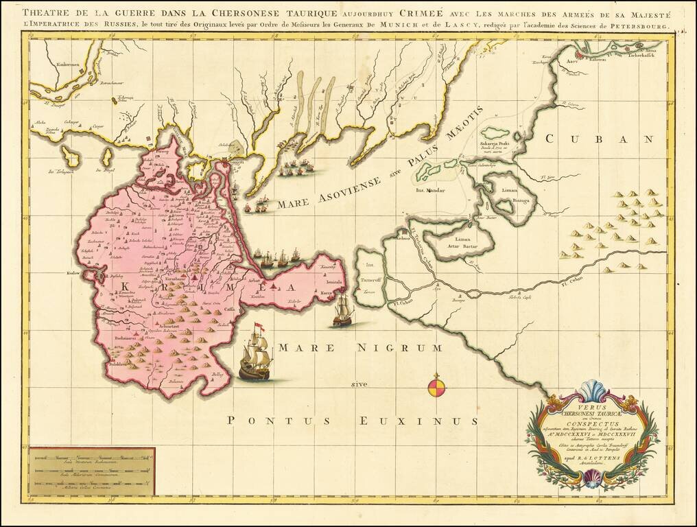
Rare map of part of the Ukraine and the Black Sea region, showing the route of the Russian Army in its expedition against the Tartars in 1736 and 1737.
Includes sailing ships, cartouche, compass rose and detailed movements of the route, including encampments.
If you are a student, write to us in telegram: @antiquemaps and indicate what material you need and for what work you need a map in high detail. We are ready to provide material on special terms. For students only!
![[Signed Political Satire Artwork] Vietnam ... Vietnam ... Vietnam ...](/map/small/68726.jpg)

