Map size in jpg-format: 1.12881MiB
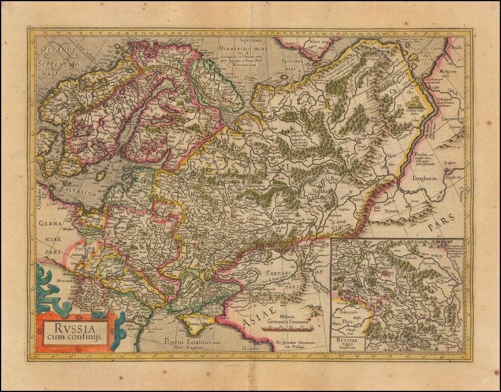
Nice outline color example of Mercator's first map of Russia.
The map shows the region from Scandinavia to the Black Sea and the Oby River. Large inset of Russia Pars Amphisicata (Moscovia).
Numerous Eastern European regions are shown, including: Prussia, Mazovia, Polonia, Lithuania, Livonia, Podolia, Moldavia, Przcopensis and Transylvania.
Norwuegia, Svecia, Boddia, and Lappia are demarcated and labeled.
If you are a student, write to us in telegram: @antiquemaps and indicate what material you need and for what work you need a map in high detail. We are ready to provide material on special terms. For students only!
![[Signed Political Satire Artwork] Vietnam ... Vietnam ... Vietnam ...](/map/small/68726.jpg)

