
![[Napoleon's Battles in France, Belgium Netherlands, Luxembourg, Germany] No. 1 Frontiere du Nord. Mesny 5.](/map/small/60727.jpg)
Finely executed manuscript map of the Theater of War in Northwestern Europe, illustrating various battles, some with dates. The maps are printed on hand made paper with a large elaborate watermark D & C Blauw, the paper of the iconic Blaeu firm,...
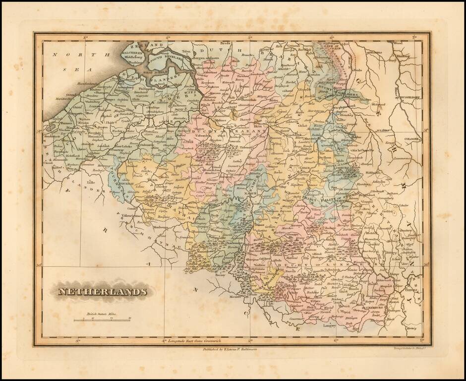
Fielding Lucas's 1823 engraved map of the Netherlands. Fielding Lucas' fine work distinguished him as the best publisher of the era. His maps are printed on a higher quality paper than contemporary maps by Carey & Lea and demonstrate a superior...

Large and highly detailed map of the Netherlands, hand colored by regions. Shows towns, railways, canals, rivers, lakes, coastal details, etc. Decorative piano key border. Scarce full color example, from Johnston's National Atlas.
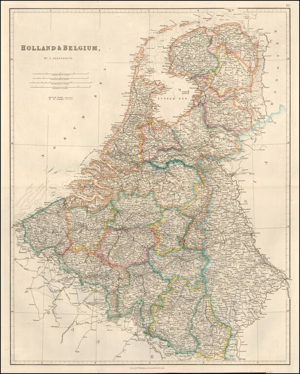
Detailed map of the Low Countries, published in London by John Arrowsmith. The map appeared in Arrowsmith's London Atlas.
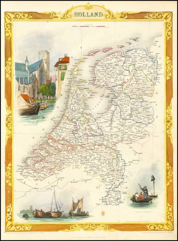
Decorative map of Holland. Includes vignettes of Rotterdam, Dutch Peasants and a boating scene on the Dort. Engraved for R. Montgomery Martin's Illustrated Atlas. Tallis was one of the last great decorative map makers. His maps are prized for the...
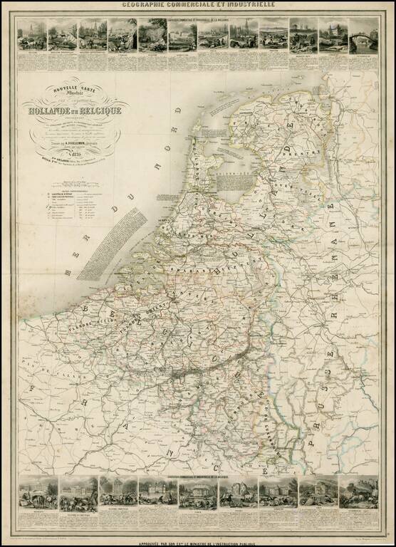
Scarce decorative large format map of the Low Countries, including 21 decorative side panel vignettes showing indigenous scenes. Finely engraved by Gerin and illustrated by A. Testard.
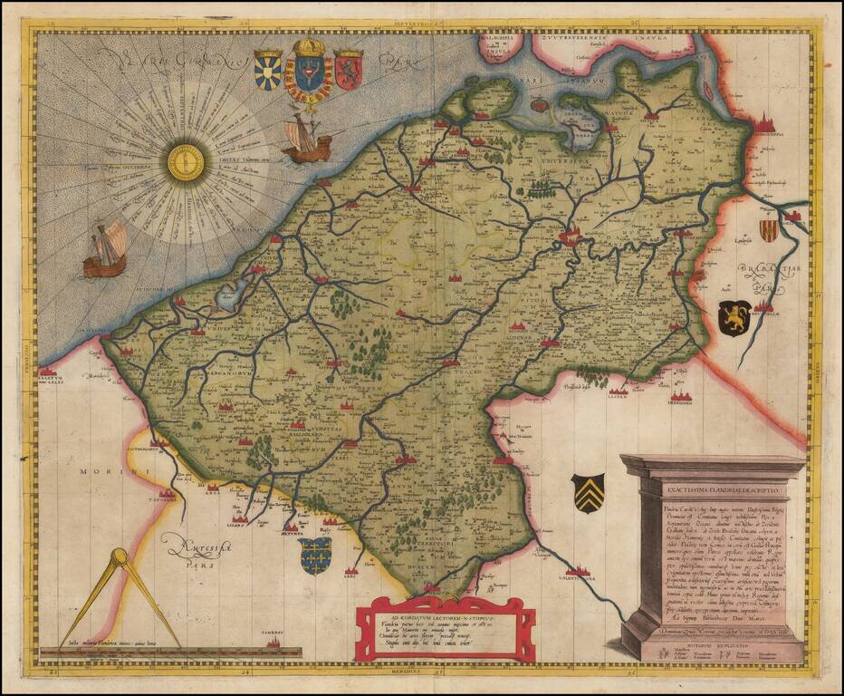
Rare Lafreri School Map of Flanders By Domenico Zenoi One of the earliest obtainable maps of the Flanders region, first published In Venice in 1559. The map is based upon Gerard Mercator's 4 sheet map of Flanders, first published in 1540. Zenoi...
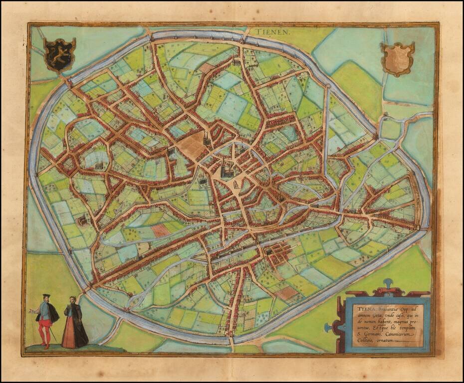
Decorative early views of Tienen in Flemish Brabant. From Braun & Hogenberg's Civitatus Orbis Terrarum, the most important book of town plans and views published in the 16th century.
![[Brugge] Brugae, Flandricarum Urbium Ornamenta](/map/small/64453.jpg)
Fine early birdseye view of the City of Brugge in Belgium. From Braun & Hogenberg's Civitatus Orbis Terrarum, the most important book of town plans and views published in the 16th Century.
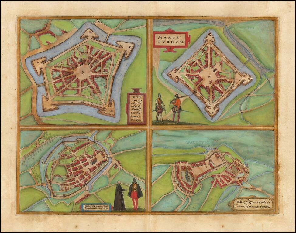
Fine set of 4 views of the towns of Philippeville, Mariembourg, Chimay, and Walcourt, from Braun & Hogenberg's Civitatus Orbis Terrarum.
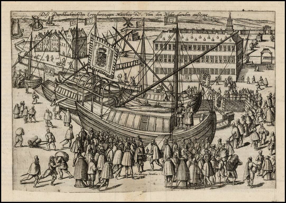
Antique engraving of the departure of Archduke Matthew from the Netherlands, 29 October 1581; Archduke Matthew and entourage are depicted embarking on their ships. This is the 1605 edition, with the plate trimmed at the bottom to remove the text,...
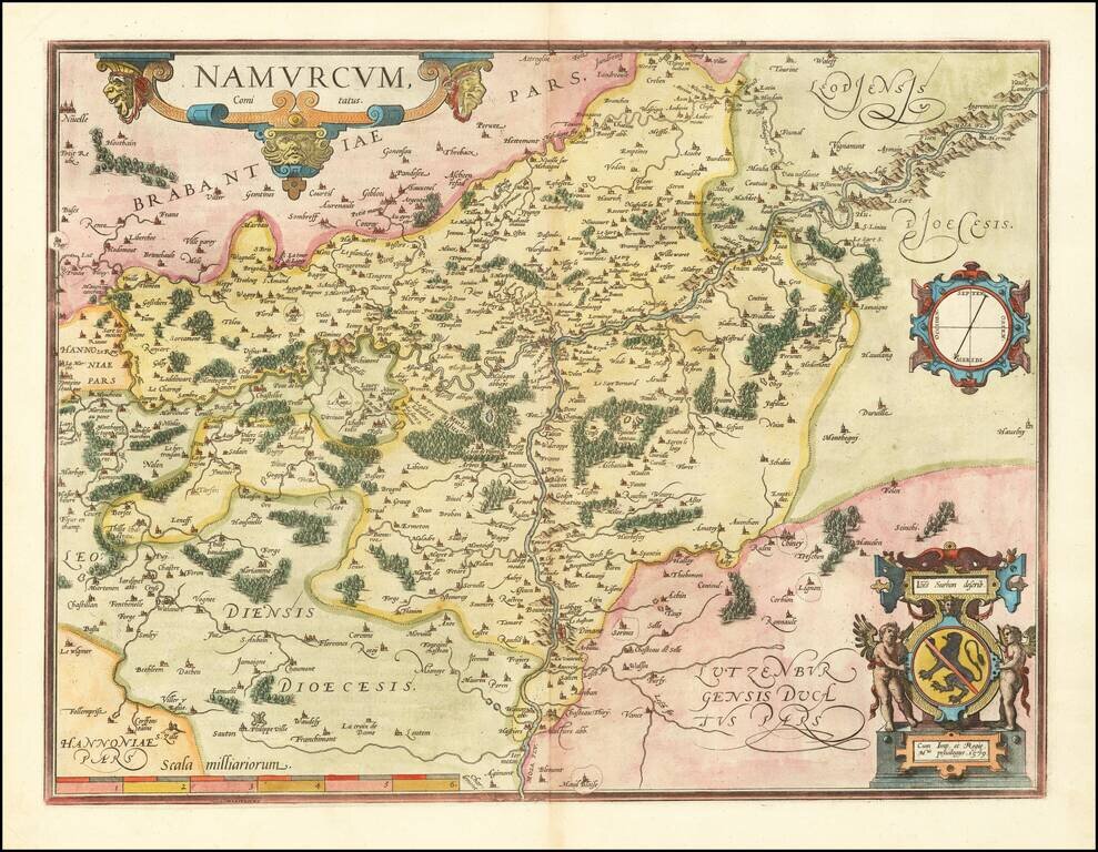
Fine old color example of Ortelius' map of Namur, with compass rose and two cartouches. From Ortelius' Theatrum Orbis Terrarum, the first modern Atlas.
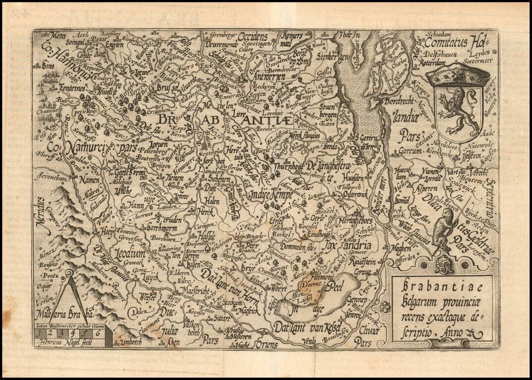
Nice example of this scarce map of the Province of Brabant, oriented with west at the top, published in Cologne. The present map was produced by two of the primary Cologne School mapmakers, Johann Bussemacher and Matthias Quad. The Cologne School of...
![[Siege of Oostende] Ostende Wie es itziger zeit gelegen, daeraus zu sehen wie weit die Ertzherzog hinan und hinein geruckt . . .](/map/small/39971.jpg)
Rare map of the Siege of Oostende, Belgium, created in the final year of the Siege of Ostend, published at the conclusion of the Spanish siege of the Ostend. Between 1601 and 1604, the Spanish besieged Ostend. The Dutch, losing 20,000 men during the...
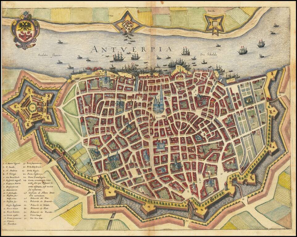
A detailed town plan of Antwerp, showing fortified walls, city gates, the inner ring of the city, important public buildings, squares, and more. A key names thirty-two important places in the city. The coat of arms in the upper left shows the symbol of...
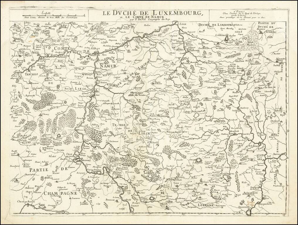
Scarce map of the Duchy Luxembourg and County of Namur, published in Paris by Pierre Du Val. Includes early manuscript annotation above Thionville, referencing Katenong (Cattenom) and Hunsingen?