logo

1848. Holland (Koningrijk der Nederlanden)

  • Holland (Koningrijk der Nederlanden)

Holland (Koningrijk der Nederlanden) information:

Year of creation: 
Resolution size (pixels): 
 4948x4128 px
Disk Size: 
 4.76645MiB
Number of pages: 
 1
Place: 
 Edinburgh

Print information. Print size (Width x height in inches):
Printing at 72 dpi 
  68.72 х 57.33
Printing at 150 dpi 
 32.99 х 27.52
Printing at 300 dpi 
 16.49 х 13.76

An example of detailing the file of this map of in a printable high-resolution:

Click to open in high resolution (open in new tab).
Attention! this is just the central piece (central area 960x960 px) of the map file!
This is an example, so that you can see and study the level of detail of a given map. The entire Map will be fully available after payment!

Holland (Koningrijk der Nederlanden)

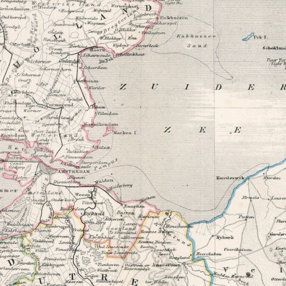
Large and highly detailed map of the Netherlands, hand colored by regions.

Shows towns, railways, canals, rivers, lakes, coastal details, etc. Decorative piano key border.

Scarce full color example, from Johnston's National Atlas.


Special conditions for students!

If you are a student, write to us in telegram: @antiquemaps and indicate what material you need and for what work you need a map in high detail. We are ready to provide material on special terms. For students only!

Item information:

Year of creation:
Size:
4948x4128 px
Disk:
4.76645MiB
Number of pages:
1
Place:
Edinburgh
Author:
Alexander Keith Johnston.
$14.99

Related item