
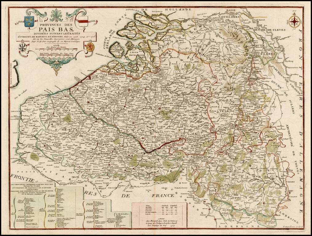
Scarce Benard edition of this detailed map of the Low Countries, from Zeland and Brabant to Luxembourg and Artois. The map includes the coats of arms of France, Austria, Brandenburg and the States General.
![Kaart van de Beneeden rivier de Maas en de Merwede van de Noord Zee tot Hardinksveld [Rotterdam Section of Maas River Map]](/map/small/25266.jpg)
Detailed section of Melchior Bolsta's 6-sheet map of the Meuse (Maas) River, showing the sections of the river which include Rotterdam and Delfshaven, along with Ysselmonde, Charlois, Byerland, and Heynoord. Bolstra's map is of the highest historical...
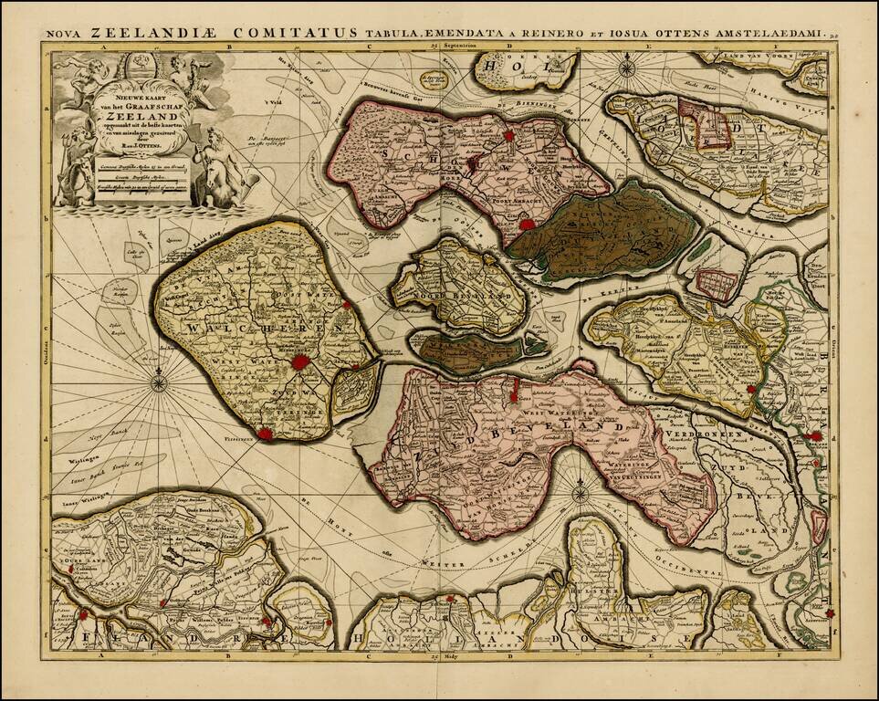
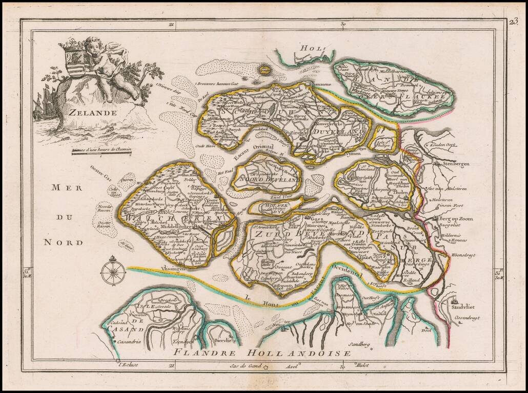
Rare map of the Province of Zeeland, with its many islands and peninsulas. Major cities, small villages, and some of the natural features are named. A nice old color example.
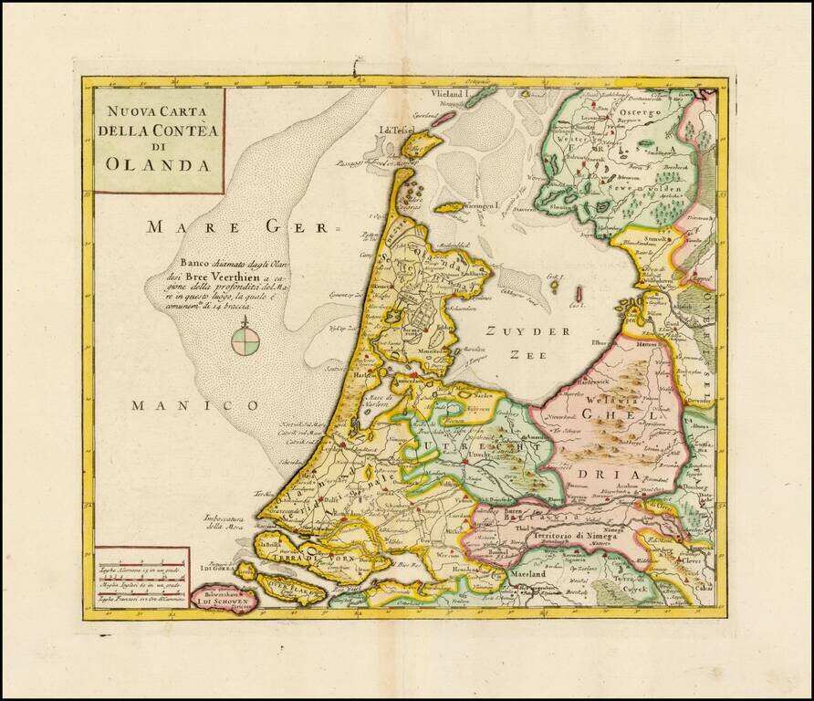
Striking map of Holland, based upon De L'Ise's map. Includes a decorative cartouche and excellent geographical detail. Albrizzi's maps are scarce and beautifully engraved.
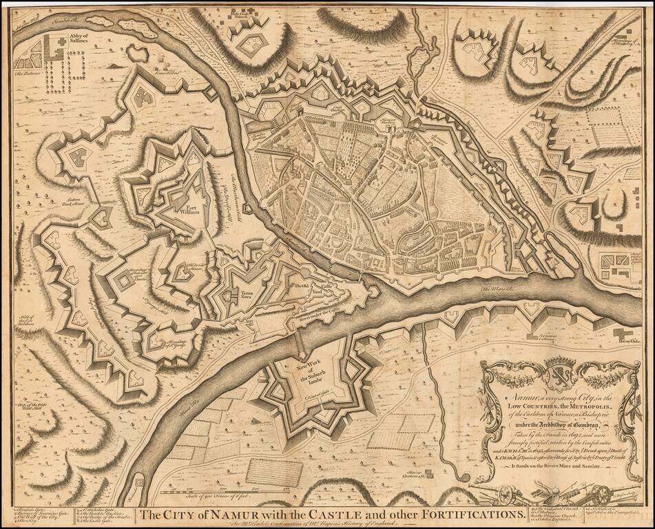
Striking plan of Namur and the Maes and Sambre Rivers, showing the town and fortifications.
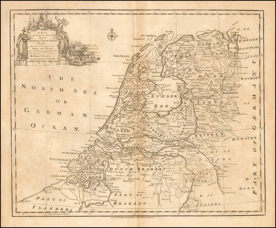
Emanuel Bowen's map of the Seven United Provinces, published in London circa 1744.
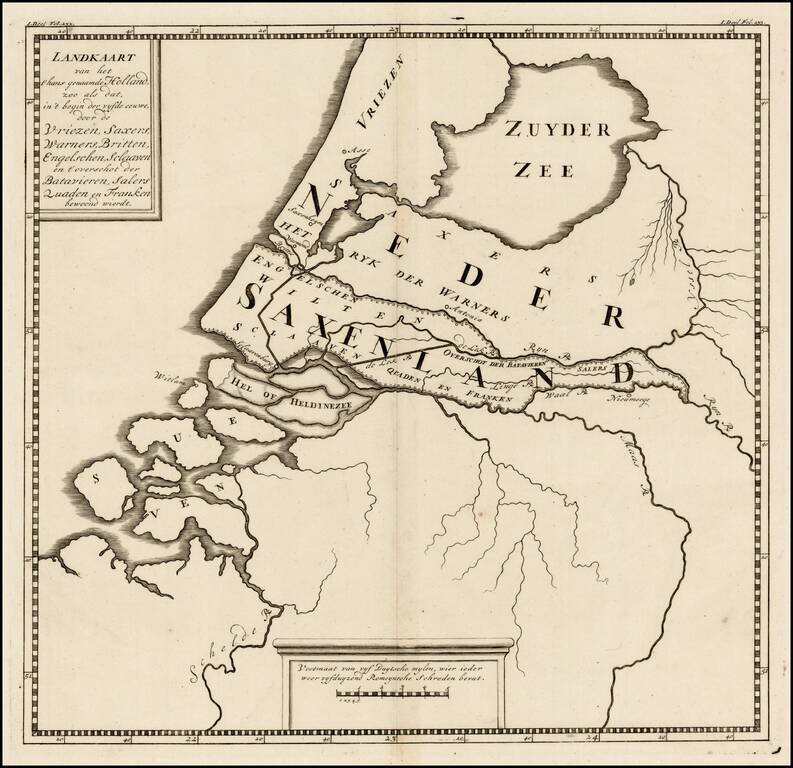
Rare ancient map of the Low Countries, with reference to the various tribes of early Europeans who came through the region. The map appeared in a 9 map atlas published in 1745 by Pieter de Hondt in Den Haag, entitled Atlas van het aloude Holland, En...
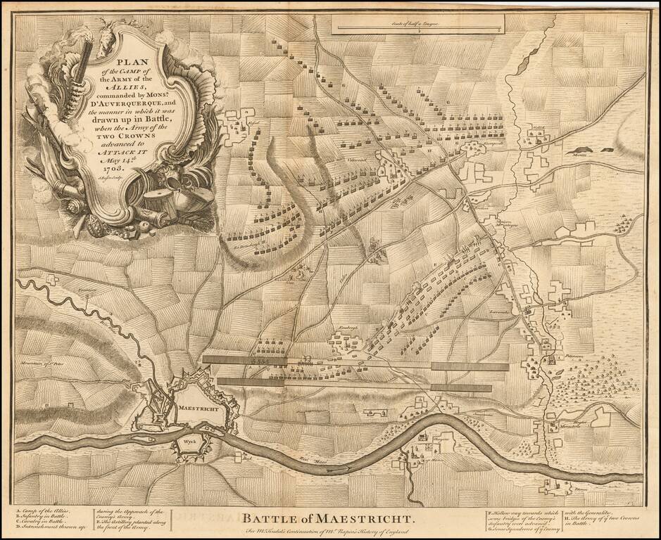
Detailed plan the Battle of Maastricht (1703), including fortifications, town plan, roads, farms, rivers, and a decorative cartouche. From Tindal's Continuation of Rapin's History.
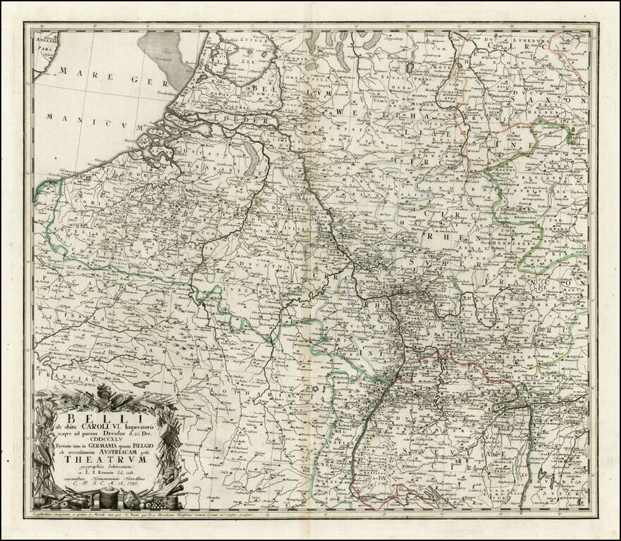
Interesting map of a part of the Theater of War in Europe, celebrating the signing of the Treaty of Dresden, on December 25, 1745. The Treaty of Dresden was signed on December 25, 1745 at the Saxon capital of Dresden between Austria, Saxony and...
Detailed map of the Low Countries, from Le Rouge's scarce Atlas Nouveau Portatif, published in Paris in 1748.
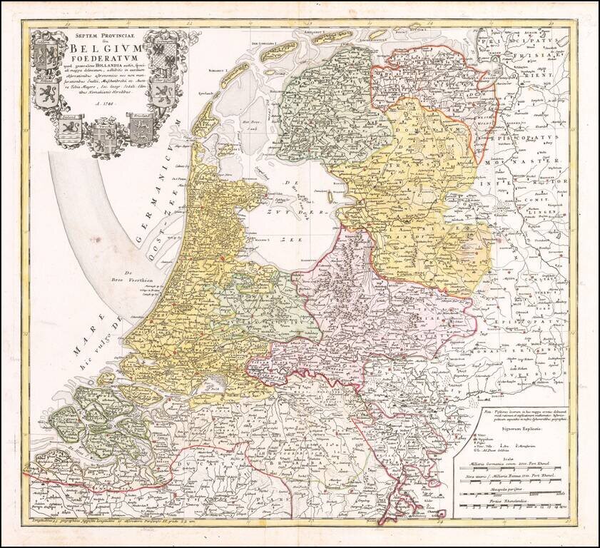
Detailed map of the Low Countries, published by the Homann Heirs in Nuremberg. The map includes a large decorative cartouche, including the 7 coats of arms of Geldern, Holland, Zeeland, Utrecht, Friesland, Ober Issel, and Groningen.
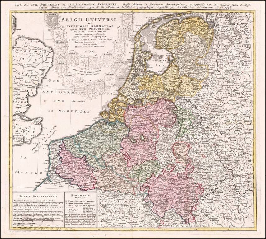
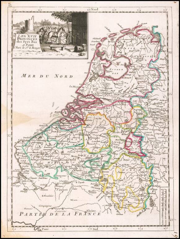
Nice regional map of the Low Countries, published by Homann Heirs in Nuremberg. Shows the coats of arms of the 17 United Provinces.
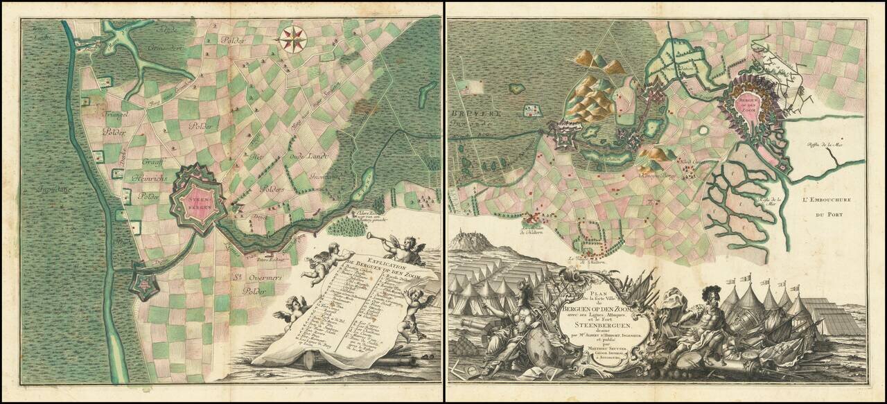
A Grand Battle Plan From the War of Austrian Succession Fine 2 sheet map of the area around Bergen-op-Zoom, illustrating the region at the time of its Siege in 1747. Oriented with east at the top, the 2 sheet map shows the town and fortifications of...