Map size in jpg-format: 1.53641MiB
Click to open in high resolution (open in new tab).
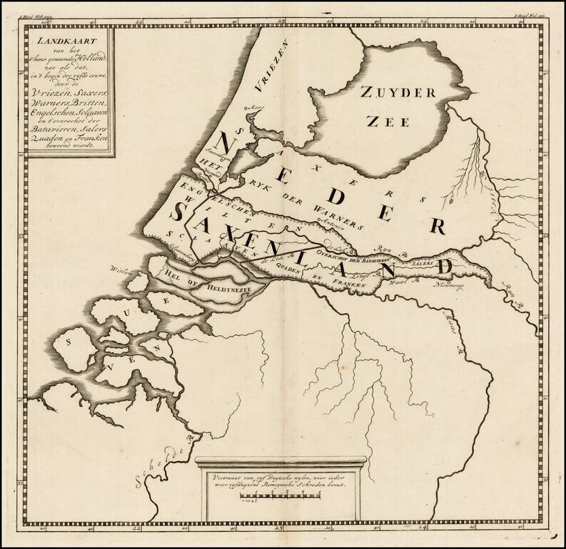
Rare ancient map of the Low Countries, with reference to the various tribes of early Europeans who came through the region.
The map appeared in a 9 map atlas published in 1745 by Pieter de Hondt in Den Haag, entitled Atlas van het aloude Holland, En deszelfs waare gelegenheid, zoo als die was, onder de Regeering der Keyzeren, Koningen, Hertogen en Graaven.
If you are a student, write to us in telegram: @antiquemaps and indicate what material you need and for what work you need a map in high detail. We are ready to provide material on special terms. For students only!


