logo

1740. Nieuwe kaart van de graafschap Zeeland . . . / Nova Zeelandiae Comitatus Tabula . . .

  • Nieuwe kaart van de graafschap Zeeland . . . / Nova Zeelandiae Comitatus Tabula . . .

Nieuwe kaart van de graafschap Zeeland . . . / Nova Zeelandiae Comitatus Tabula . . . information:

Year of creation: 
Resolution size (pixels): 
 5190x4138 px
Disk Size: 
 5.77171MiB
Number of pages: 
 1
Place: 
 Amsterdam

Print information. Print size (Width x height in inches):
Printing at 72 dpi 
  72.08 х 57.47
Printing at 150 dpi 
 34.6 х 27.59
Printing at 300 dpi 
 17.3 х 13.79

An example of detailing the file of this map of in a printable high-resolution:

Click to open in high resolution (open in new tab).
Attention! this is just the central piece (central area 960x960 px) of the map file!
This is an example, so that you can see and study the level of detail of a given map. The entire Map will be fully available after payment!

Nieuwe kaart van de graafschap Zeeland . . . / Nova Zeelandiae Comitatus Tabula . . .

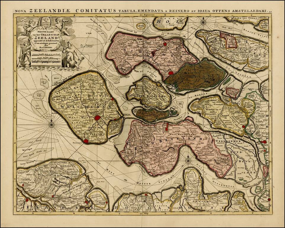
Rare map of the Province of Zeeland, with its many islands and peninsulas.

Major cities, small villages, and some of the natural features are named.

A nice old color example.


Special conditions for students!

If you are a student, write to us in telegram: @antiquemaps and indicate what material you need and for what work you need a map in high detail. We are ready to provide material on special terms. For students only!

Item information:

Year of creation:
Size:
5190x4138 px
Disk:
5.77171MiB
Number of pages:
1
Place:
Amsterdam
Author:
Reiner & Joshua Ottens.
$14.99

Related item