Map size in jpg-format: 8.77337MiB
Click to open in high resolution (open in new tab).
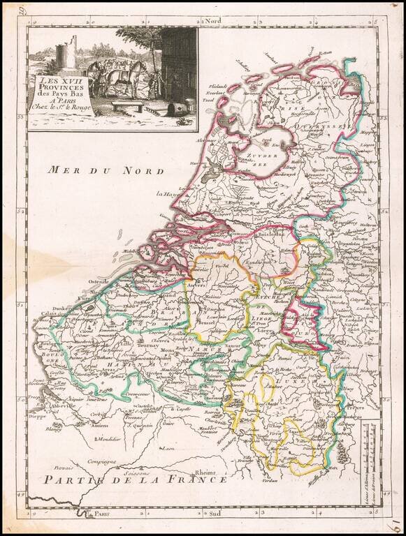
Detailed map of the Low Countries, from Le Rouge's scarce Atlas Nouveau Portatif, published in Paris in 1748.
If you are a student, write to us in telegram: @antiquemaps and indicate what material you need and for what work you need a map in high detail. We are ready to provide material on special terms. For students only!


