Map size in jpg-format: 6917010B
Click to open in high resolution (open in new tab).
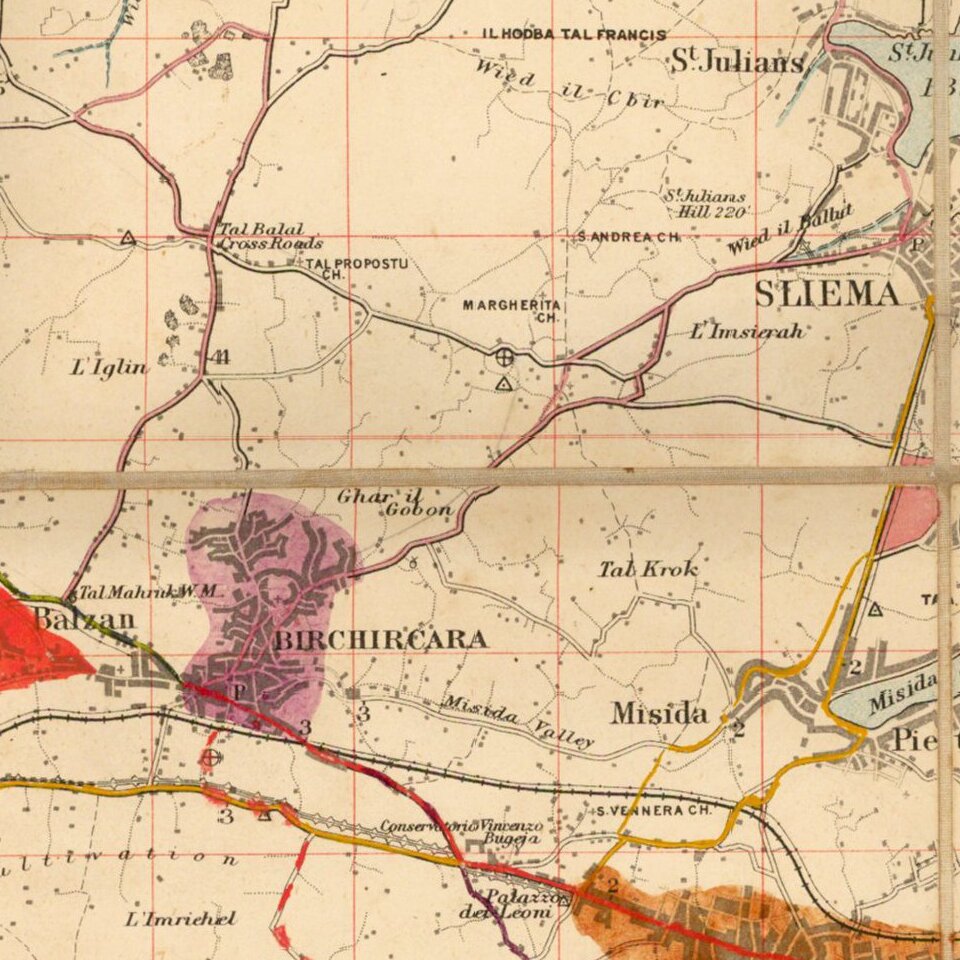
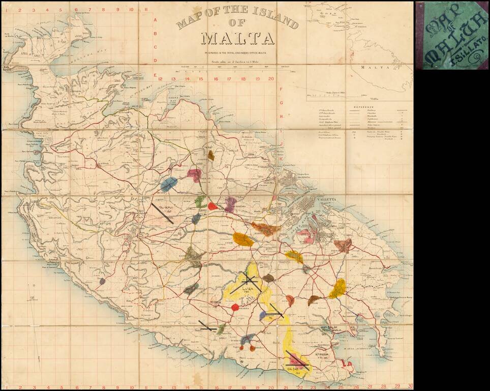
Fascinating map of Malta, pubished by the War Office in London.
This example includes some interesting manuscript additions.
Detailed map of Malta on a scale of two inches to a mile, with a key detailing roads, railways, churches, police stations, aquaducts and other water supplies. At the time the island was the Royal Navy's base in the Mediterranean.
The map shows contour lines, trig points, roads, communications, principal buildings. Reference table to conventional signs. Overprinted with a grid in red.
Inset outline map of Malta and Gozo at 1 inch to 3 miles.
If you are a student, write to us in telegram: @antiquemaps and indicate what material you need and for what work you need a map in high detail. We are ready to provide material on special terms. For students only!
![Partie Meridionale du Royaume De Naples ou se trouvent La Calabre et L'Isle et Royaume de Sicile . . . 1779 [with] Supplement pur L'Isle De Malte](/map/small/35618.jpg)