logo

1578. Tab. X. Europae Macedoniam, Epirum ac Peloponnesum repraesentans . . .

  • Tab. X. Europae  Macedoniam, Epirum ac Peloponnesum repraesentans . . .

Tab. X. Europae Macedoniam, Epirum ac Peloponnesum repraesentans . . . information:

Year of creation: 
Resolution size (pixels): 
 11825x9436 px
Disk Size: 
 29.3595MiB
Number of pages: 
 1
Place: 
 Amsterdam
Author: 

Print information. Print size (Width x height in inches):
Printing at 72 dpi 
  164.24 х 131.06
Printing at 150 dpi 
 78.83 х 62.91
Printing at 300 dpi 
 39.42 х 31.45

An example of detailing the file of this map of in a printable high-resolution:

Click to open in high resolution (open in new tab).
Attention! this is just the central piece (central area 960x960 px) of the map file!
This is an example, so that you can see and study the level of detail of a given map. The entire Map will be fully available after payment!

Tab. X. Europae  Macedoniam, Epirum ac Peloponnesum repraesentans . . .

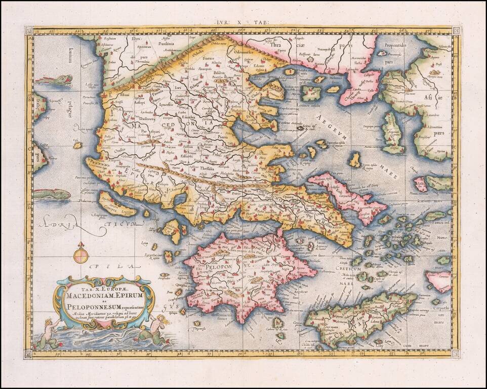
Nice example of Mercator's map of Greece from Mercator's edition of Ptolemy's Geographia, first published in 1578 and republished in Amsterdam beginning in 1695.

Includes a Sea Monster, cartouche and a detailed treatment of the region.

Gerard Mercator published his edition of Ptolemy’s maps as what he intended as a companion to his Atlas of the Modern World. Beginning with the 1695 edition, the plates were re-worked, substituting a new cartouche within the map, containing a second title.


Special conditions for students!

If you are a student, write to us in telegram: @antiquemaps and indicate what material you need and for what work you need a map in high detail. We are ready to provide material on special terms. For students only!

Item information:

Year of creation:
Size:
11825x9436 px
Disk:
29.3595MiB
Number of pages:
1
Place:
Amsterdam
Author:
Gerhard Mercator.
$14.99

Related item