
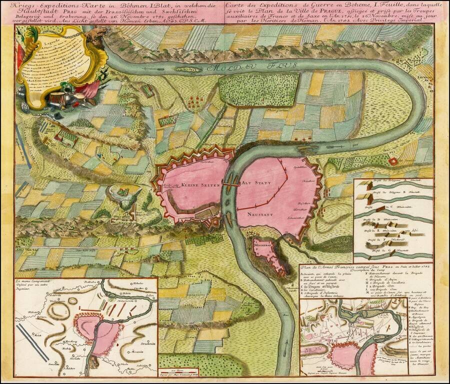
Plan of the fortifications of Prague, published by Homann Heirs in Nuremberg. The plan shows a region extending up and down the Moldava River and illustrating a battle fought between the French and Saxon Troops in November 1741. Shows battle plans,...
![[Prague] Wahrhaffter und Accurater entworffener Plan und Grund-Riss der Hauptstadt Prag in dem Königreiche Böhmen; wie Solche von dem Kayserlichen Königlichen Preussischen Auxiliar Trouppen im Monath September A. 1744 belagert und erobert worden.](/map/small/37226.jpg)
A finely drafted manuscript plan of Prague, depicting Frederick the Great's 1744 siege of the city, executed by the Danish engineer Gregers Daa Trellund. This magnificent plan shows Prague and its environs as they appeared in 1744, after the Prussian...
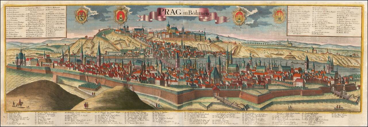
A Fine Large View of Prague Striking large format view of Prague, published by Johann Friedrich Probst (Heirs of Jeremiah Wolff), including 4 decorative coats of arms. Includes a key locating 76 places on the view. The view is based upon the...
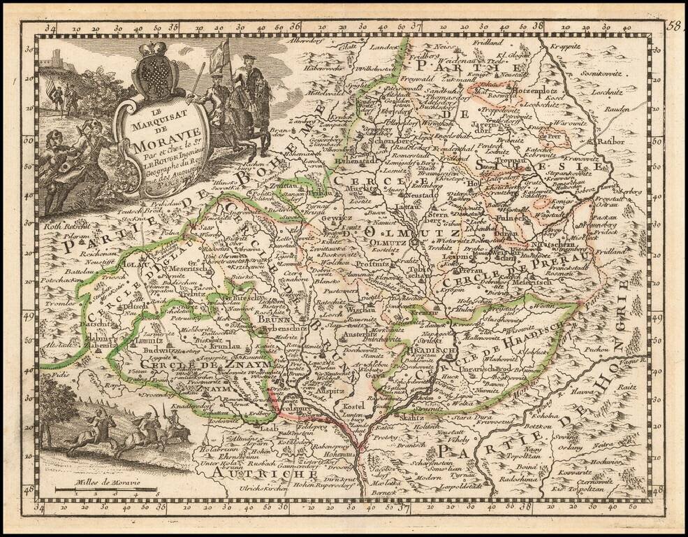
Decorative map of Moravia, published by George Louis Le Rouge, one of the most important French mapmakers of his generation. Includes a coat of arms.
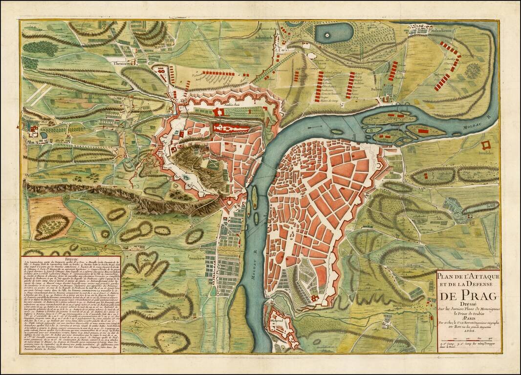
Finely executed battle plan, showing the Siege of Prague in 1742. French forces first under the command of de Broglie were surrounded by a large Austrian army in June 1742. A French relief column forced the Austrians to partially lift the siege in...
Detailed map of the Bohemia, Moravia and Austrian Silesia, published in De Vaugondy's first atlas.
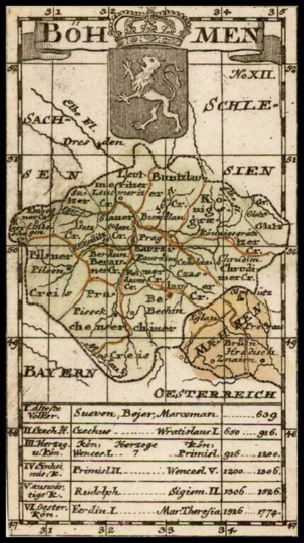
Rare second edition of this small map of Bohemia, which apeared in the 11th edition of Kurtze, erlauterung . . . published in Berlin in 1795.
![[Austrian Army Positions in Moravia, May 1758] . Plan du Campe de L'Armee Imperiale dans les Environs de Chotze le 4me May 1758.](/map/small/59816.jpg)
Chocen, Hemze and Bestovice, Czechia -- May 1758 -- Positions of the Austrian Army Under The Command of Count von Daun Finely executed map illustrating the Austrian military positions, likely under the Command of Field Marshall Count Leopole Josef von...
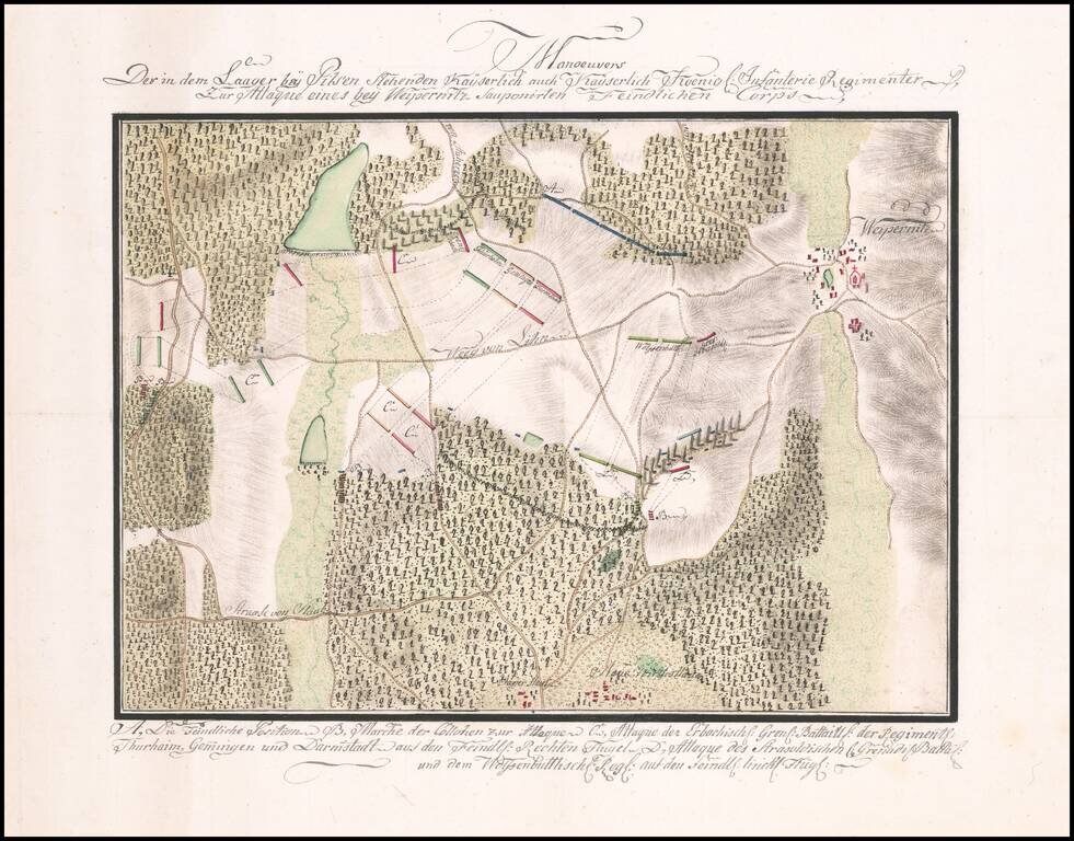
Manuscript Battle Plan of the area around Vejprnice, Czechia. Finely executed battle plan showing the troop positions to the west of the town of Weipernitz (Vejprnice), about 4 miles west of Pilsen (Plzen) in the northern part of the Czech Republic....
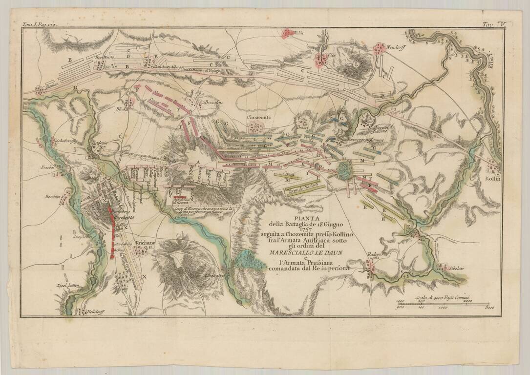
Detailed Italian language battle plan of the Battle of Kolin, fought to the east of Prague on July 18, 1757, during the Seven Years War. The Battle of Kolín saw 44,000 Austrians under Count von Daun, defeat 32,000 Prussians under Frederick the...
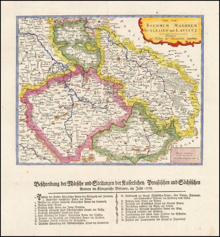
Rare separately published map showing a description of Marche and the position of the imperial Prussian and Sachis armies in Bohemia in 1778.
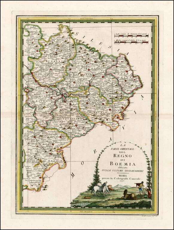
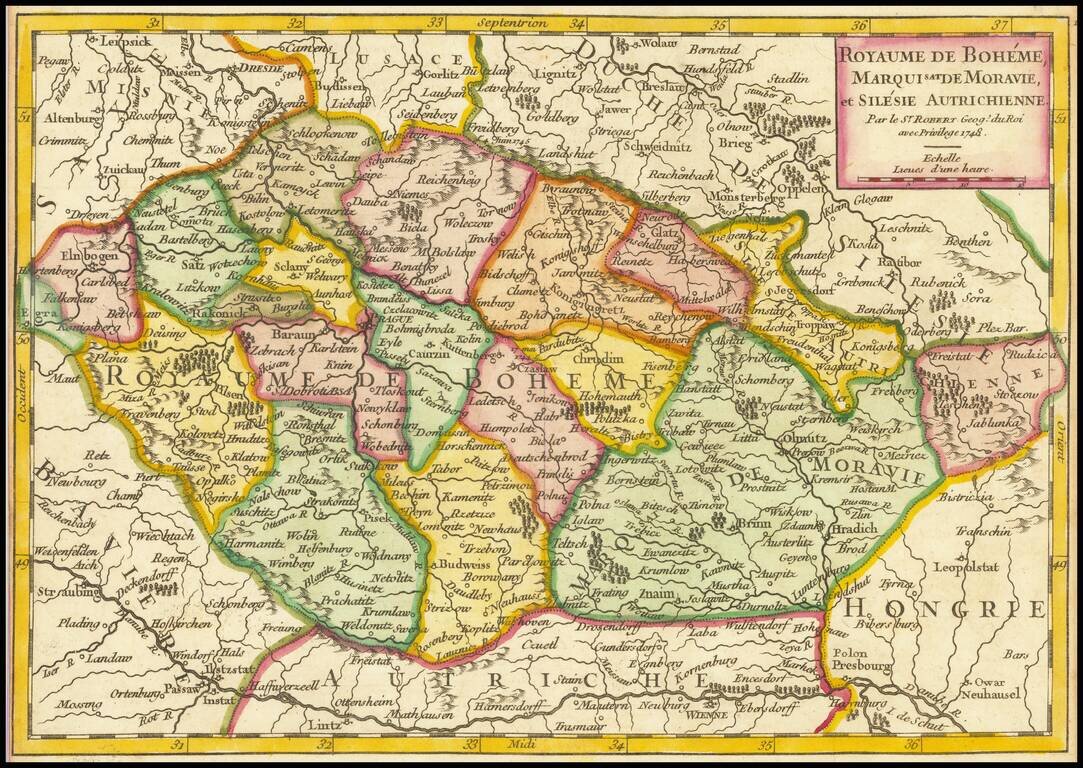
Rare and highly decorative regional map of the Eastern part of Bohemia. The map shows Prague in the west and extends to the Moravian and Silesian borders. Includes an ornate cartouche.
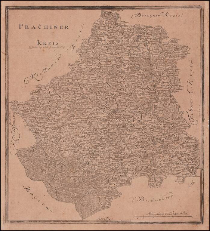
Rare Separately Published Map of Prachatice District From The First Atlas of Bohemia Rare regional map of the Prachatice District, covering the southwestern portion of the modern Czech Republic. The atlas contained 13 maps, and was based upon...
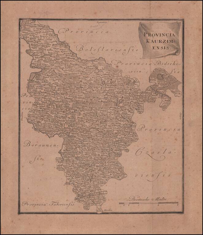
Rare Separately Published Map of Kauzim Province From The First Atlas of Bohemia Rare regional map of the Kaurzim Province, including Prag in the northwest, covering the central portion of the modern Czech Republic. The atlas contained 13 maps and...
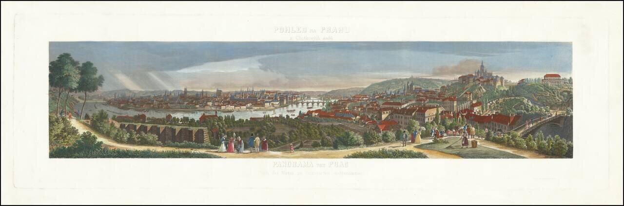
Rare panoramic view of Prague, showing the town from the Chotkovy hillside. The view is based upon a drawing by Morstat and engraved by F. Geissler.
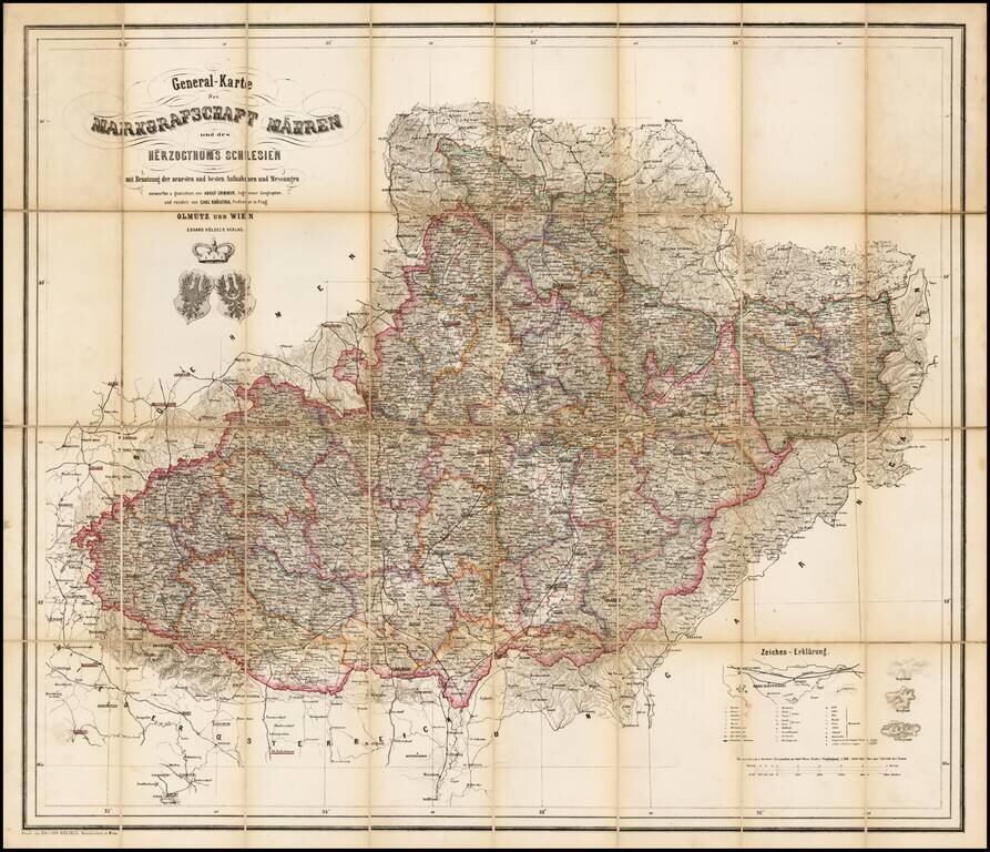
Rare map of the Moravia and Schliesen, depicting the region in remarkable and exacting detail. Includes tables, coats of arms and graphic details.