logo

1860. General-Karte der Markgrafschaft Mahren und des Herzogthums Schleisen mit Benutzund der neuesten und besten Aufnahrnen und Messungen entworfen u gezeichnet . . .

  • General-Karte der Markgrafschaft Mahren und des Herzogthums Schleisen mit Benutzund der neuesten und besten Aufnahrnen und Messungen entworfen u gezeichnet . . .

General-Karte der Markgrafschaft Mahren und des Herzogthums Schleisen mit Benutzund der neuesten und besten Aufnahrnen und Messungen entworfen u gezeichnet . . . information:

Year of creation: 
Resolution size (pixels): 
 6261x5385 px
Disk Size: 
 7.38706MiB
Number of pages: 
 1
Place: 
 Vienna
Author: 

Print information. Print size (Width x height in inches):
Printing at 72 dpi 
  86.96 х 74.79
Printing at 150 dpi 
 41.74 х 35.9
Printing at 300 dpi 
 20.87 х 17.95

An example of detailing the file of this map of in a printable high-resolution:

Click to open in high resolution (open in new tab).
Attention! this is just the central piece (central area 960x960 px) of the map file!
This is an example, so that you can see and study the level of detail of a given map. The entire Map will be fully available after payment!

General-Karte der Markgrafschaft Mahren und des Herzogthums Schleisen mit Benutzund der neuesten und besten Aufnahrnen und Messungen entworfen u gezeichnet . . .

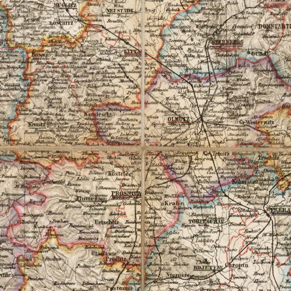
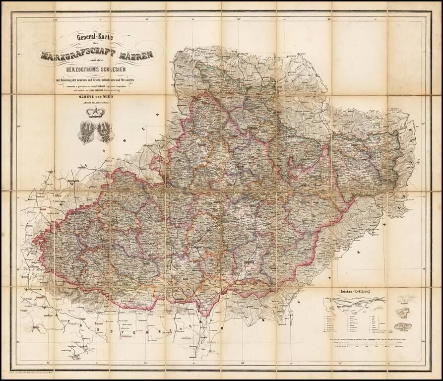
Rare map of the Moravia and Schliesen, depicting the region in remarkable and exacting detail.

Includes tables, coats of arms and graphic details.


Special conditions for students!

If you are a student, write to us in telegram: @antiquemaps and indicate what material you need and for what work you need a map in high detail. We are ready to provide material on special terms. For students only!

Item information:

Year of creation:
Size:
6261x5385 px
Disk:
7.38706MiB
Number of pages:
1
Place:
Vienna
Author:
Adolf Sommer.
$14.99

Related item