logo

1778. Carte von Boehmen Maehren Schlesien und Lausitz

  • Carte von Boehmen Maehren Schlesien und Lausitz

Carte von Boehmen Maehren Schlesien und Lausitz information:

Year of creation: 
Resolution size (pixels): 
 8110x8732 px
Disk Size: 
 12.818MiB
Number of pages: 
 1
Place: 
 Nuremberg

Print information. Print size (Width x height in inches):
Printing at 72 dpi 
  112.64 х 121.28
Printing at 150 dpi 
 54.07 х 58.21
Printing at 300 dpi 
 27.03 х 29.11

An example of detailing the file of this map of in a printable high-resolution:

Click to open in high resolution (open in new tab).
Attention! this is just the central piece (central area 960x960 px) of the map file!
This is an example, so that you can see and study the level of detail of a given map. The entire Map will be fully available after payment!

Carte von Boehmen Maehren Schlesien und Lausitz

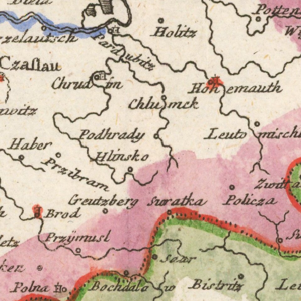
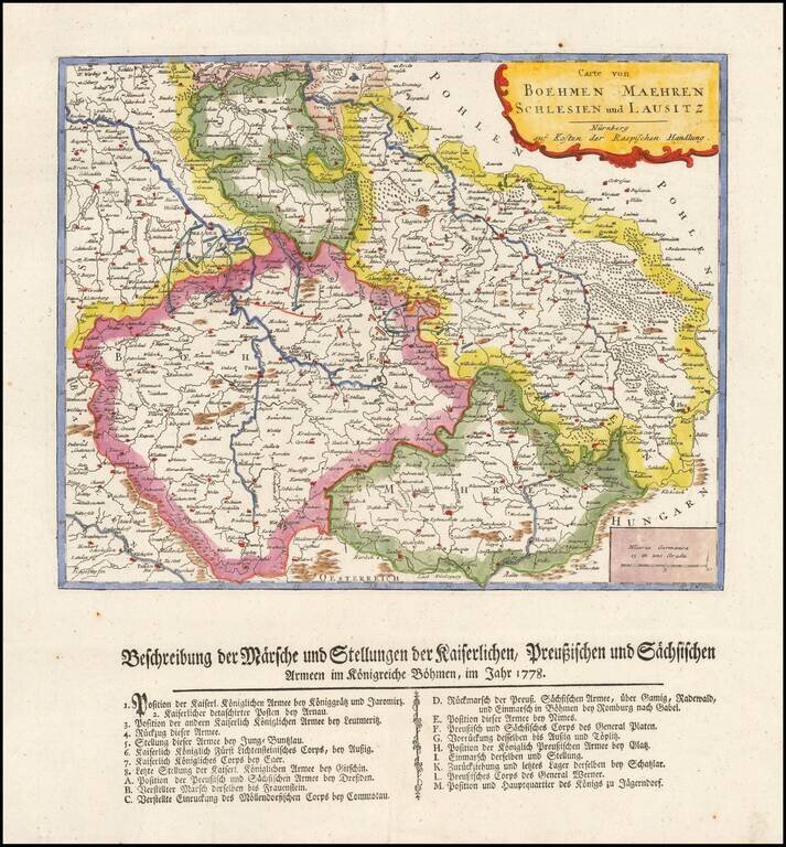
Rare separately published map showing a description of Marche and the position of the imperial Prussian and Sachis armies in Bohemia in 1778.


Special conditions for students!

If you are a student, write to us in telegram: @antiquemaps and indicate what material you need and for what work you need a map in high detail. We are ready to provide material on special terms. For students only!

Item information:

Year of creation:
Size:
8110x8732 px
Disk:
12.818MiB
Number of pages:
1
Place:
Nuremberg
Author:
Gabriel Nikolaus Raspe.
$14.99

Related item