Map size in jpg-format: 9.31241MiB
Click to open in high resolution (open in new tab).
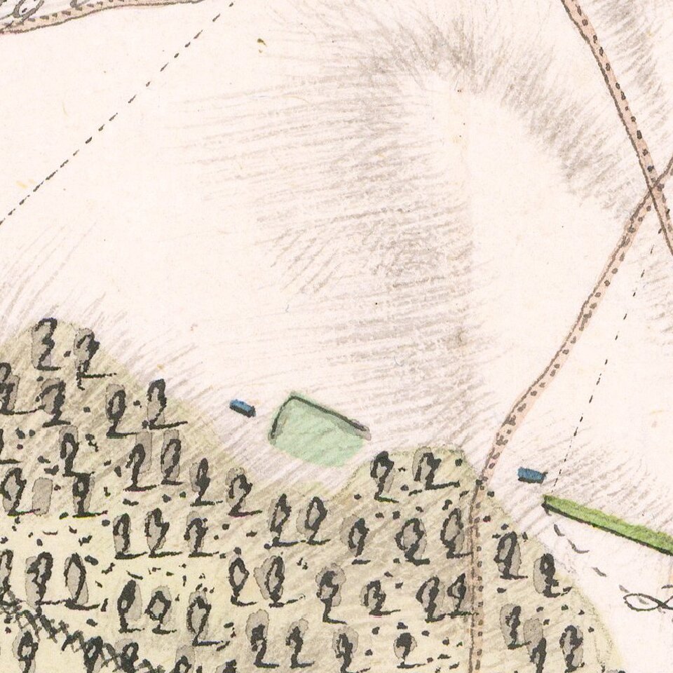
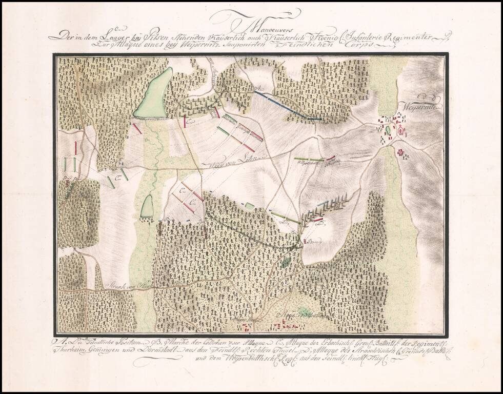
Manuscript Battle Plan of the area around Vejprnice, Czechia.
Finely executed battle plan showing the troop positions to the west of the town of Weipernitz (Vejprnice), about 4 miles west of Pilsen (Plzen) in the northern part of the Czech Republic.
The map shows troop battle positions during the Seven Years War. The map would appear to show the movements of the Hesse-Darmstadt Army in 1759, with one of the commanders being Reinhard von Gemmingen-Hornberg.
If you are a student, write to us in telegram: @antiquemaps and indicate what material you need and for what work you need a map in high detail. We are ready to provide material on special terms. For students only!