logo

1690. Le Royaume D'Irlande Divise en Provinces subivisees en Compte et en Baronies selon les Memoires du Sr. Petty . . .

  • Le Royaume D'Irlande Divise en Provinces subivisees en Compte et en Baronies selon les Memoires du Sr. Petty . . .

Le Royaume D'Irlande Divise en Provinces subivisees en Compte et en Baronies selon les Memoires du Sr. Petty . . . information:

Year of creation: 
Resolution size (pixels): 
 3793x5034 px
Disk Size: 
 4.60576MiB
Number of pages: 
 1
Place: 
 Paris
Author: 

Print information. Print size (Width x height in inches):
Printing at 72 dpi 
  52.68 х 69.92
Printing at 150 dpi 
 25.29 х 33.56
Printing at 300 dpi 
 12.64 х 16.78

An example of detailing the file of this map of in a printable high-resolution:

Click to open in high resolution (open in new tab).
Attention! this is just the central piece (central area 960x960 px) of the map file!
This is an example, so that you can see and study the level of detail of a given map. The entire Map will be fully available after payment!

Le Royaume D'Irlande Divise en Provinces subivisees en Compte et en Baronies selon les Memoires du Sr. Petty . . .

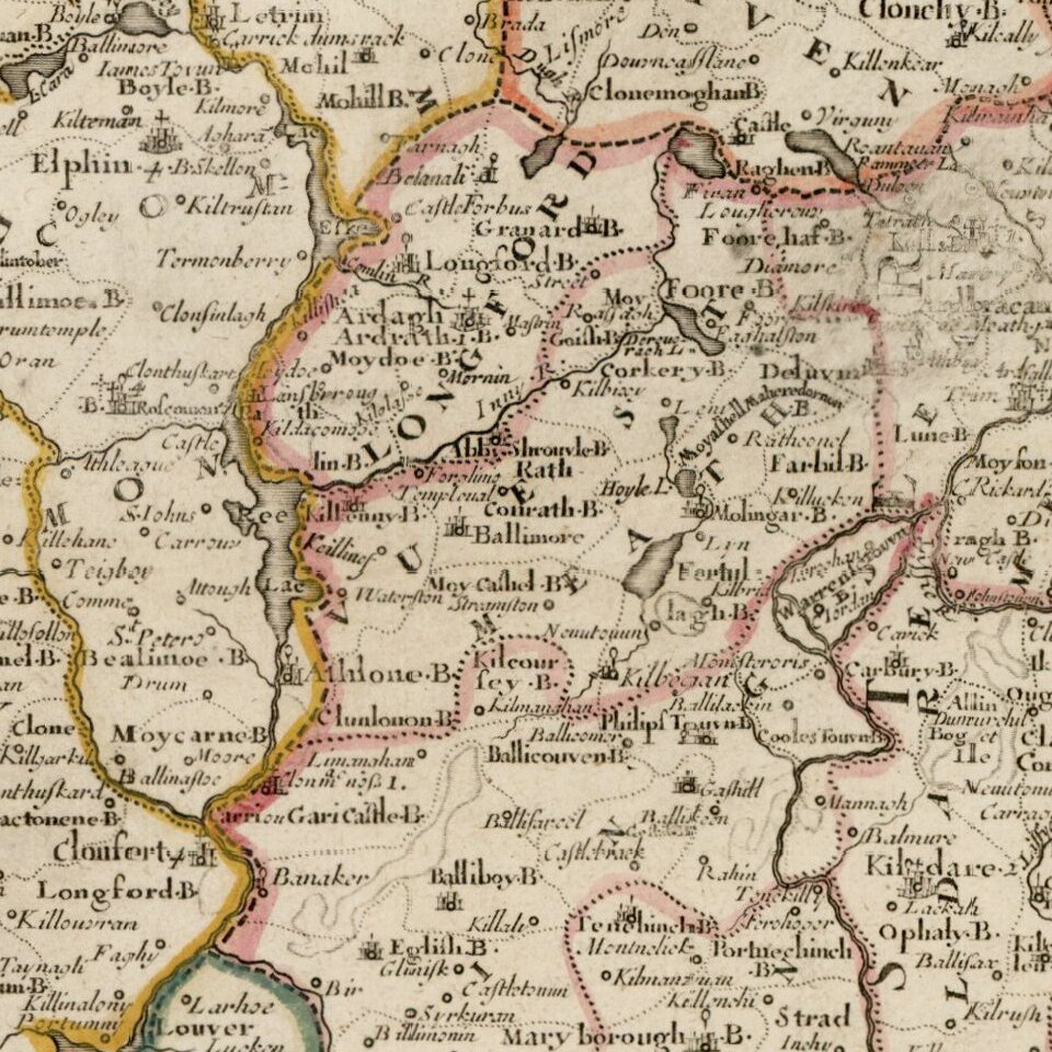
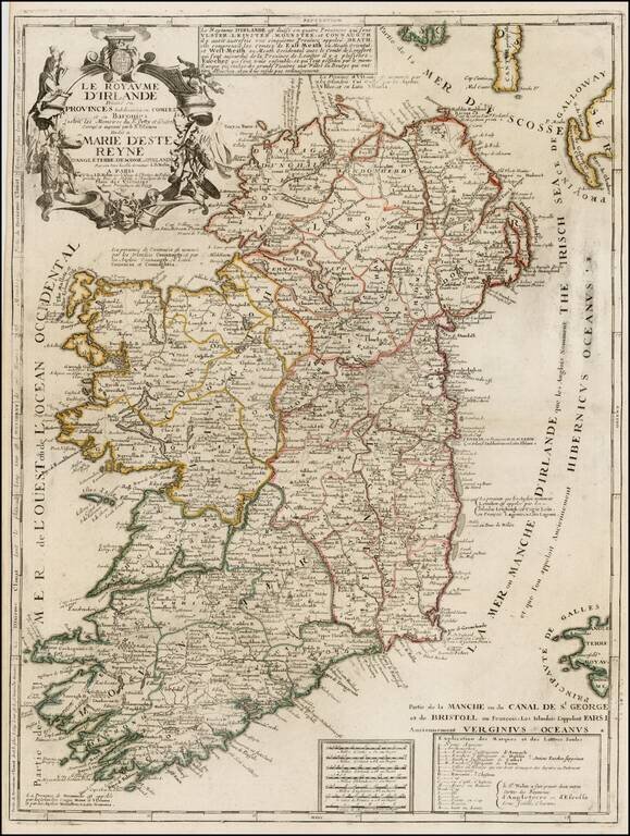
Scarce map of Ireland, published by Nolin.

The map is colored by counties and includes an ornate cartouche, dedication to the Queen and a box of explanatory text not present in all editions. Nolin's maps are among the most accurate and well engraved of the period and are sought after by collectors.


Special conditions for students!

If you are a student, write to us in telegram: @antiquemaps and indicate what material you need and for what work you need a map in high detail. We are ready to provide material on special terms. For students only!

Item information:

Year of creation:
Size:
3793x5034 px
Disk:
4.60576MiB
Number of pages:
1
Place:
Paris
Author:
Jean-Baptiste Nolin.
$14.99

Related item