logo

1607. Hiberniae Ireland Anglis Yverdon Britannis Erin incolis Ierna . . .

  • Hiberniae Ireland Anglis Yverdon Britannis Erin incolis Ierna . . .

Hiberniae Ireland Anglis Yverdon Britannis Erin incolis Ierna . . . information:

Year of creation: 
Resolution size (pixels): 
 8666x6916 px
Disk Size: 
 23.8996MiB
Number of pages: 
 1
Place: 
 London
Author: 

Print information. Print size (Width x height in inches):
Printing at 72 dpi 
  120.36 х 96.06
Printing at 150 dpi 
 57.77 х 46.11
Printing at 300 dpi 
 28.89 х 23.05

An example of detailing the file of this map of in a printable high-resolution:

Click to open in high resolution (open in new tab).
Attention! this is just the central piece (central area 960x960 px) of the map file!
This is an example, so that you can see and study the level of detail of a given map. The entire Map will be fully available after payment!

Hiberniae Ireland Anglis Yverdon Britannis Erin incolis Ierna . . .

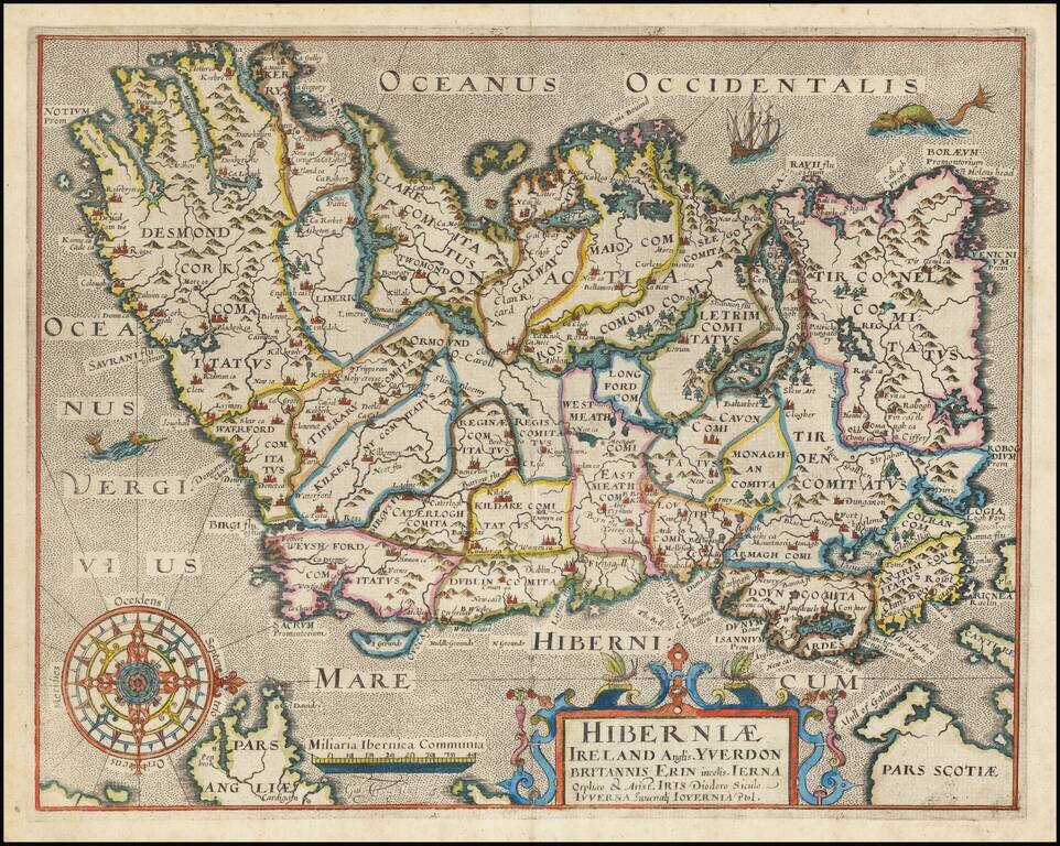
One of the earliest obtainable maps of Ireland, published in London.

Oriented with West at the top.


Special conditions for students!

If you are a student, write to us in telegram: @antiquemaps and indicate what material you need and for what work you need a map in high detail. We are ready to provide material on special terms. For students only!

Item information:

Year of creation:
Size:
8666x6916 px
Disk:
23.8996MiB
Number of pages:
1
Place:
London
Author:
William Hole.
$14.99

Related item