
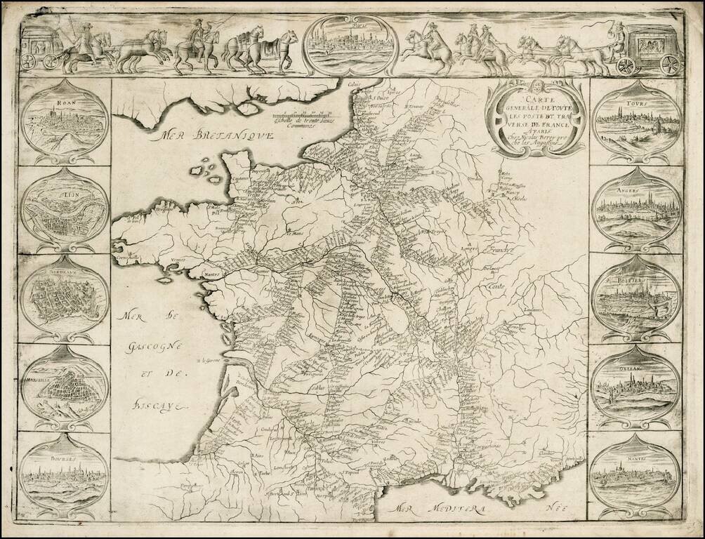
Striking example of Nicholas Berey's rare map of the Postal Routes of France, one of the first printed postal maps of France and one of the earliest European postal maps. This separately issued map, which appeared at about the same time as Tavernier's...
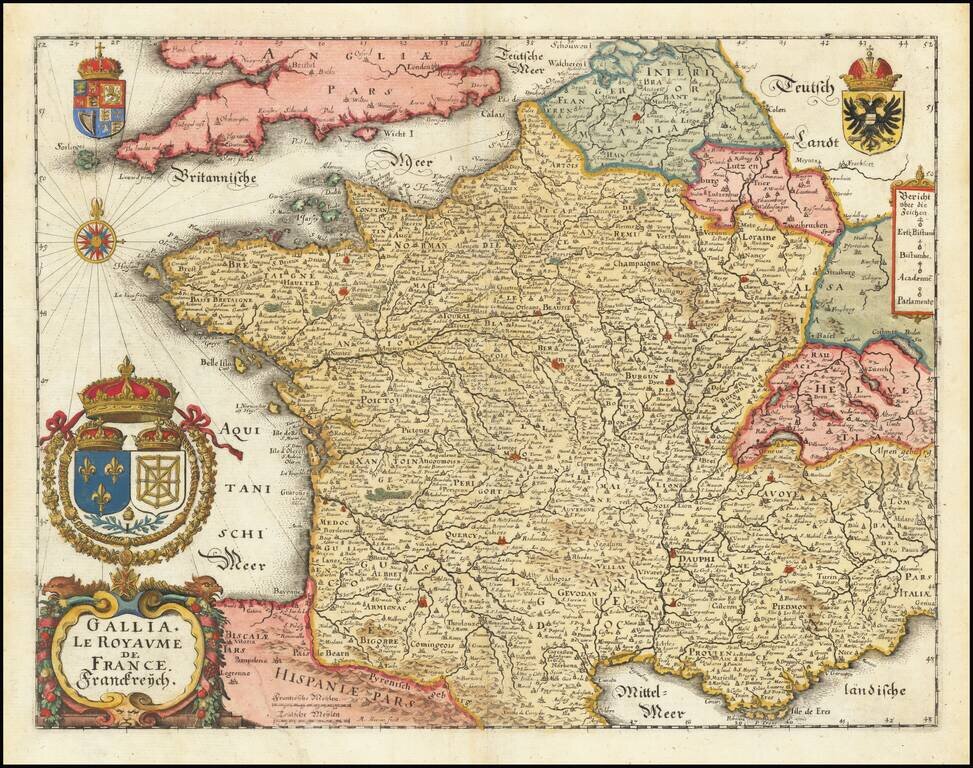
A striking full-color example of Merian's decorative map of France. The map includes a large cartouche, compass rose, and four coats of arms. The map is extensively and accurately detailed, typical of Merian's maps. Parts of adjoining countries are...
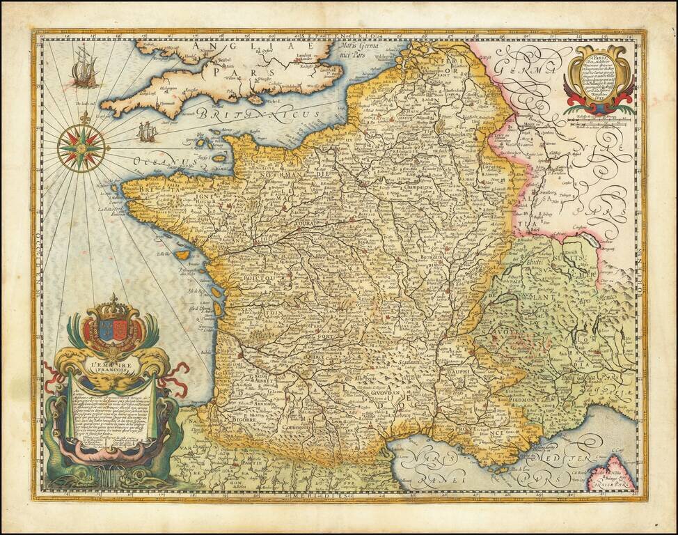
The French Empire in 1637 Fine early map of France, published by Melchior Tavernier. The use of the title L'Empire Francois is quite unusual, given that France was, at the time, a Kingdom and would not use the term "Empire" until Napoleon.
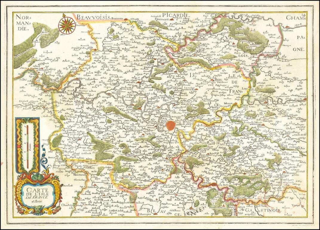
Fine early map of Isle de France and Brie, centered on Paris.
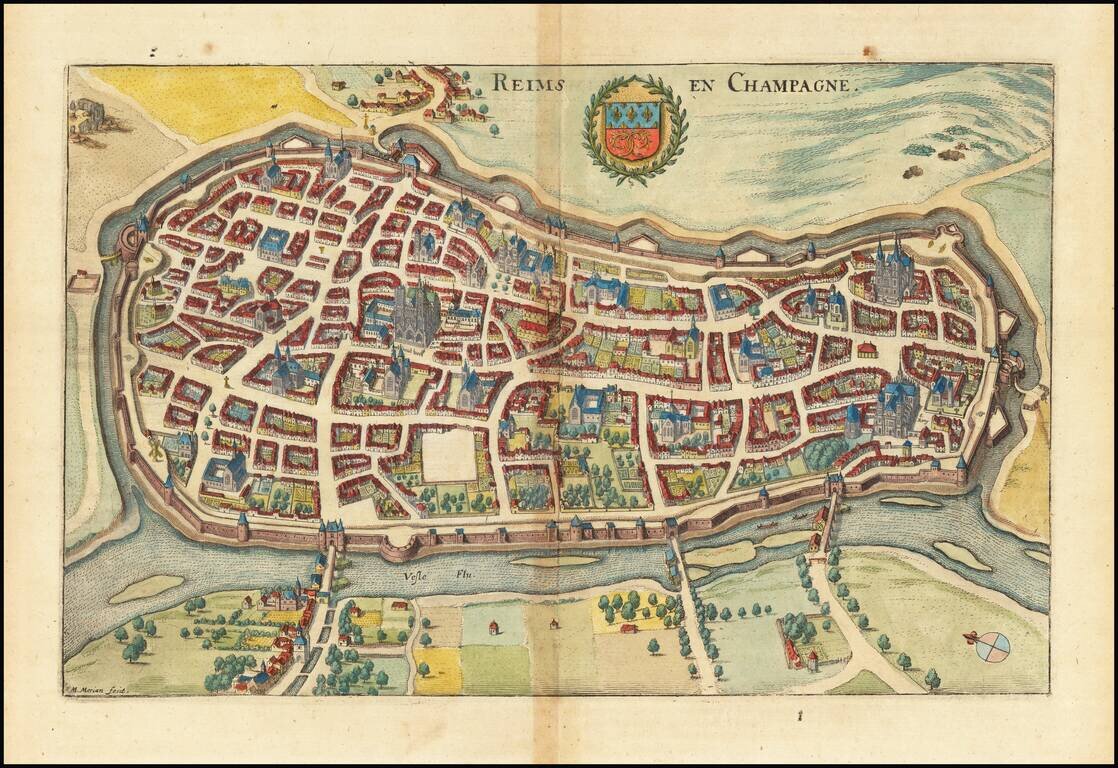
Striking birdseye view of Reims in Champagne, from Merian's Neuwe Archontologica Cosmica . . ., published in 1638. Shows detailed town plan,Vesle River, Iausa River, fortified walls, Kremlin, public buildings, churches, bridges, etc. Includes the...
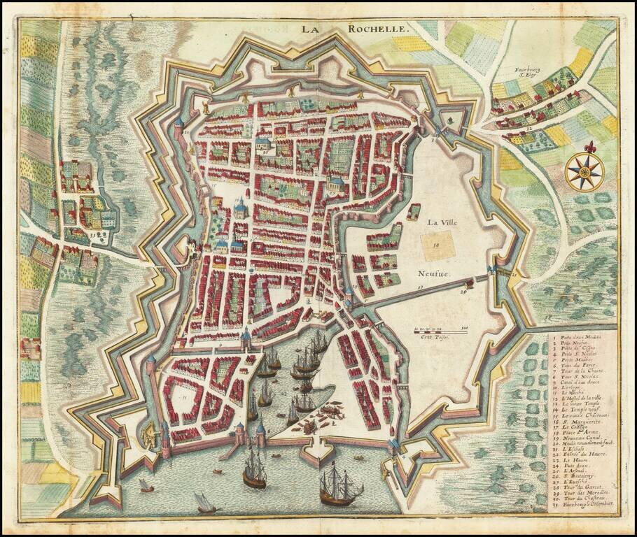
Striking birdseye view of La Rochelle, from Merian's Neuwe Archontologica Cosmica . . ., published in 1638. Shows the harbor, ships, detailed town plan, fortified walls, churches, bridges, and the neighboring region. Gorgeous elaborate coat of arms,...
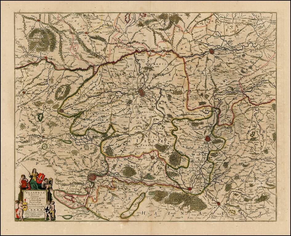
Detailed map of the French part of Flanders, including Douay, Lille, Doornick, Conde, St. Amand. Decorative cartouche.
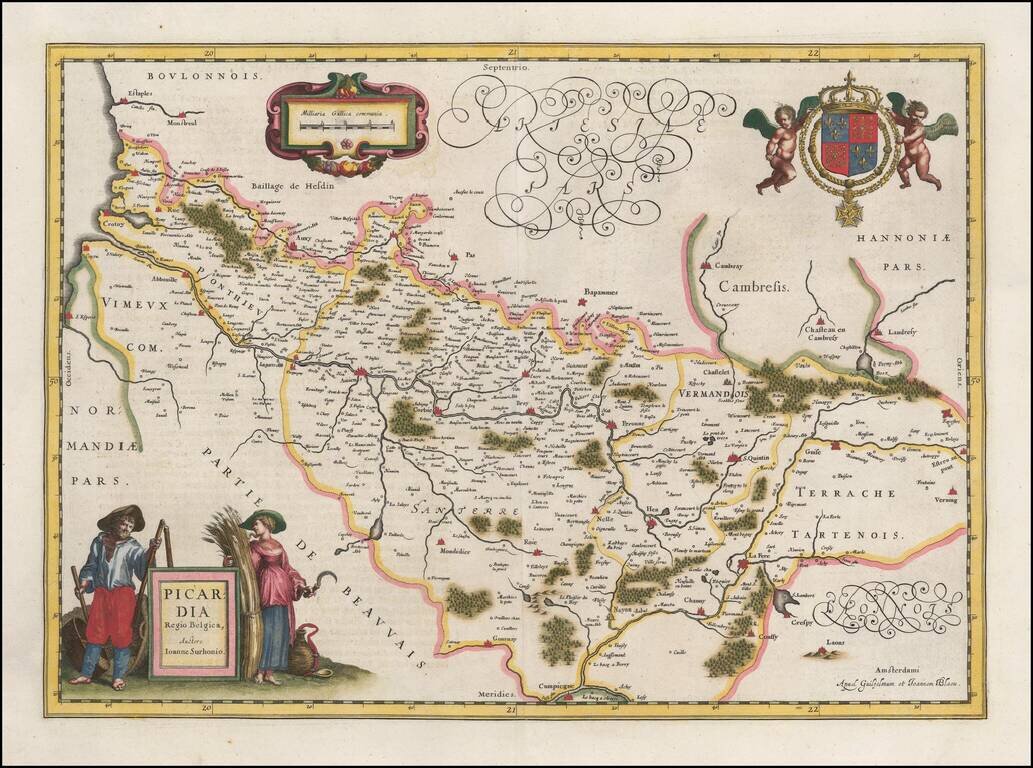
Decorative map of the Picardie region of Northwestern France, with decorative cartouche and coat of arms. The map is centered on Amiens.
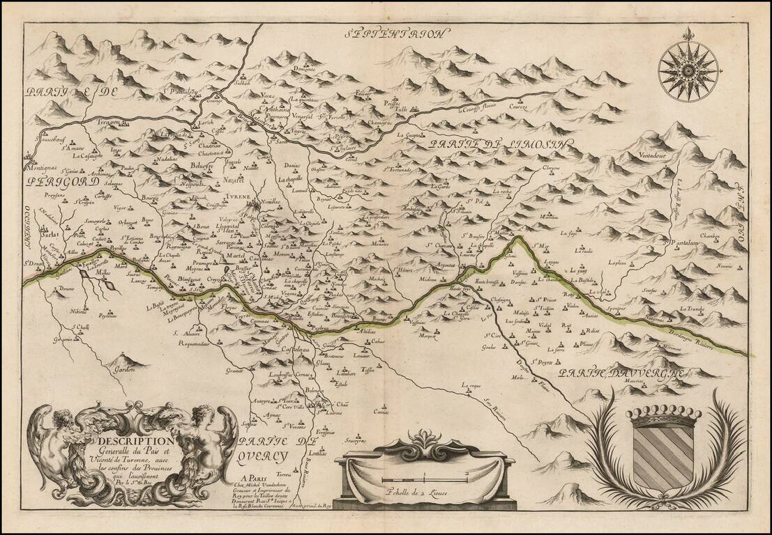
Rare map of the Dordogne River Valley and the Coureze River Valley, published in Paris by Michel Van Lochem. The map is centered on the Turenne Region, Correze Department in the Limonsin region.
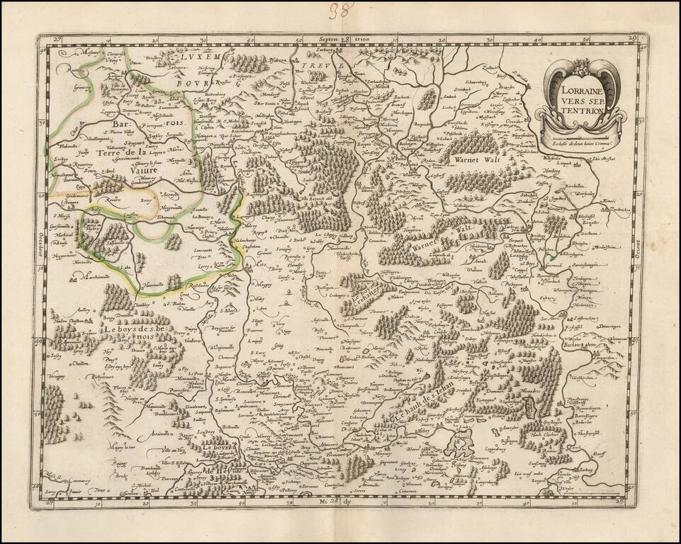
Rare late edition of Francois Bougereau's map of Lorraine region, first published in 1594. The map shows the northern part of Lorraine, based upon an earlier map by Mercator. This edition has the credit of Bougereau (and later imprint of Le Clerc)...
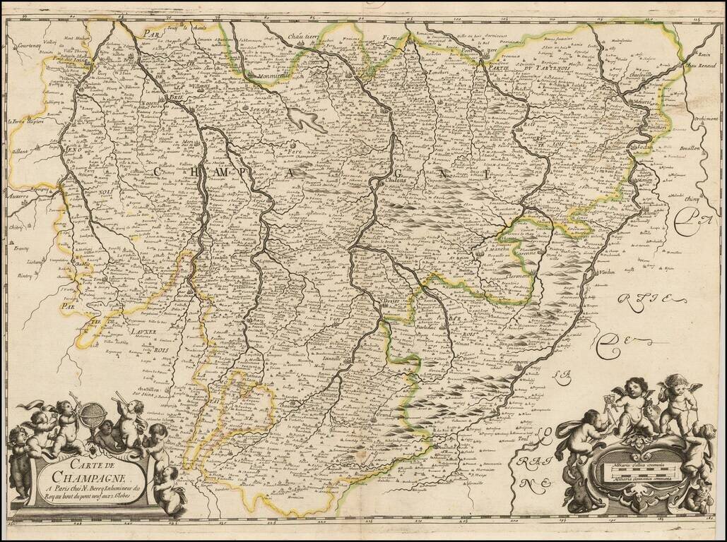
Exceedingly rare map of the Champagne region, published by Nicolas Berey in Paris. The map covers a wide swath of central France, with northwest at the the top. Auxerre is shown at the center left of the map, with the Moselle River at the far right...
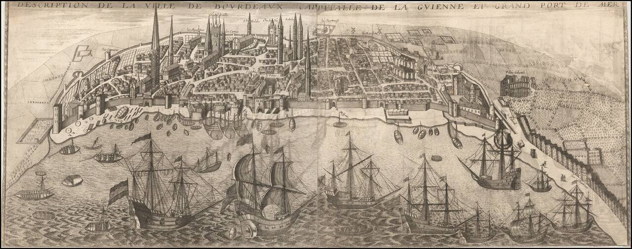
Rare early view of Bordeaux, published in Paris by Jean Boisseau. A fine early panoramic view of the city of Bordeaux from the east, with the Garonne River in the foreground. Bourdeaux's Roman amphitheater, Le Palais Galien, is shown at far right,...
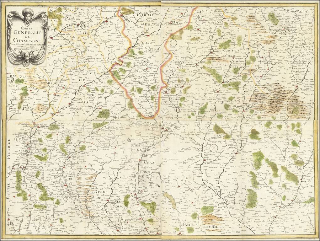
A rare early map of the Champagne region, from Nicolas Tassin's rare large-format atlas of France. The map shows Champagne looking eastwards, showing the many rivers, cities, towns, and hills of this agricultural region of northeastern France. Borders...
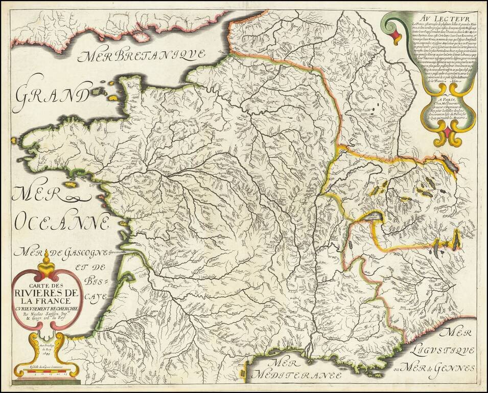
Nice example of Sanson's 1641 double-page engraved map of the rivers of France. Nicolas Sanson (1600-1667) sometimes called Nicolas Sanson d'Abbeville or Sanson d'Abbeville, was the most important French cartographer of the 17th century. Tooley...
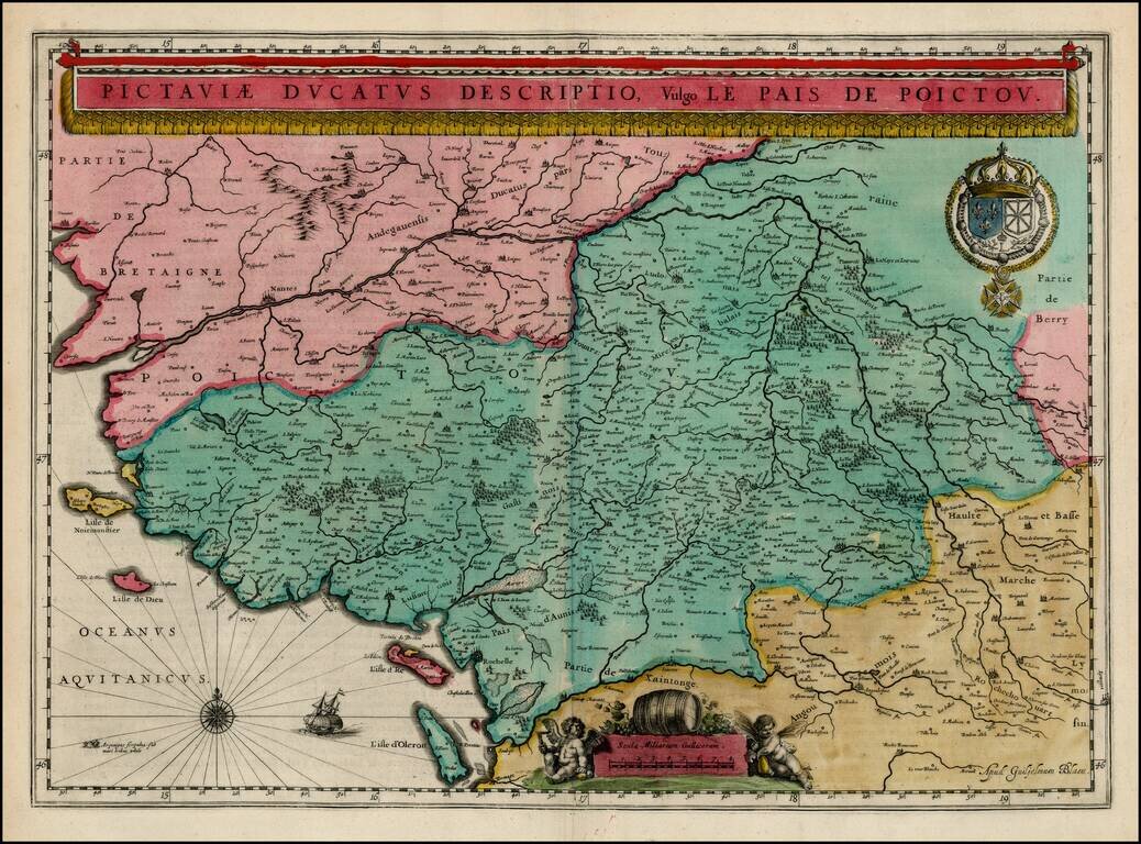
Decorative early map of the Poictou region, including Isle d'Re and Isle d'Oleron. Decorative title banner, cartouche and compass rose. Old color.
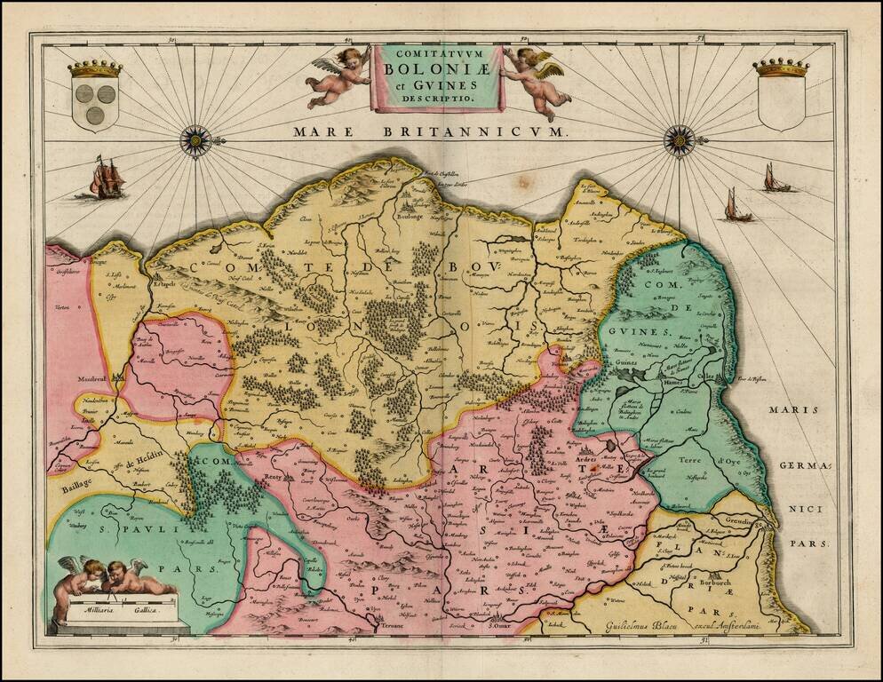
Early regional map of France, showing the French Coastline from Estapels to Greuelinge. Includes Boulonge, Cales, Borborch, S. Omar, Renty, Montreul, Guine, Hames and Fiennes. Two decorative cartouches, coats of arms, sailing ships and compass roses.