
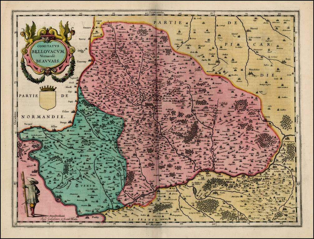
Attractive map of Beauvais region, showing Meulan, Pontoise, Compienge (Champagne), Milly and Beauvais. Fine old color example.
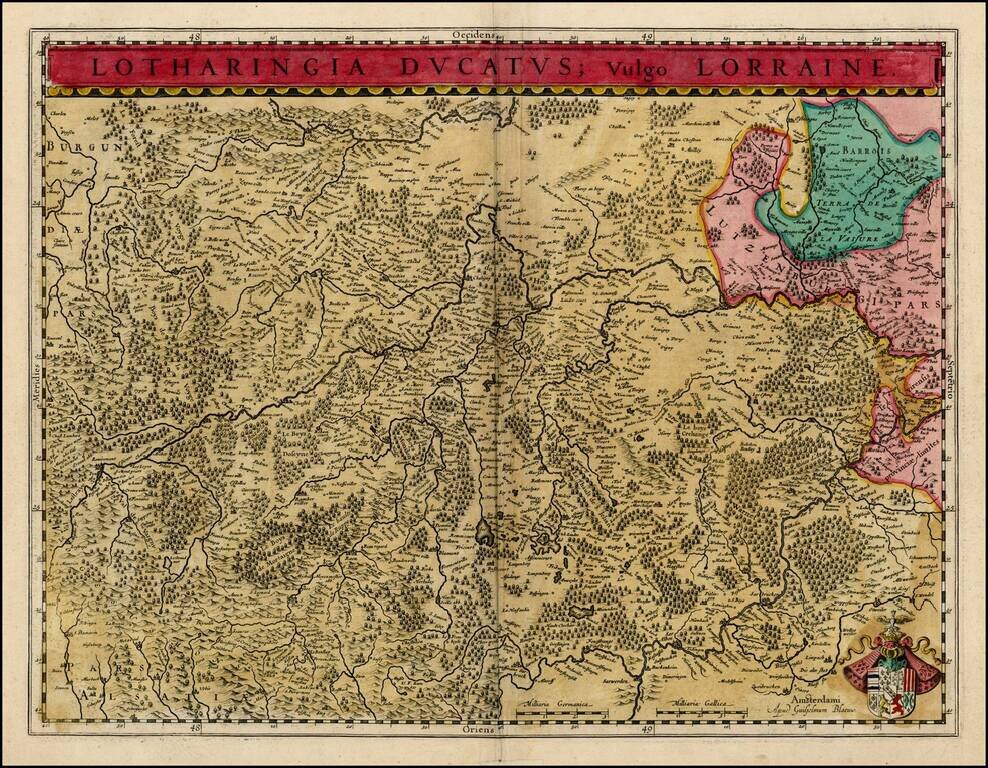
Fine old color example of Blaeu's map of the Lorraine Reigon, centered on Bayone and Nancy and including the Sar and Moselle River Valleys. Title banner and decorative coat of arms.
![Loudonois -- Laudunum [on sheet with] Mirebalais](/map/small/25821.jpg)
Decorative pair of regional maps of France, the larger map centered on the town of Loudun and the smaller map showing Mirebeau, Moncontour, Ceaux, Champigni, and Chasteherault.
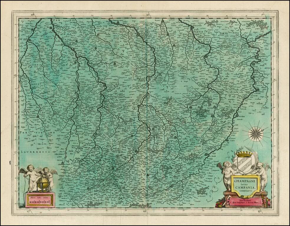
Decorative map of the Champagne Region. Large decorative cartouche, scale of miles and 2 coats of arms.

Rare Damien de Templeux map of the region to the northeast of Paris, between the Oise River in the west and the Marne River in the east. Champagne-sur-Oise is shown in the west, Soissons in the north and Meaux in the east.
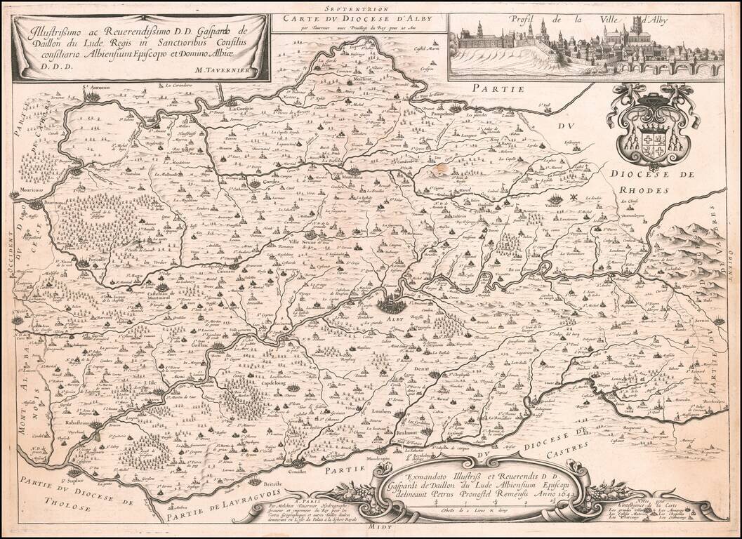
Rare map of the city of Albi on the Tarn River, with a large profile view of the city, several cartouches and a coat of arms. The map is very rare on the market. This is only the second example we have offered in over 20 years.
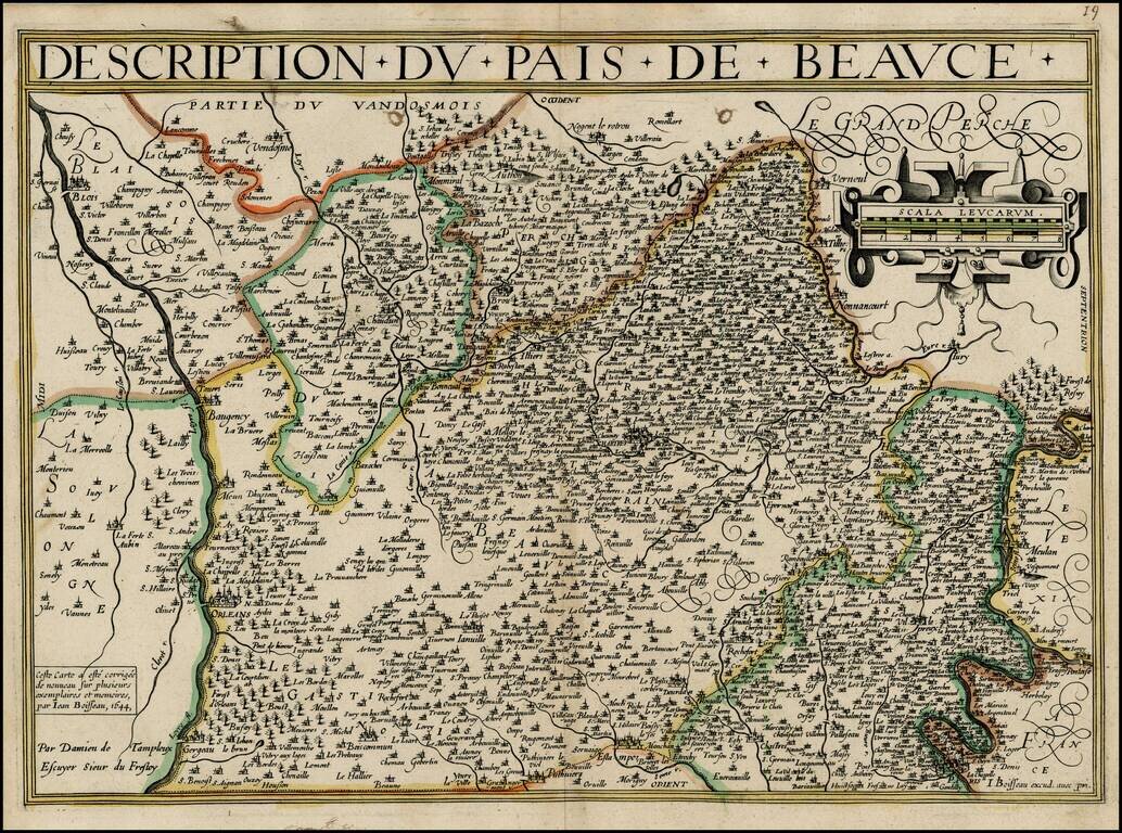
Rare map of Beauce, from Jean Boisseau's Theatre Des Gaules, first published in 1642. The map extends from Paris and the Seine River in the north to the Loire River in the south, centered on Chartes. All of Boisseau's maps are rare. As noted in...
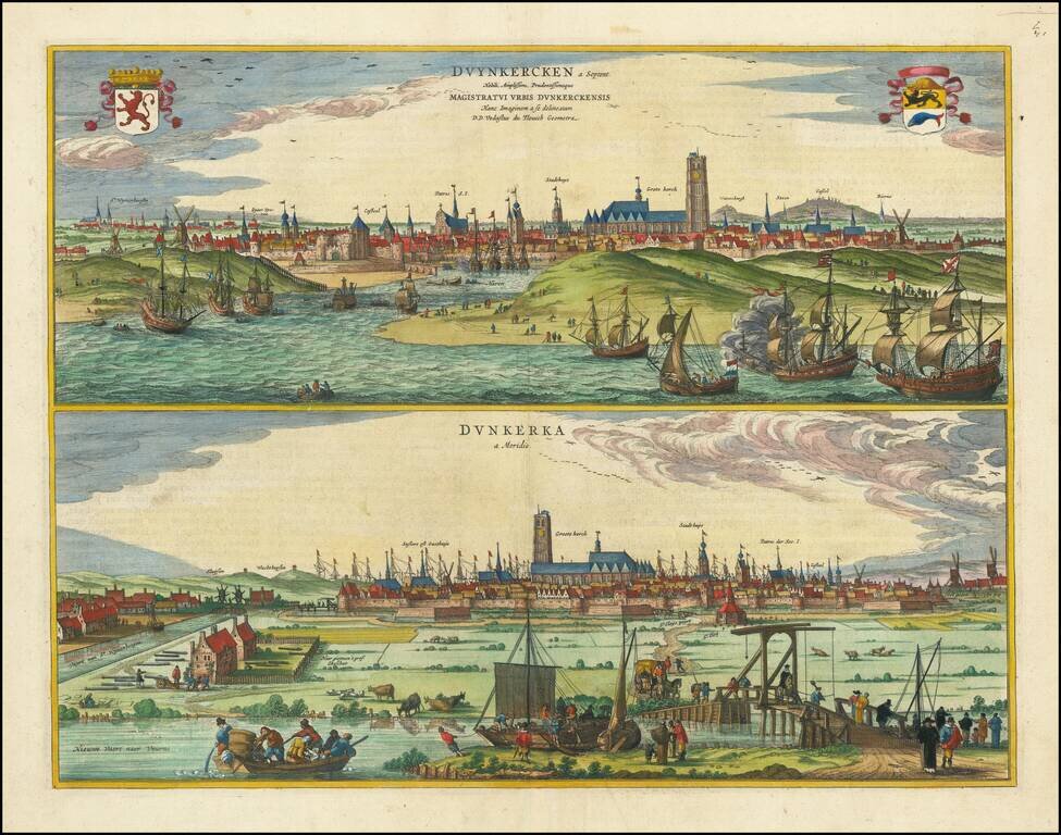
Fine pair of views of Dunkirk from the North and South, from Blaeu's Novum Ac Magnum Theatrum Urbium Belgicae Regiae.
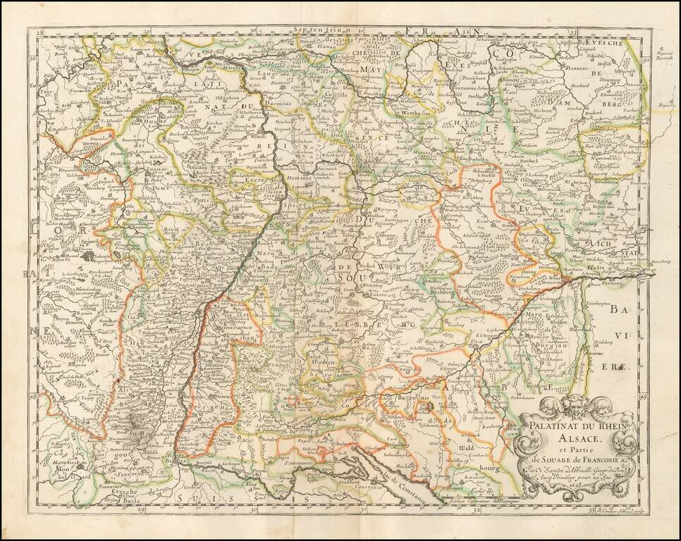
Nice old hand-color example of Sanson's 1641 double-page engraved map of the Rhineland and Alsace. Nicolas Sanson (1600-1667) sometimes called Nicolas Sanson d'Abbeville or Sanson d'Abbeville, was the most important French cartographer of the 17th...
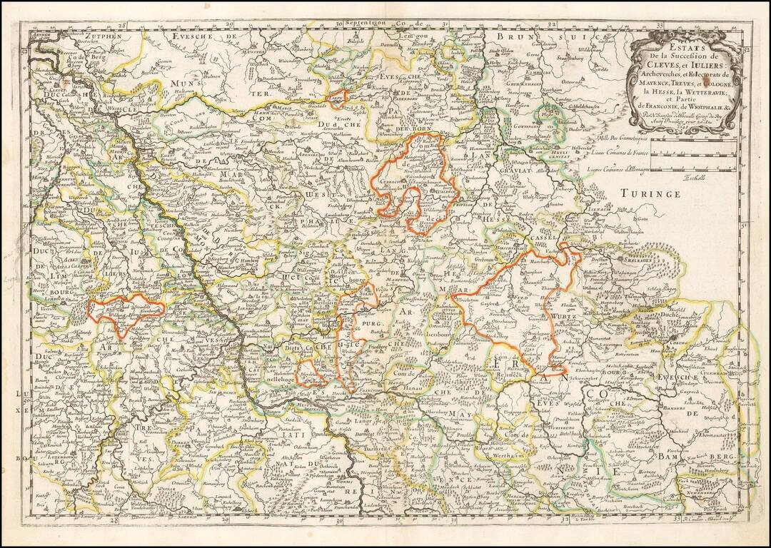
Nice old hand-color example of Sanson's 1641 double-page engraved map of the Duchy of Cleves. Nicolas Sanson (1600-1667) sometimes called Nicolas Sanson d'Abbeville or Sanson d'Abbeville, was the most important French cartographer of the 17th century....
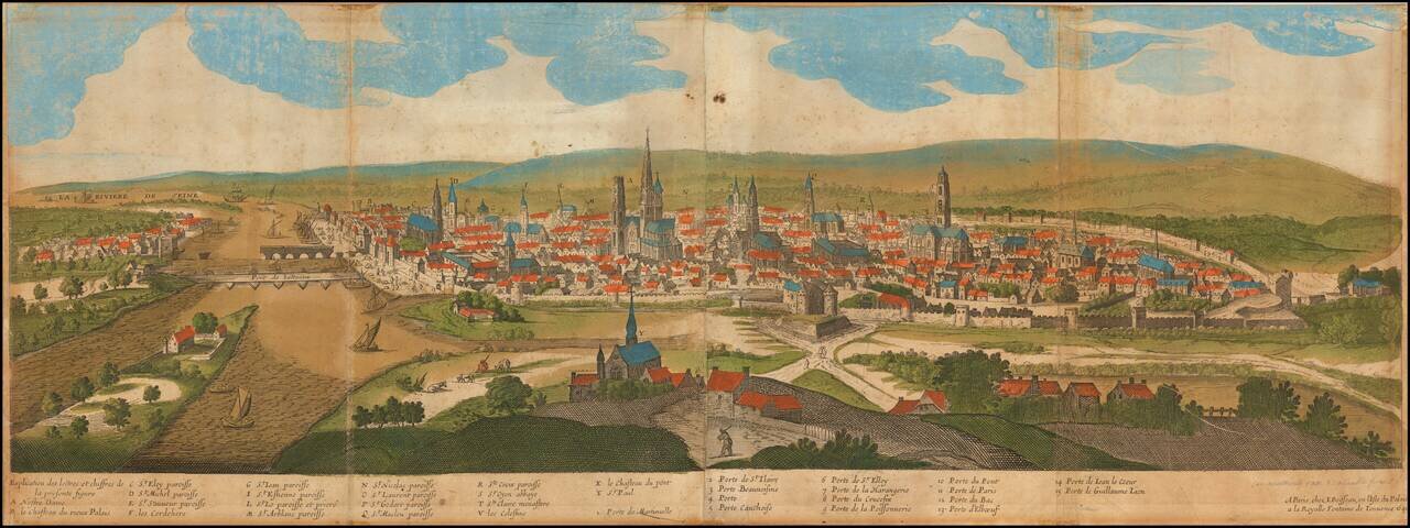
Rare old color example of this early view of Rouen, published in Paris by Jean Boisseau. A fine early panoramic view of the city of Rouen from the south, with the Seine River and St. Paul Church in the foreground and the Notre Dame Cathedral in the...

Rare map of the forest of Fontainebleau, published in Paris by Boisseau. The map shows the castle of Fontainebleau in the center of the map, with two small views of Melun and Moret. Text in the bottom right notes: "This map represents the forest of...
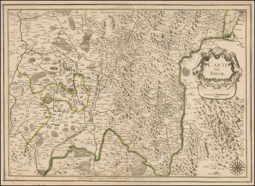
Rare map of the Bresse Region, published by Nicolas Langlois in Paris. The map shows Lyon and Chambery at the bottom of the map and Lake Geneva at the top right, with Franche-Comte at the top. The map is crossed by the Rhone River in the south.
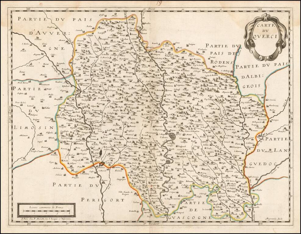
Scarce map of Quercy, centered on Cahors on the Lot River. Oriented with east at the top.
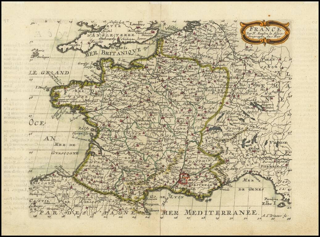
Fine old color example of this finely engraved map of France, first published by Nicholas Sanson in 1654. Sanson was the Royal Geographer to the King of France and perhaps the most important commercial mapmaker of his generation.
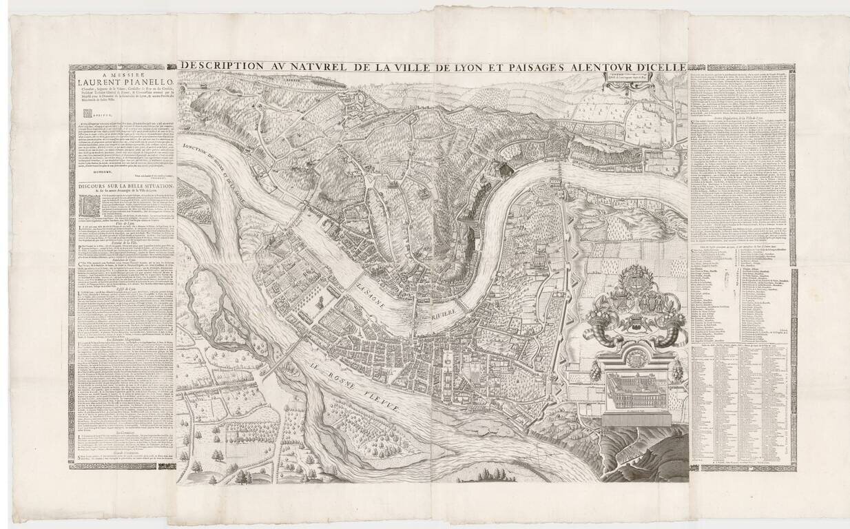
Remarkable large format plan of Lyon, first published in 1659 by Simon Maupin. The first edition of the map included a different coat of arms, which was modified in 1694. The present example has been reissued following the death of Louis XIV, in order...