
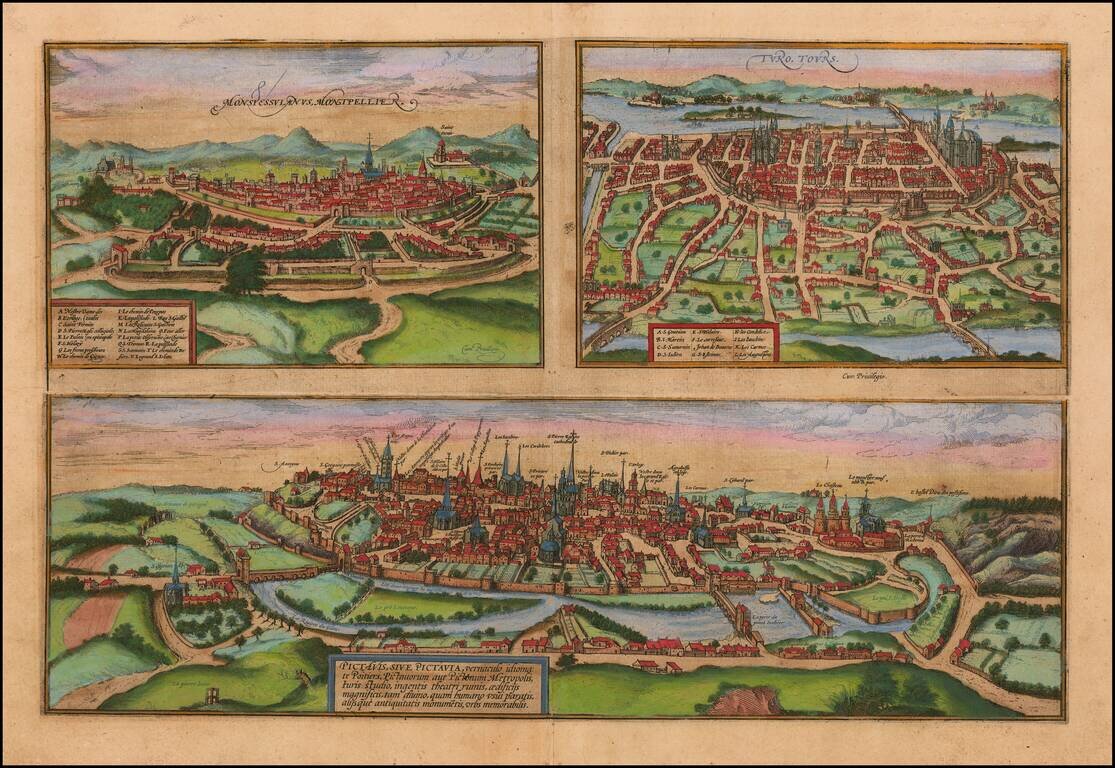
Detailled plan of the towns of Poitiers, Montpellier and Tours, from Braun & Hogenberg's Civitatus Orbis Terrarum, the most important book of town plans and views published in the 16th Century. Beautiful old colored plan of the three cities,...
![[France]](/map/small/71049.jpg)
Rare map of France, likely engraved by Joost Amman in Frankfurt. The map illustrates Charlemagne in the foreground, holding a globe aloft, with a map of France and neighboring regions as a background. The map apparently appeared in a 1576 publication...
![Regionis Biturigum Exactiss: Descriptio Per D. Ioannem Calamaeum [with] Limaniae Topographia Gabriele Symeoneo Auct.](/map/small/61579.jpg)
Nice old color pair of regional maps of France. The larger map covers the Loire region from Gian to Le Blang and Argenton, centered on Chateau Neuf and Bourges. The smaller map shows the area around Beauregard and Cleremont.
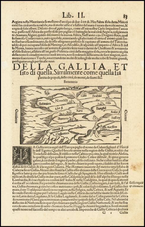
Interesting early map of France, using a stylized hill format which was popularized in maps of the 15th Century. Munster's Cosmography was one of the most influential georgraphical works of the 16th Century. It was published in a number of editions...
![[Venaissin]](/map/small/60728.jpg)
Manuscript Map of the Comte de Venaissin Fine early manuscript map of the Comte / County of Venaissin, oriented with west at the top, in an early French hand. The region shown is just above Avignon and tracks the Rhone River from Caderousse and...
![[Marseille] Marsilia](/map/small/61341sb.jpg)
An Important 16th Century View of Marseille Extremely rare bird's-eye anonymously published view / plan of Marseille from above "Le Fort de Notre Dame de la Garde". The view includes a coat of arms of the city of Marseille. Text description of...
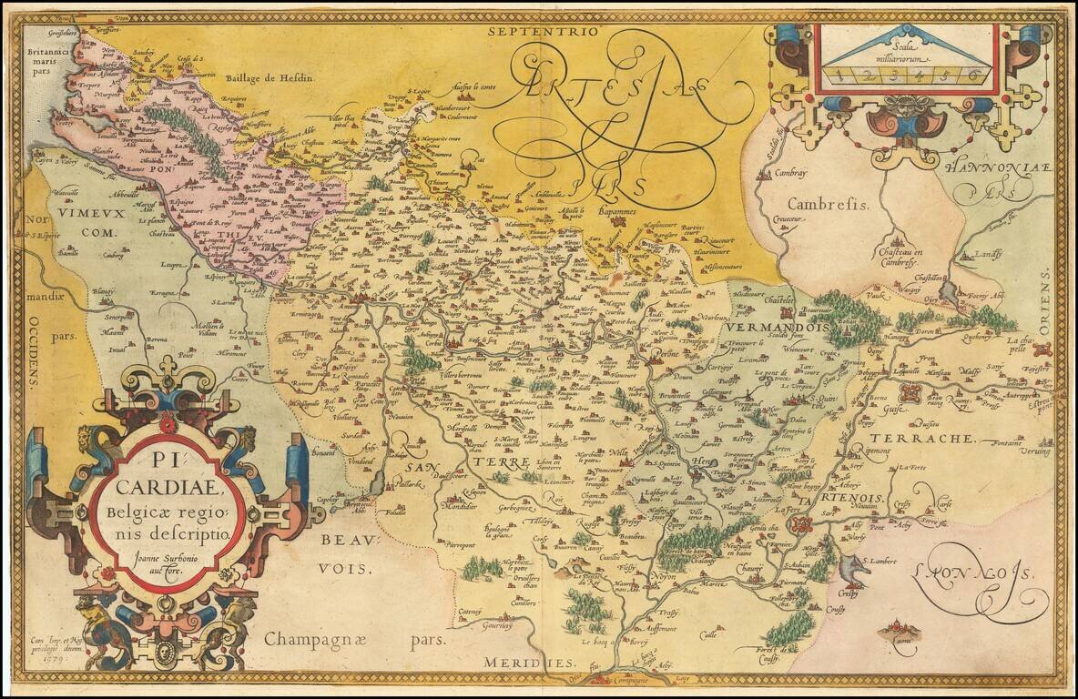
Fine old color example of this regional map of Picardie, from Ortelius' Theatrum Orbis Terrarum, the first modern atlas of the world, first published in 1570. Ornate cartouche and scale of miles.
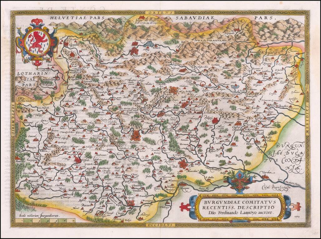
Beautifully hand-colored, decorative regional map of Burgundy in France, centered on Besancon, Poligny, Quingey and St Anne. Includes a number of famous wine regions, from Ortelius's Theatrum Orbis Terrarum, the first modern atlas of the world. The...
![[Grenoble and Romans-sur-Isère] Gratianopolis [with] Romans Delfina](/map/small/54748mp2.jpg)
Braun and Hogenberg's double-page engraved map of Grenoble and Romans-sur-Isère in south-central France.
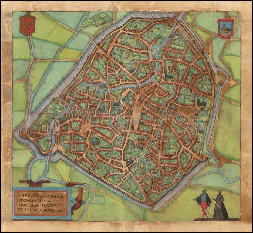
Nice example of this iconic plan of 16th century f Valenciennes, which appeared in Braun & Hogenberg's 6 volume Civititas Orbis Terrarum. The verso translates as follows: The Loire, an exceedingly well-known river in France, flows directly past...
![[Douai] Duacum, Catuarcorum urbs tam situ, quam incolis, et litterarum studijs elegantissime ornata](/map/small/55817mp2.jpg)
Nice example of important plan of 16th century Douai, which appeared in Braun & Hogenberg's 6 volume Civititas Orbis Terrarum.
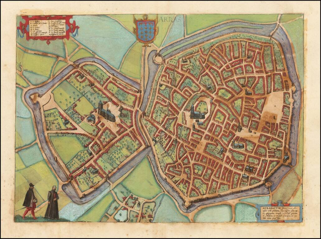
Nice example of this iconic plan of 16th century Arras, which appeared in Braun & Hogenberg's 6 volume Civititas Orbis Terrarum.
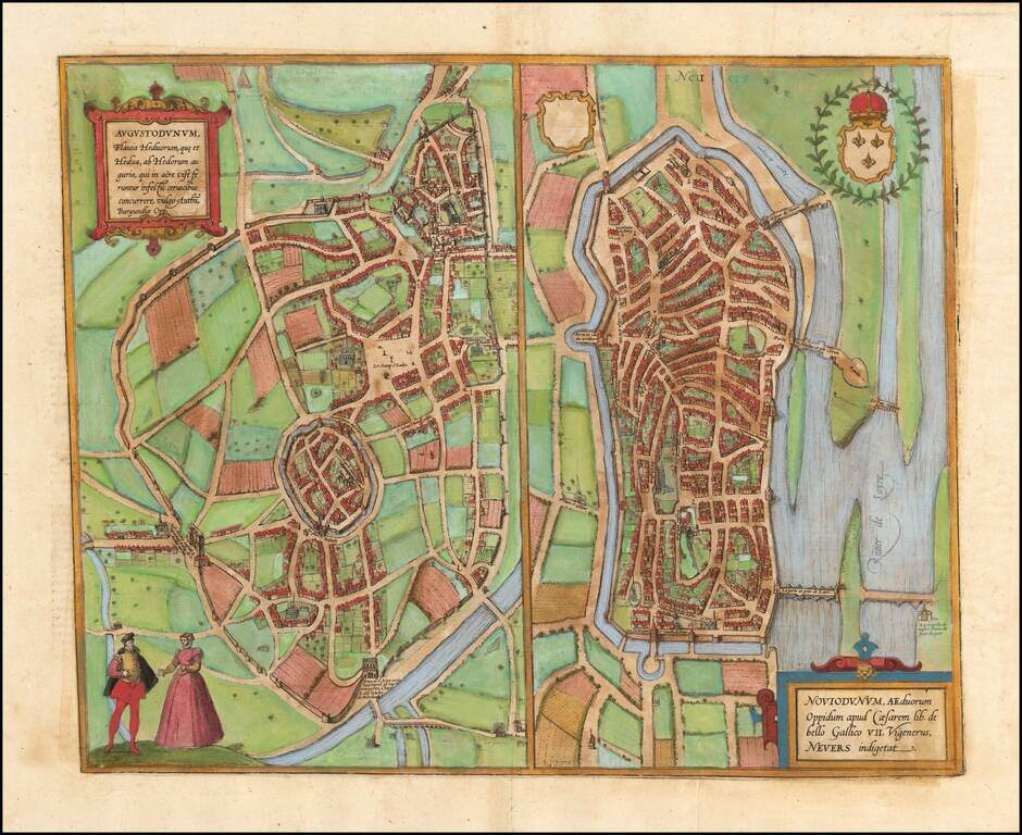
Nice example of these early plans of Autun and Nevers, which appeared in Braun & Hogenberg's 6 volume Civititas Orbis Terrarum.
![Palatinatus Bavariae Descriptio . . . [with] Wirtenbergensis Ducatus...](/map/small/65838.jpg)
Fine pair of maps, published by Abraham Ortelius. Ortelius' map of Bayern is based on the map by Erhart Reich. The map includes Regensberg, Nuremberg and Bamberg. The map of the Rhine, both south and north of Strassbourg is based on Daniel Specklin's...
![[Anjou] Andegavensium Ditionis Vera Et Integra Descriptio](/map/small/50232.jpg)
Attractively hand-colored regional map of France, centered on the Loire River and Angiers. Includes several bridges across the Loire and its tributaries. Abraham Ortelius Abraham Ortelius (1527-1598) was, along with Gerard Mercator, the most...
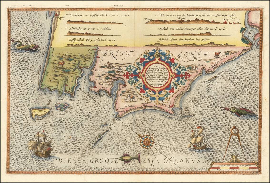
Striking full color example of Wagenhaer's map the French Bretagne Coastline, showing the western most part of Bretagne, centered on the area around Brest and Crozon. Wagenhaer was a Dutch pilot who produced the first set of effective navigational...