
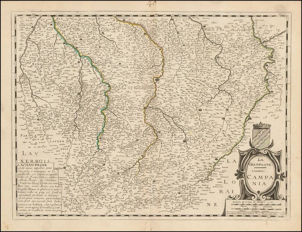
Detailed map of the Champagne region, published by Jollain.
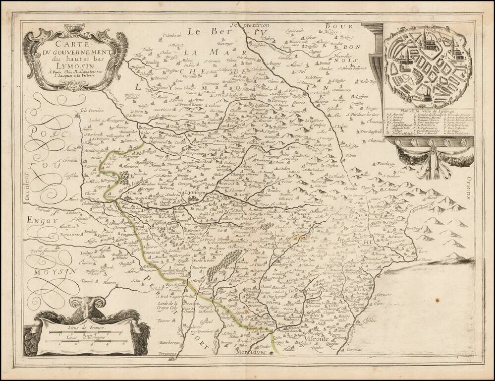
Rare Nicolas Langlois map of the Lymosin region of France, with a large plan of Limoges. The map is centered on Lymoges.
![Itineraire de France, pour la Route de Paris a Lion [with] Route de Lion a Marseille et a Nice.](/map/small/47011.jpg)
Antique engraved map of the routes from Paris to Lyon and Lyon to Marseille and Nice in the middle of the 17th century. The map was published by Pierre Du Val probably around 1660.
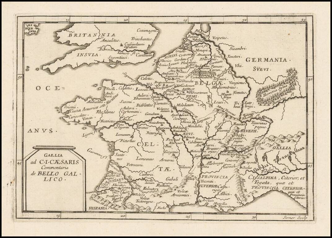
Antique engraved map of ancient France intended to illustrate Julius Caesar's commentary on the Gallic Wars. The map was issued by Pierre Du Val, probably in the 1660s. The map is scarce, this being the first time we have had it.
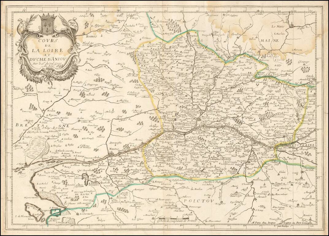
Rare double-page engraved map of the Loire River watershed, focusing on Anjou. Pierre Du Val (1619-83) was born in Abbeville, France. He was the nephew of the well-known geographer and cartographer Nicolas Sanson (1600-1667). After moving to Paris...
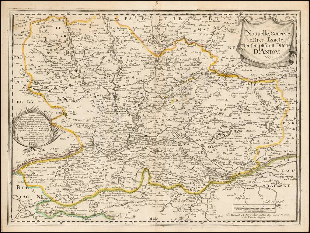
Scarce early map of the Anjou region of France, published by Gerard Jollain. The map is centered on the Loire River, extending from Champtoceaux in the west to Langeais in the east, and from Sablé-sur-Sarthe in the north to Cholet and Clisson in the...
![Salces en Roussillon. [Salses-le-Château, France].](/map/small/37766.jpg)
A rare view by Sébastien Pontault de Beaulieu, depicting the action around the fortress of Salses-le-Château in Roussillon during the Franco-Spanish War. Salses-le-Château (called Salces in both Spanish and Catalan) was, until the mid-17th Century,...
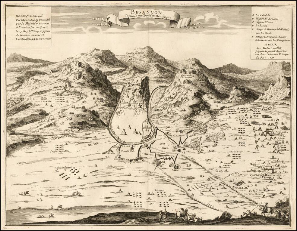
Rare separately published view of Bensancon, issued by Hubert Jaillot in Paris. The second title is: Besançon, Attaquée par l'Armée du Roy Com[m]andée par Sa Majesté en personne et Rendue à son obeissance le 15 May 1674 après 9 jours de...
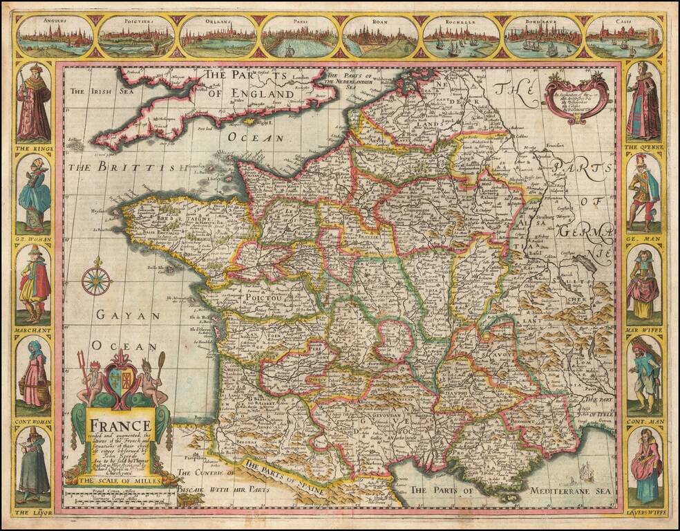
Decorative map of France, published in London by John Speed. Side panels depict costumed figures, while above are vignettes of notable places including Orleans, Paris, Calais, Bordeaux, and Poitiers. The map was engraved by Dirck Gryp in 1626, but...
Decorative map of France, published in Rome by Rossi for the Mercurio Geografico overo Guida Geografica in tutte le parti del Mondo.
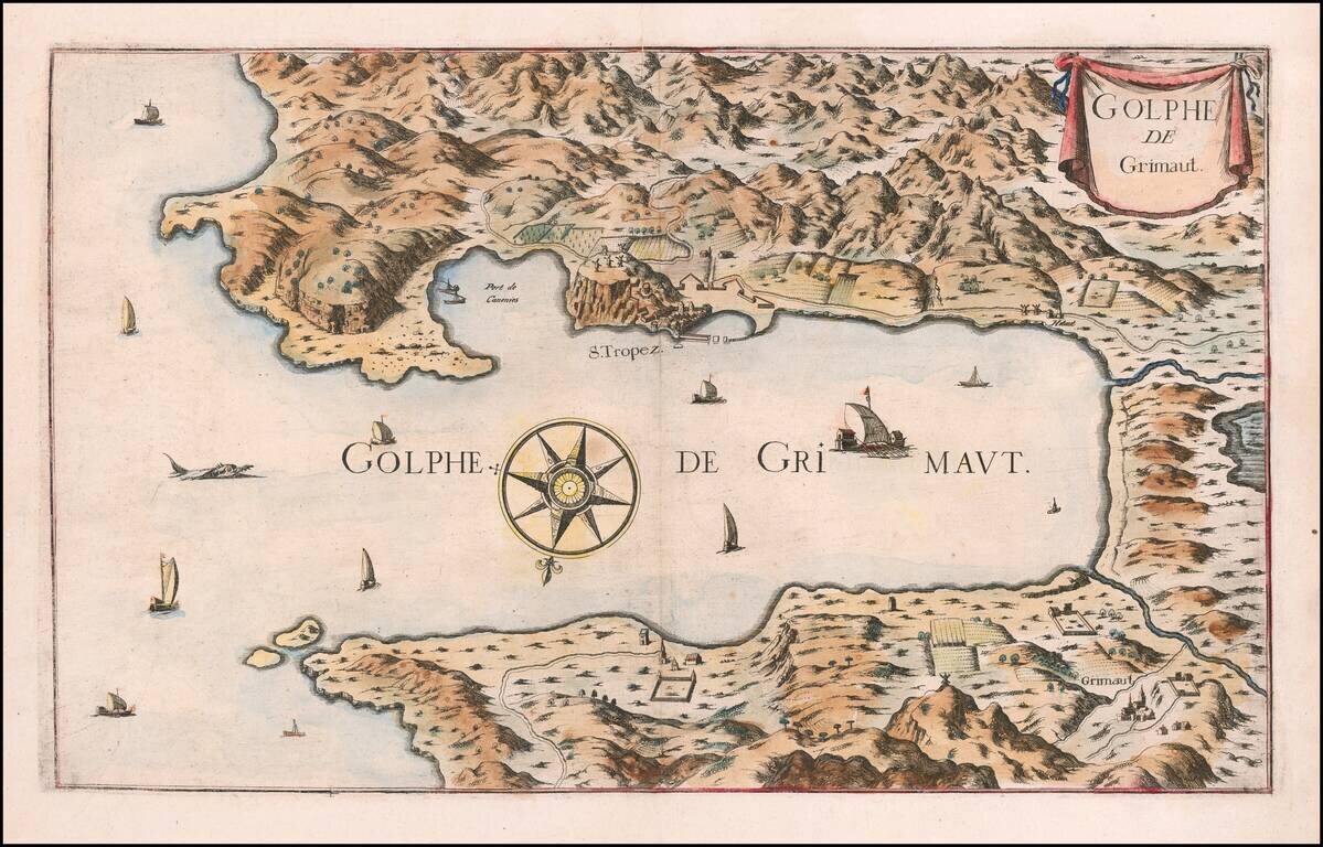
Rare map of the Gulf of Grimault, oriented with south at the top. The map shows San Tropez and environs, with sailing ships a compass rose and other embellishments.
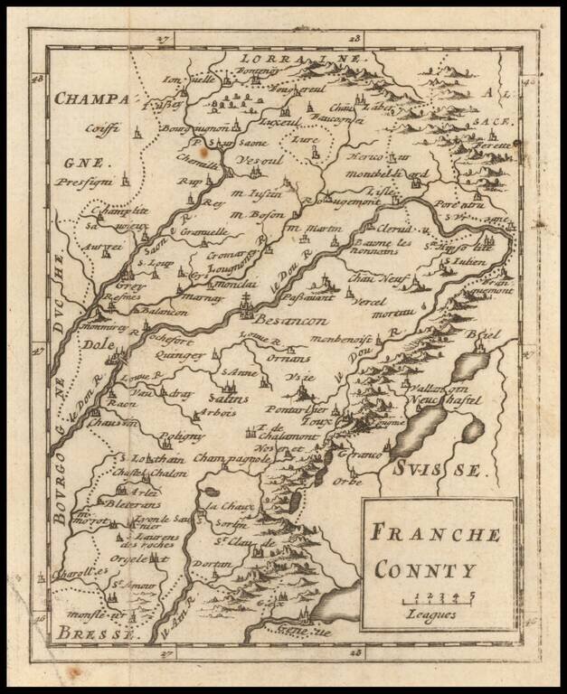
Rare map of Franche Comte, published by Sir Jonas Moore in London. The map appeared in Moore's A New Geography. Many of the plates in the work were engraved by Herman Moll, who had moved to London in 1678 and had not yet begun publishing under his...
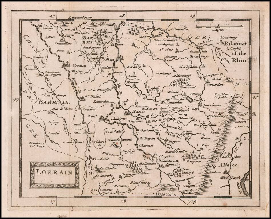
Rare map of Lorrain, published by Sir Jonas Moore in London. The map appeared in Moore's A New Geography. Many of the plates in the work were engraved by Herman Moll, who had moved to London in 1678 and had not yet begun publishing under his own...
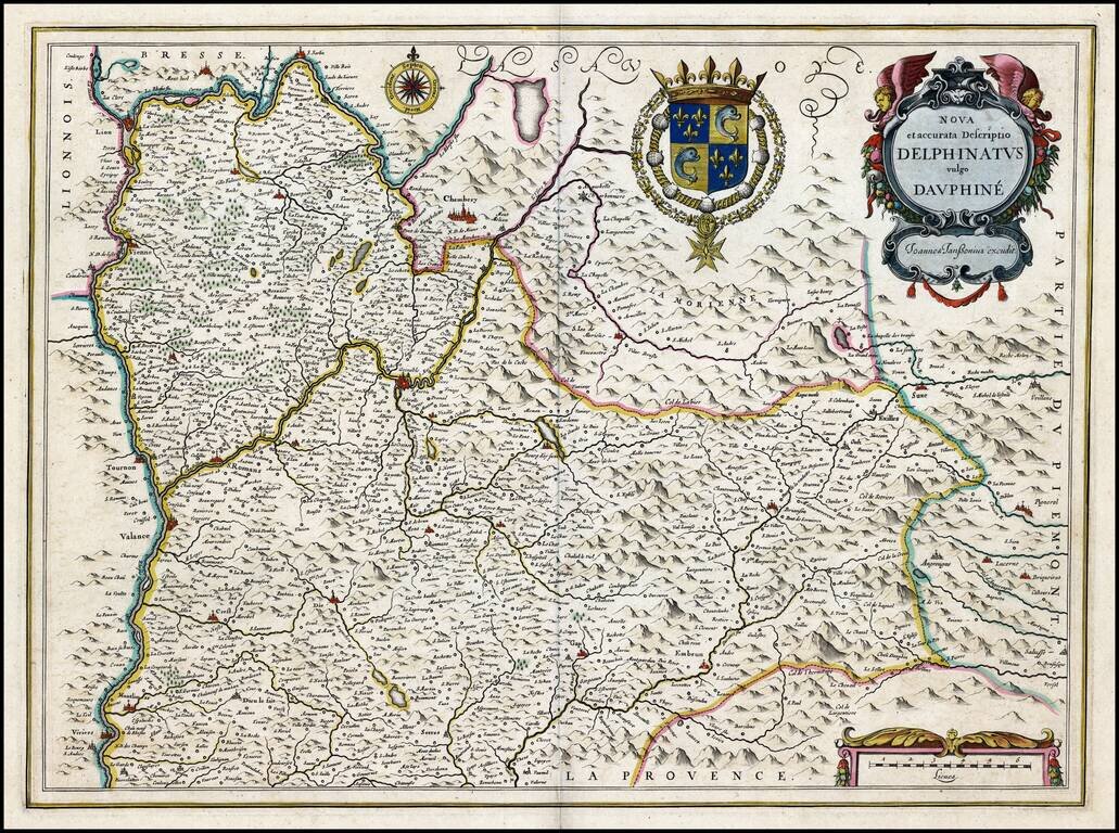
Old Color, gold heightened example of this fine regional map of the wine regions of southeastern France. A decorative map of Dauphiné region in France. Originally a separate province in southeastern France, the area now comprises of the present day...
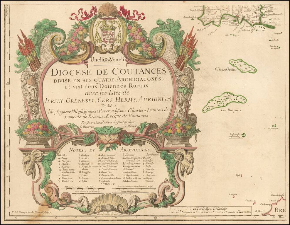
Title sheet of a rare 4 sheet map of the Diocese of Coutances, published in Paris. This is the lower left sheet of this rare 4-sheet wall map, showing mainly a title cartouche with the islands of Minquiers and Banes Grélets to the right. In top right...
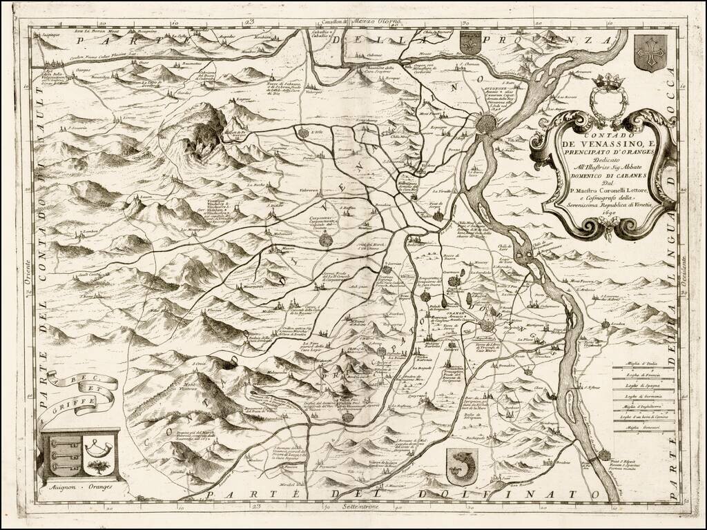
Nice example of this scarce map of Avignon and environs, with north at the bottom, published by Coronelli in his C orso Geogrpaphico. Includes a decorative cartouche and a number of coats of arms. The map shows Coronelli's finely executed...