Map size in jpg-format: 1.04557MiB
Click to open in high resolution (open in new tab).
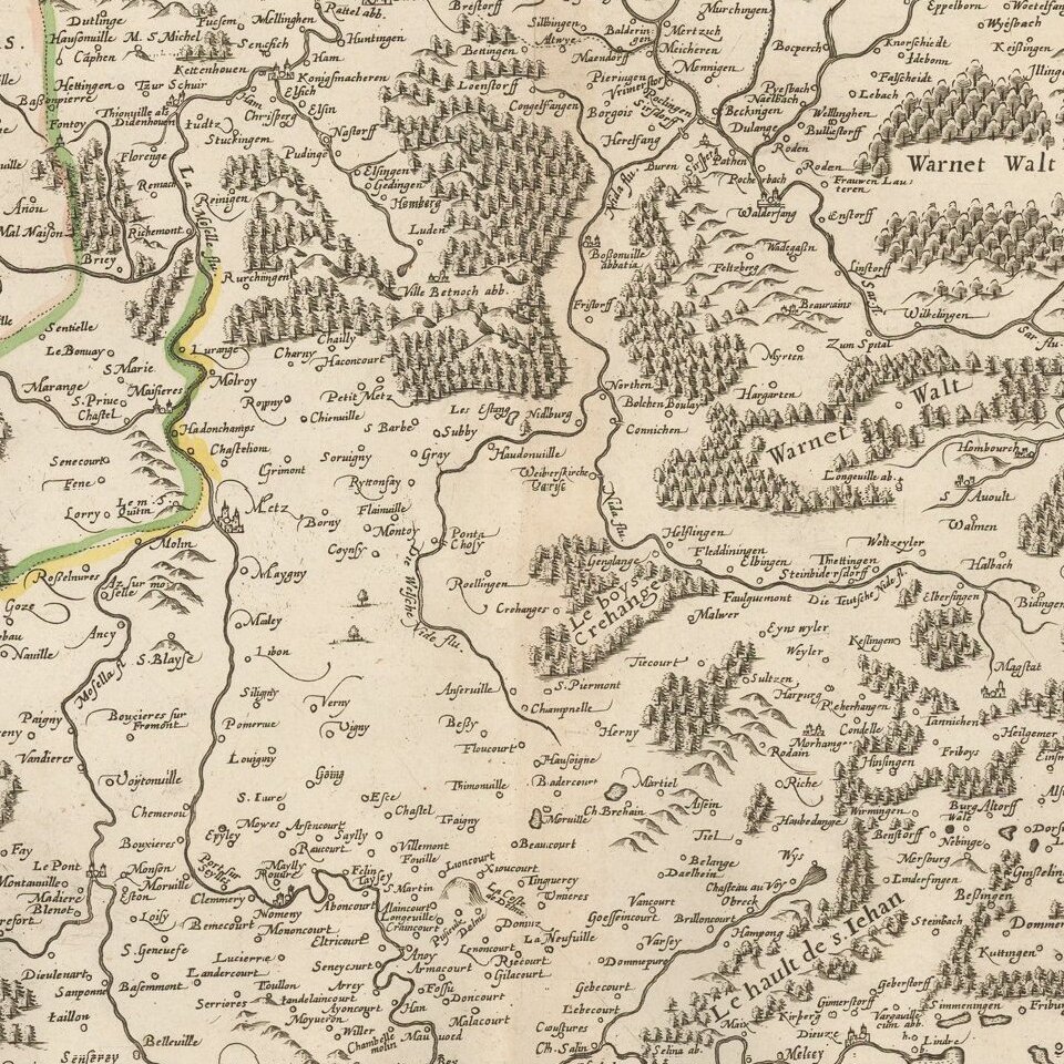
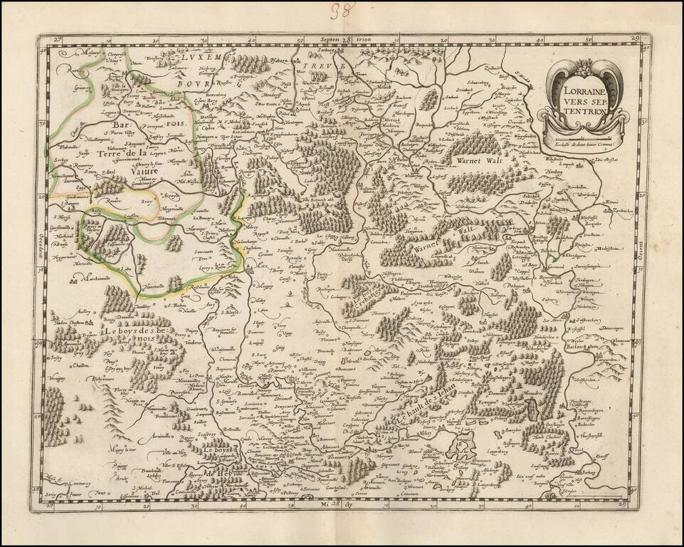
Rare late edition of Francois Bougereau's map of Lorraine region, first published in 1594.
The map shows the northern part of Lorraine, based upon an earlier map by Mercator.
This edition has the credit of Bougereau (and later imprint of Le Clerc) removed and the cartouche revised, but is definitely the original plate.
If you are a student, write to us in telegram: @antiquemaps and indicate what material you need and for what work you need a map in high detail. We are ready to provide material on special terms. For students only!
![Carte d'Etude [Study Map]](/map/small/66795.jpg)
![Orange [Vauban Style Fortress]](/map/small/62043.jpg)
