Map size in jpg-format: 95.59MiB
Click to open in high resolution (open in new tab).
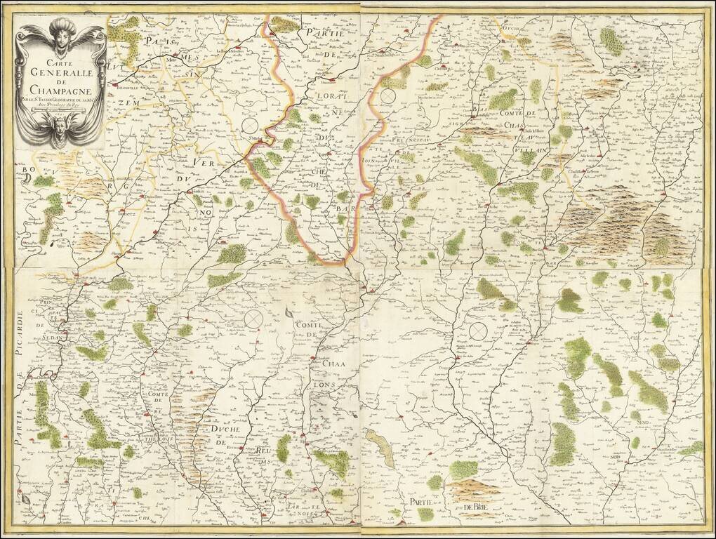
A rare early map of the Champagne region, from Nicolas Tassin's rare large-format atlas of France. The map shows Champagne looking eastwards, showing the many rivers, cities, towns, and hills of this agricultural region of northeastern France. Borders are shown with Loraine, and other regions including Brie, Chateau Villain and Vernois are all named.
The major cities of the area are mentioned, including Reims, Rethel, Verdun, Troye, Aubenton, and others. The many rivers of this region are denoted as well, as are several other features.
Champagne is, of course, most famous today for its namesake wine. Production is centered in the region just south of Reims, particularly in the Vallee de la Marne. The cities which contain the great champagne producers are named, including Esperney, home of Moet et Chandon, Veuve Cliquot, and Dom Perignon. This map contains all the terroir in which AOP champagne is produced, even the Cotes de l'Aube region south of Troye.
This map attractively shows all of these regions and more. The woods, marshes, and hills of the area are elegantly designed and colored, typical of Tassin's style. In all, this makes for a desirable map for a beautiful French region.
Nicolas Tassin (fl. 1633-55) was appointed 'royal cartographer' at Dijon before setting up as an engraver in Paris where he issued various collections of small maps and plans of France, Switzerland, Germany and Spain. Tassin first published his maps in his own atlas Cartes Generale de Toutes Les Provinces de France in 1634, with an enlarged second edition in 1637 (France, royaumes et provinces d'Europe). Maps by Tassin in original colors are rare.
If you are a student, write to us in telegram: @antiquemaps and indicate what material you need and for what work you need a map in high detail. We are ready to provide material on special terms. For students only!
![Carte d'Etude [Study Map]](/map/small/66795.jpg)
![Orange [Vauban Style Fortress]](/map/small/62043.jpg)
