
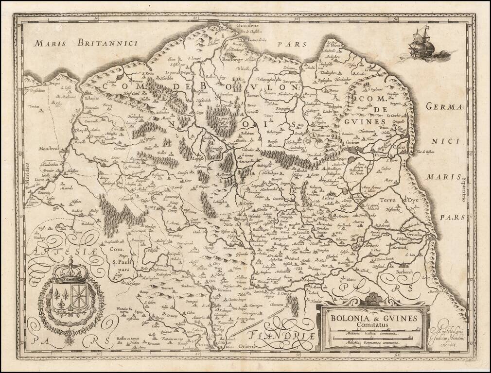
Rare Jodocus Hondius map of part of northwestern France. The map is oriented with west at the top and shows the French coast from Calais to Grofflieres and the Canche River. Within the map, the cities of Boulogne-Sur-Mer, Guines, Montreul, Renty,...
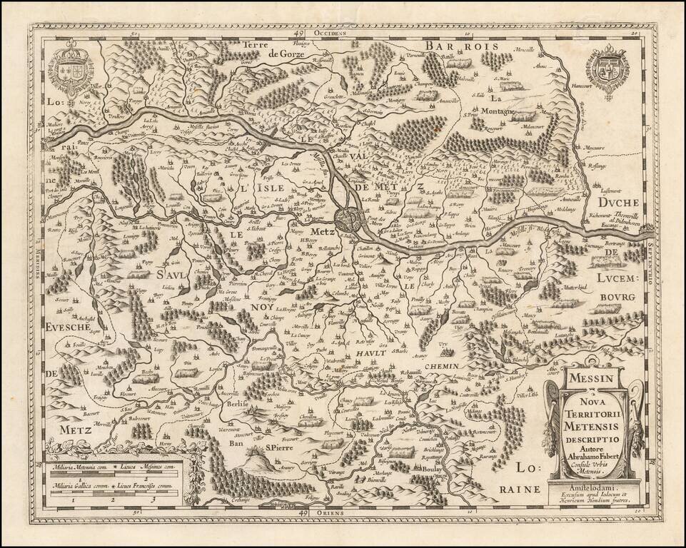
Striking example of Jodocus and Henricus Hondius' map of a portion of the Metz region of northeastern France. The map is centered on Metz and the Moselle River Region. The map is quite unusual, bearing the imprint of both Jodocus Hondius and Henricus...
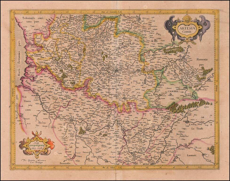
Nice old color example of Mercator's detailed regional map of Artois, which appeared in Mercator's Atlas Sive Cosmographia, the first collection of maps to use the modern name "Atlas."
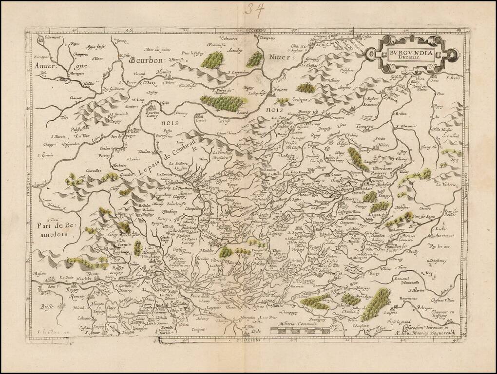
Fine map of Burgundy oriented with west at the top, originally published by Maurice Bouguereau and later re-issued by Le Clerc. Mauricij Bogueraldj is the Flemish name utilized by Maurice Bouguereau toward the beginning of his career.
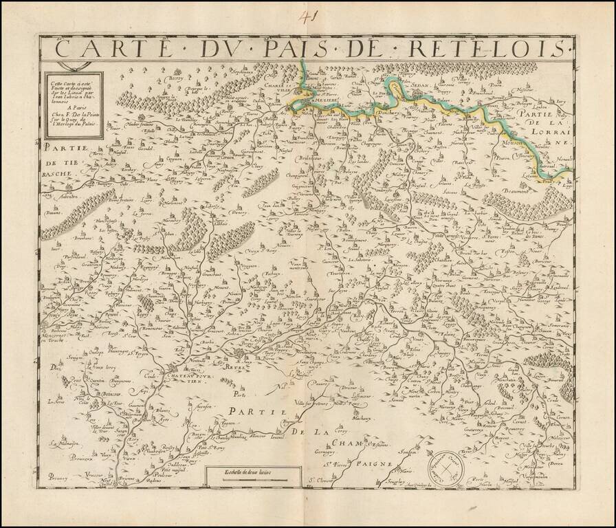
Rare De laPointe edition of Jean Le Clerc's map of Retelois. Shows the cities of Rethel, Montcornet en Tirache, Beaumont, and Charleville. A credit is given at the bottom to the French surveyor Jean Jubrien Claonnais (1569-1641).
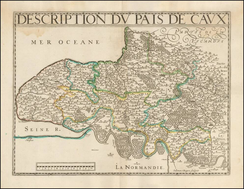
Rare map of a portion of Normandy, engraved by Salomon Rogers. We note a copy in the Bibliotheque National de France, which is what we used to date the map. A variant of the map likely first apperaed in Le Clerc's Theatre Geographique du Royaume de...
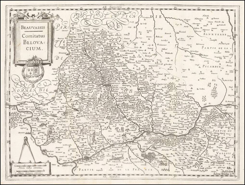
Detailed map of the Beauvais region. The map follows the course of the Seine River.
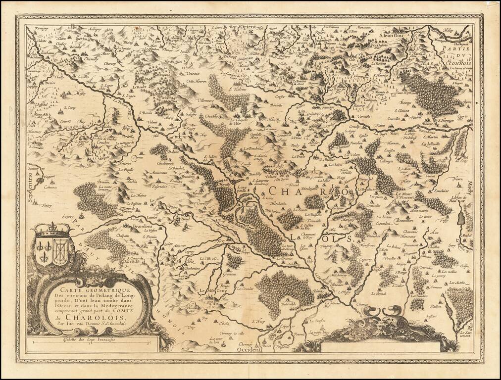
Striking map of the region of Charlois, published in Amsterdam.
Rare early regional map of France, extending form Isle D'Oleron to the Seure River and Lusson, centered on Isle de Re. The map includes multiple sailing vessels, sea monster and an ornate compass Rose. A large military and pilgrim encampment surrounds...
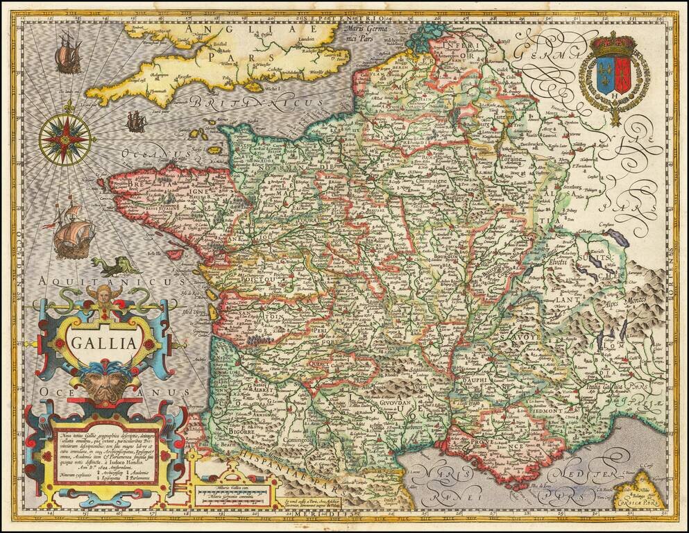
Rare early map of France, published by Jodocus Hondius. The map is richly adorned with a huge, strapwork title cartouche, a coat of arms, sailing ships, a sea monster and a beautiful compass rose. This is the first state with Hondius' imprint and the...
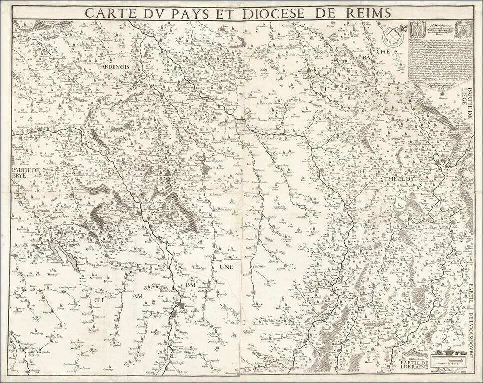
Very Rare French Wall Map of Reims. An attractive map of the region around Reims, one of the earliest to show the area in detail. The map is oriented to the northeast, meaning that most of the rivers of the region run vertically. Many cities, towns,...
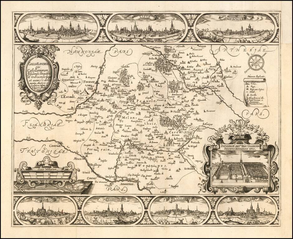
Rare regional map of French Flanders, with decorative views of the cities of Douai, Lille, Orchies, La Bassee, Armentières, Lannoy and Comines and the Jesuit College of Lille. In 1627, Martin Le Bourgeois also published a large (35 x 31 inches) plan...
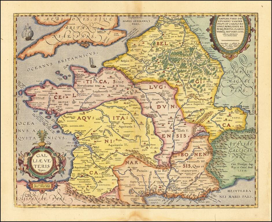
Detailed Ortelius Map of France in Roman Times, Based on Classical Sources Vivid map of Ancient France from Ortelius' Parergon, the first historical atlas. The map is based upon information from classical sources such as Strabo, Virgil, Ovid and...
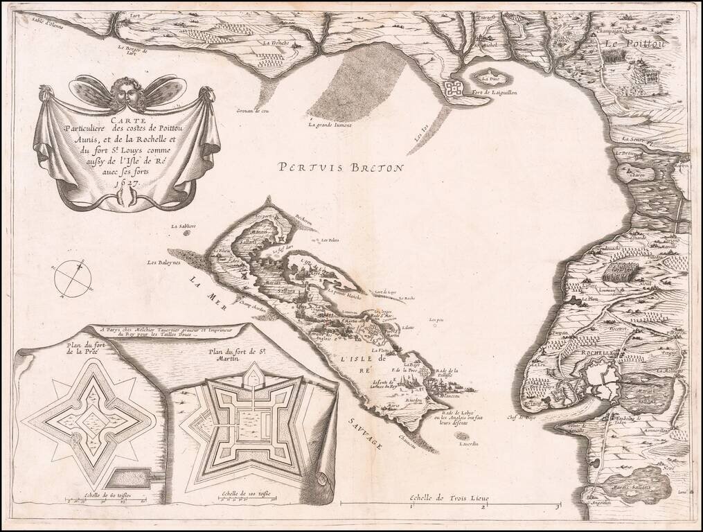
Very rare map of Poitou-Charentes with Île de Ré and the French coast with La Rochelle, oriented to the Northwest, with two inset fortification plans: Fort de la Pree and Fort de St Martin, published in 1627 by Melchior Tavernier. The map shows the...
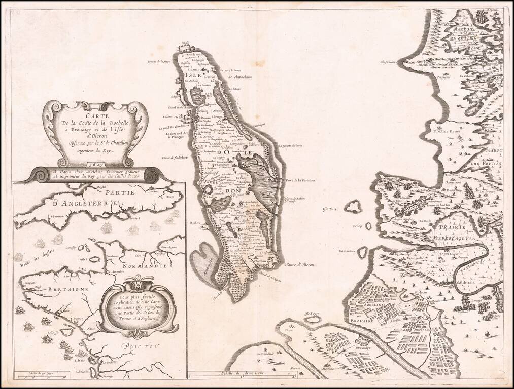
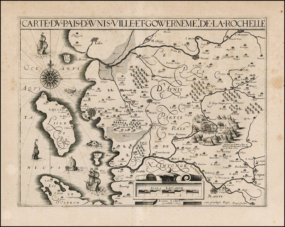
Contemporary Map of the Siege of La Rochelle Detailed map of the area around La Rochelle and the Isle of Olearon, published in Paris in 1627, illustrating both the Hugenot stronghold of La Rochelle and the Catholic stronghold of Brouage, which was...
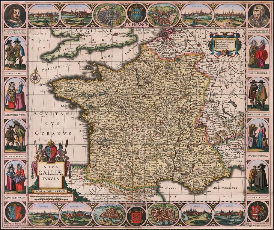
Rare separately published map of France, surrounded by views of French Cities, portraits and local costumes. Rare carte-à-figures map in its 2nd state (of 4) with Cloppenburgh's imprint;. This is the second state of the map of France first published...