
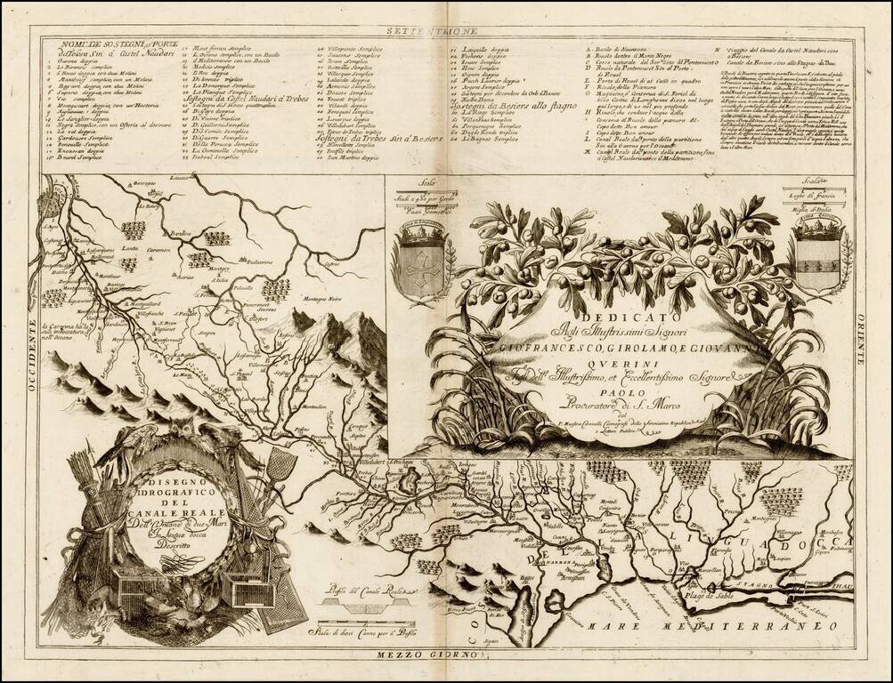
Finely engraved map of the Languedoc Canal, published by Vincenzo Coronelli. Includes decorative cartouche and 2 coats of arms, plus a highly detailed table of locations. Vincenzo Maria Coronelli, a Venetian scholar and Minorite Friar, was one of the...
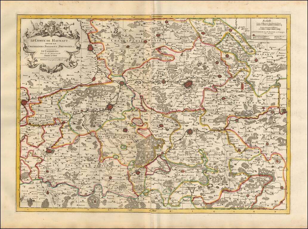
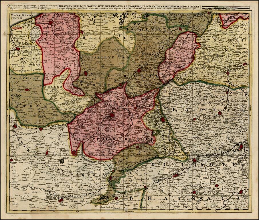
Detailed map of the French Hainaut region, published in Amsterdam. The map includes a second sheet, illustrating 8 fortified towns (2 of Conde, Valenciennes, Maubeuge, Landrecy, Bouchain, Auesnes and Quesnoi) and an Index page. The map shows the...
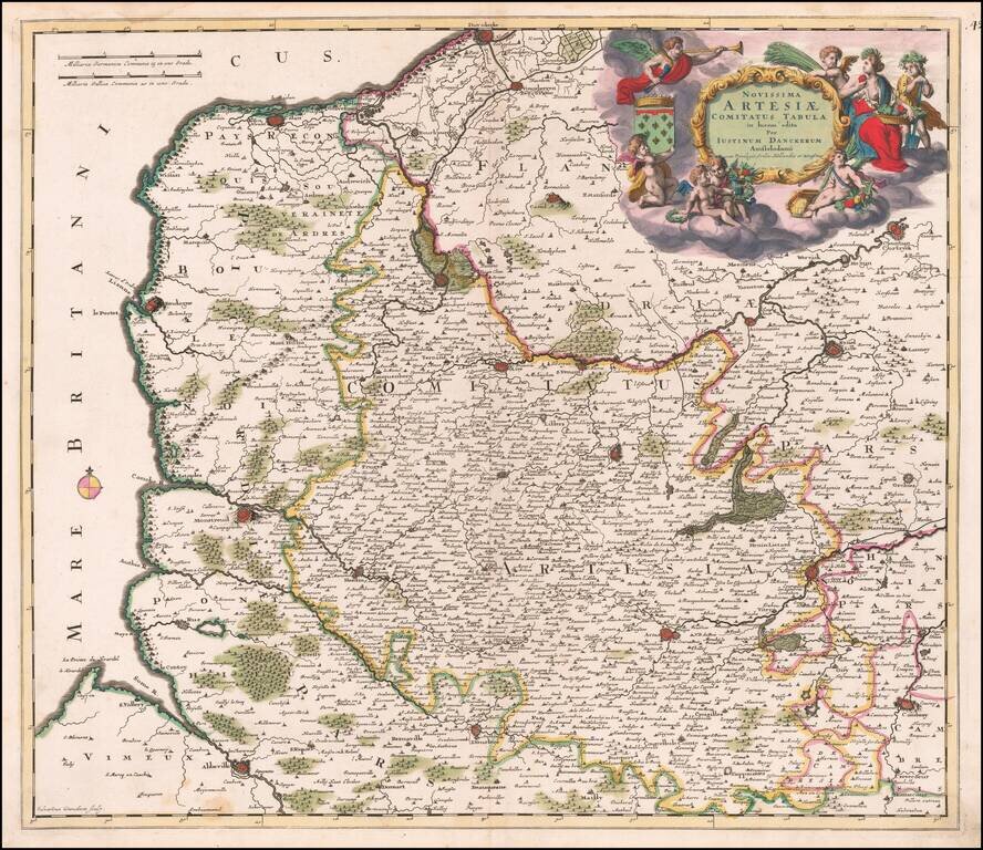
Fine original color example of Justus Danckerts map of Artois, published in Amsterdam.
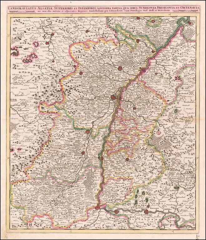
Antique Map of the Upper Rhine Region, Alsace, etc. Detailed map of the Upper Rhine River region, published in Amsterdam. The map extends from Basel, Rheinfeld and Lauffenburg in the south, to Philipsburg and Landau, centered on Landau.
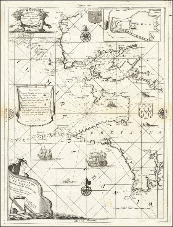
Finely engraved sea chart Bretagne coastline, centered on Brest, published by Vincenzo Coronelli. Includes decorative cartouche, dedication cartouche, coats of arms, compass roses and an inset map of the fortifications in the harbor. Vincenzo Maria...
![[Duke of York's Copy] Le Toulois ou sont Les Chatellenies et Les Prevotes du Temporel de l'Eveche de Toul et de son Chapitre; Partie du Balliage de l'Eveche de Verdun. Le Duche de Barrois ou Balliage de Bar le Duc . . .](/map/small/71292.jpg)
The Duke of York's Copy Nice example of Jaillot's map of the region centered on Bar le Duc, in eastern France, with the bookplate of the Duke of York on the verso. The Duke of York as a Prolific Map Collector Frederick Augustus, Duke of York and...
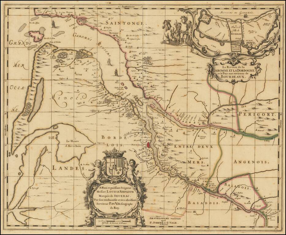
Rare map of Map of the Gironde estuary, published in Amsterdam by Schenk & Valk. The map shows the area where the Dordogne and Garonne rivers meet, and includes a plan of the fortified walls of the city of Bordeaux, along with several elaborate...
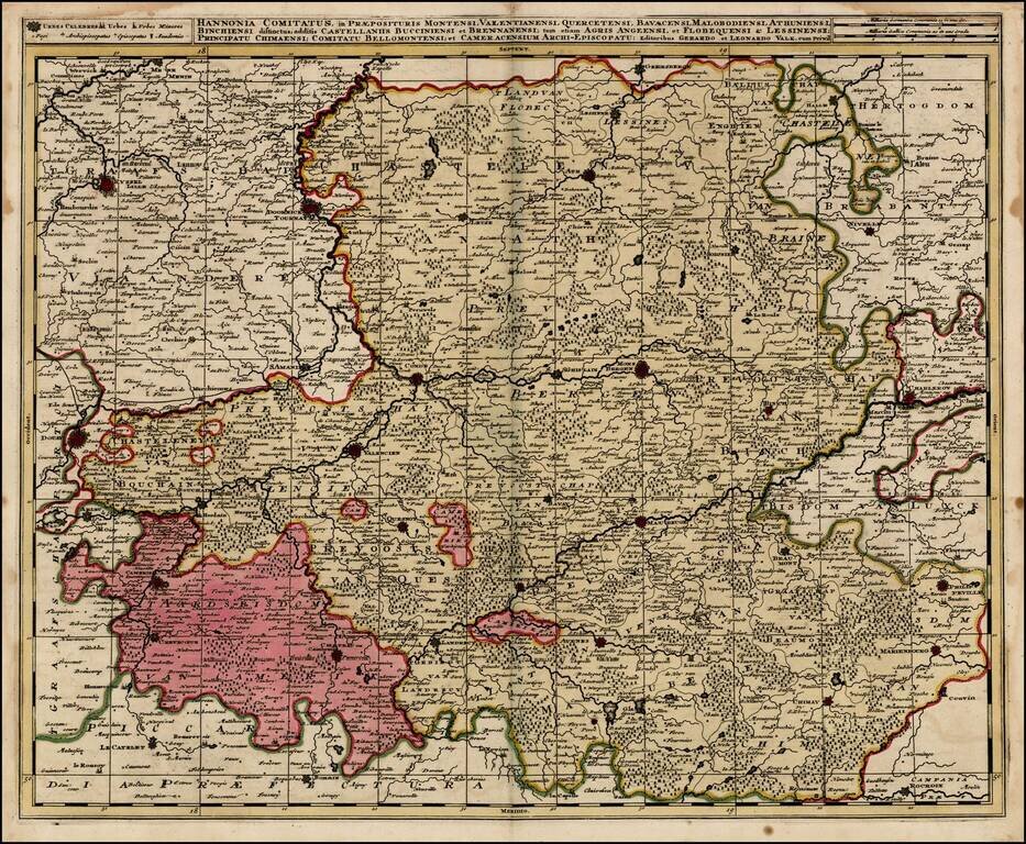
Detailed regional map, extending from Lille and Douay in the west and Charleroy and Phlippeville in the east, centered on Valencien, Conde, Mons, S. Amande, Cambray, Tournay, etc.
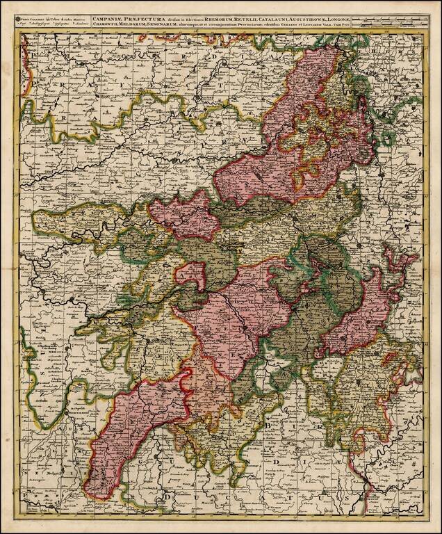
Detailed map of the Champagne region of France. Old Color. Double Thick Paper.
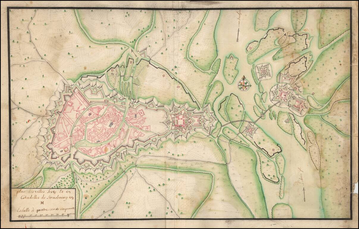
Manuscript Plan of Strasbourg and Environs, including the fortifications at Kehl. Detailed hand drawn plan of Strasbourg, focusing on its fortifications in the Vauban style.
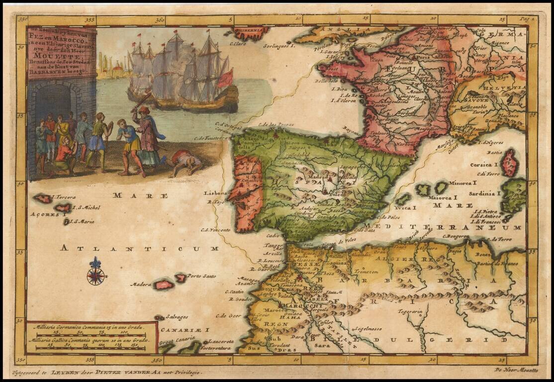
Fascinating map illustrating a voyage from Dieppe to Marseille, via the Straits of Gibralter. Decorative cartouche.
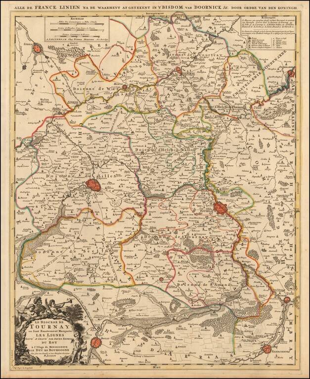
A fine example of Jaillot's map of the border area between France and Belgium with the towns of Tournai, Lille, Ipres, Douay, Condé and others. The map also locates smaller towns, churches, religious schools, residential areas, castles, cabarets,...
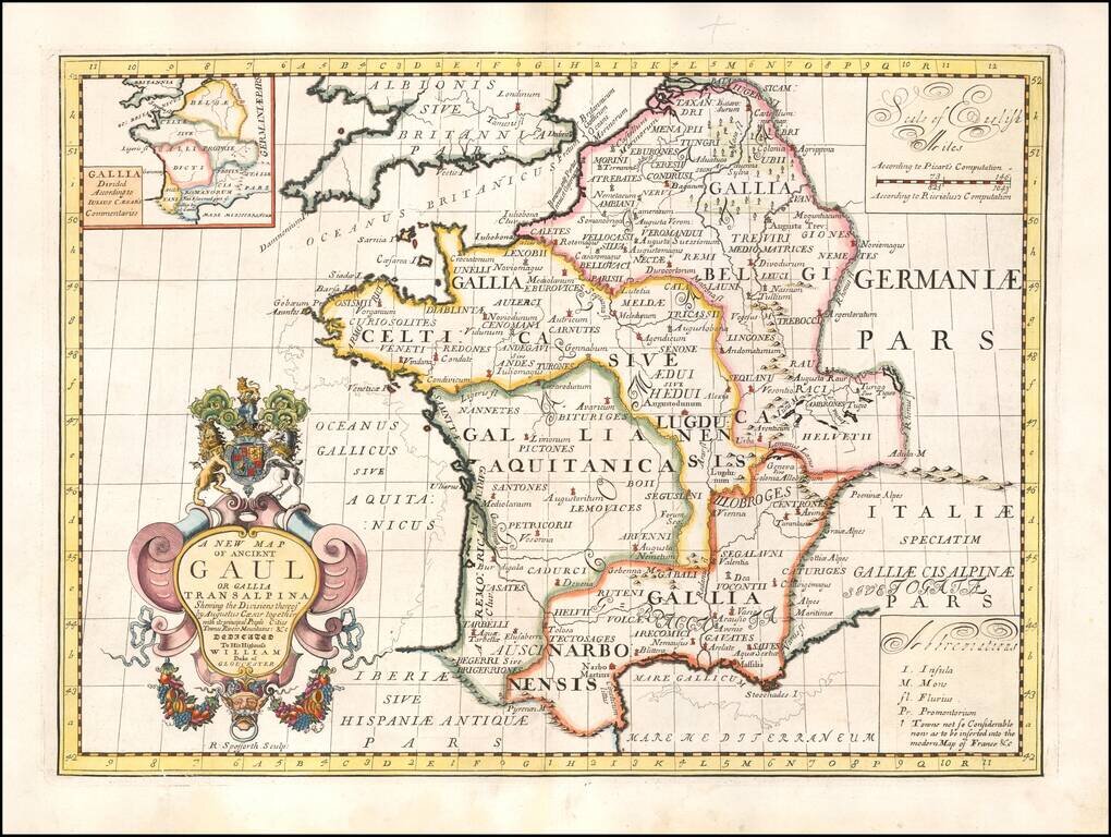
Decorative map of France, as divided by Augustus Ceasar. This decorative map was part of a set of 22 maps dedicated to William, Duke of Glouchester, who was then an 11 year old student at Oxford.
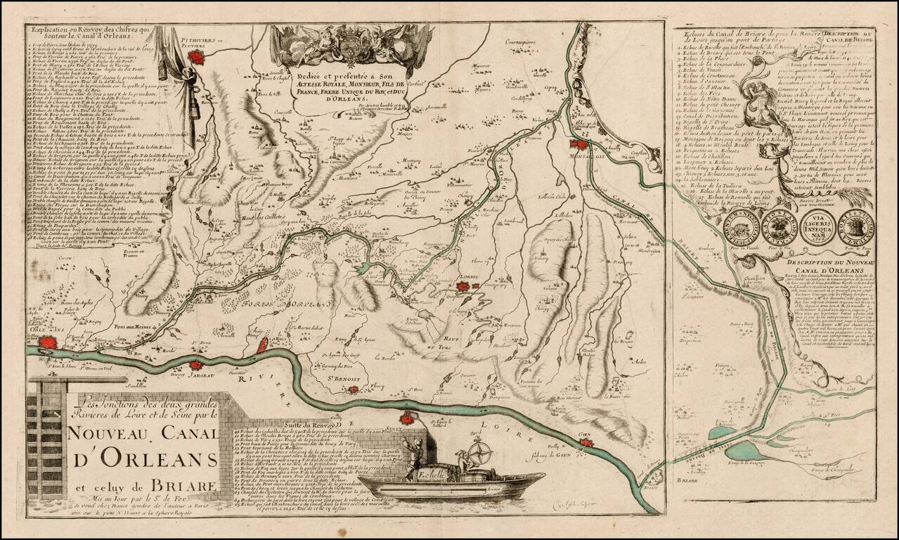
Rare early plan showing the Canal de Briare and the Canal D'Orleans, including keys identifying 65 places and 27 places on the two different canals, a dedication cartouche and illustration of a lock. The map is engraved using two plates, suggesting an...
Detailed map of Southern Belgium and Northwestern France, extending from Gend and Veurne in the north to Arras, Arleux and Maubeuge in the south, centered on Lille.
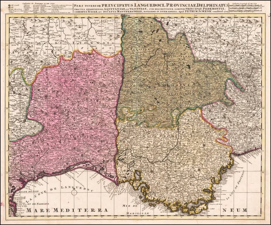
Detailed map of Southeastern France and the contiguous Italian Border (extending to Turin). Fine old color example.