
An Exceptional Ortelius Rarity in Wonderful Condition. Van Den Broecke Estimates "Five or six copies have survived." Proof state of this separately-issued map of France, published by Abraham Ortelius and drawn by Guillaume Postel. Van Den Broecke...
![[Ile de Re and La Rochelle] Die Zee Custe Van tLandt van Poictou ende Bordeaux tuschen Picqueliers ende de Riviere van Bordeaux alsoe hem tlant aldaer vuyt der zee opdoet ende verhoont.](/map/small/61451.jpg)
Striking full color example of Wagenhaer's map the French Coastline, from Bordeaux to Poictou, with the Islands of Ile de Re and Oleron, centered on La Rochelle Wagenhaer was a Dutch pilot who produced the first set of effective navigational charts,...
Fine old color example of this map of the Rhine, both south and north of Strasbourg, based on Daniel Specklin's three-sheet map of the Elzas of 1576. From edition of Ortelius' Theatrum Orbis Terrarum, the first modern atlas of the World.
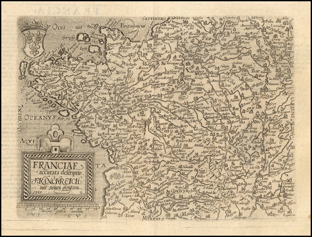
Scarce 16th Century modern map of France, published in Cologne. Matthaus Quad was a German cartographer based in Cologne. The map was engraved by Johannes Bussemacher and appeared in several Geographical works published by Quad and Bussemacher at the...
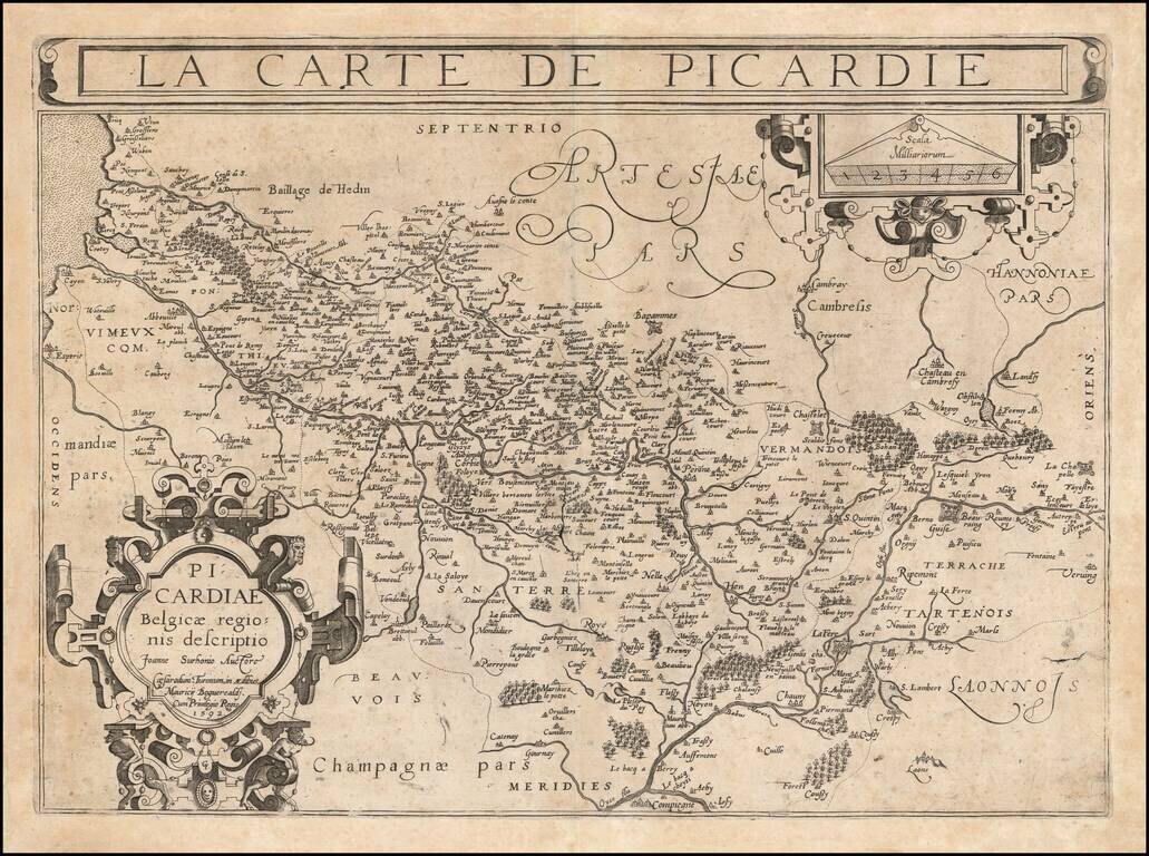
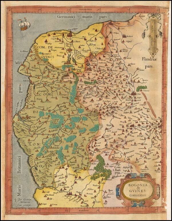
An Important Early Map of Picardy Rare example of Francois Bougereau's map of Picardy region of France, published in Tours, from his Le Theater Francoys. The map is centered on the Somme River, extending from its source near Vermandois to the sea....
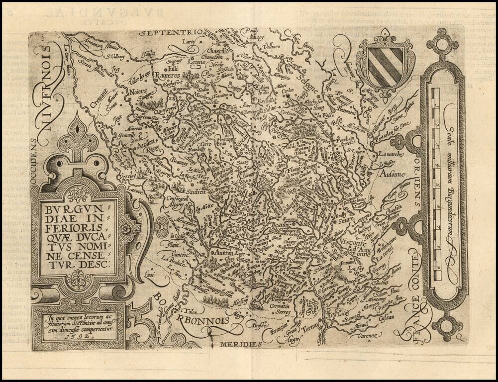
Scarce early map of the Burgundiae Inferioris region of France. Matthaus Quad was a German cartographer based in Cologne. The map was engraved by Johannes Bussemacher and appeared in several Geographical works published by Quad and Bussemacher at the...
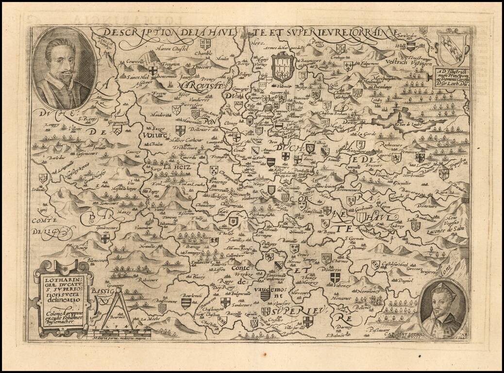
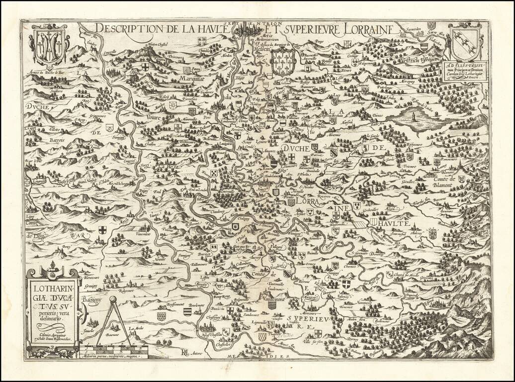
Scarce early map of the Lotharingau Inferioris region of France. Includes two portraits and a number of coats of arms of various towns. Matthaus Quad was a German cartographer based in Cologne. The map was engraved by Johannes Bussemacher and...
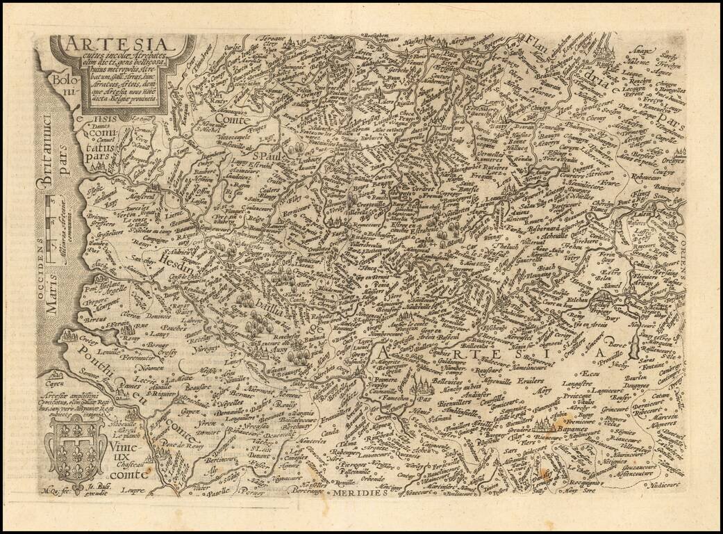
Scarce early map of the Arras region of France. Matthaus Quad was a German cartographer based in Cologne. The map was engraved by Johannes Bussemacher and appeared in several Geographical works published by Quad and Bussemacher at the end of the 16th...
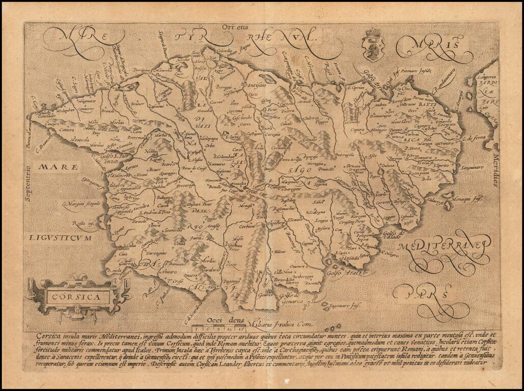
Scarce early map of Corsica. Matthaus Quad was a German cartographer based in Cologne. The map was engraved by Johannes Bussemacher and appeared in several Geographical works published by Quad and Bussemacher at the end of the 16th and beginning of...
Old color example of Gerard Mercator's map of Northwestern France. The map extends from Calais and Dunkirk in the North, to La Canche River in the south.
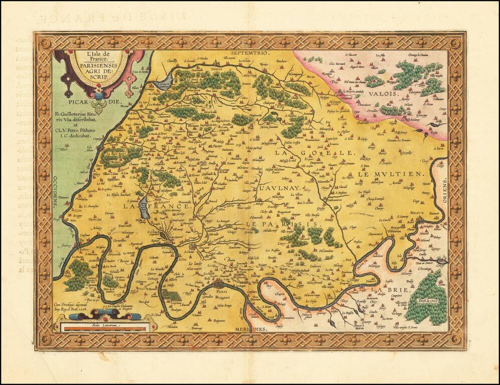
Fine old color example of this important early map of the region around Paris and the Isle de France, published by Abraham Ortelius in Antwerp. The map appeared in Ortelius' Theatrum Orbis Terrarum, the first modern atlas of the world. The map is...
Rare separately published map of the Lorraine region by Johannes Bussemacher of Cologne. The map is centered on the course of the Moselle River and the Meuse (Maas) Rivers, with dozens of smaller coats of arms locating early towns and families. The...
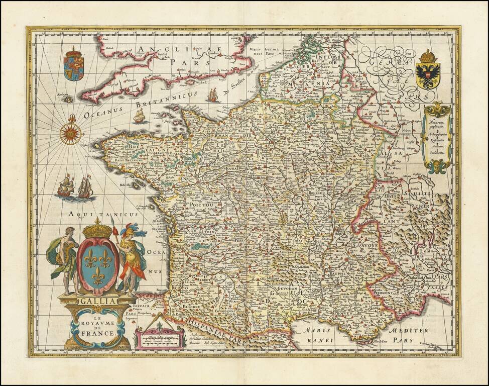
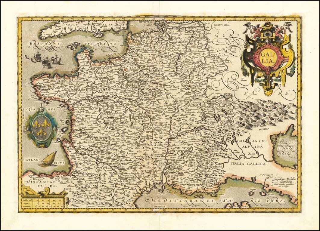
Rare edition of Blaeu's 1607 map of France, modified by Blaeu for publication in his 1631 Atlas Appendix, prior to completion of his updated map of France which appeared thereafter. The map was first published with border figures in 1607. When Blaeu...
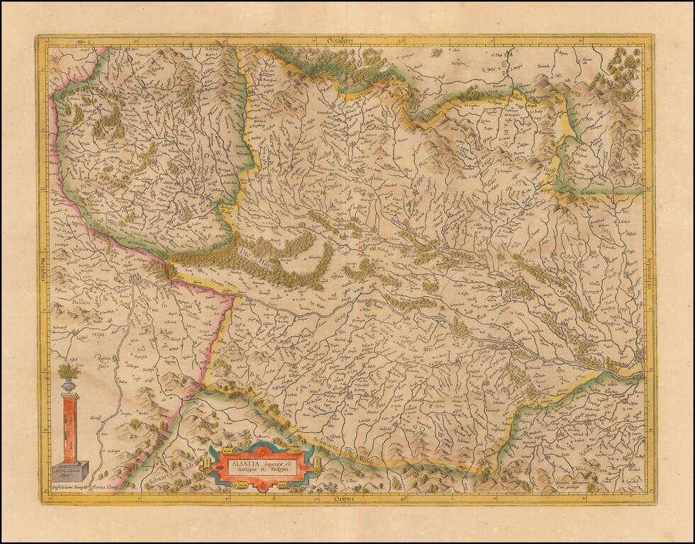
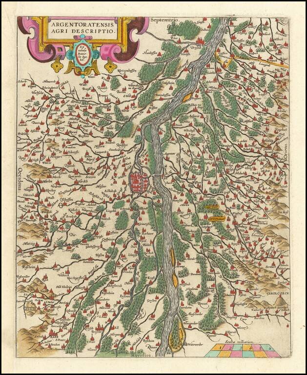
Nice old color example of the Mercator-Hondius map of part of Alsatia. West is oriented on the top. The map is centered on the course of the Rhine River, from Strasbourg in the north (right side of ma) to Basle.
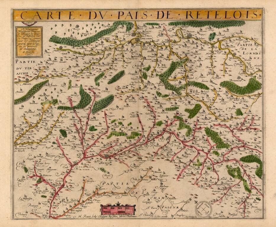
Rare map of Retelois, from Jean Le Clerc's very rare atlas of France. A credit is given at the bottom to the French surveyor Jean Jubrien (1569-1641).
![Corsica [and] Sardinia](/map/small/41806.jpg)
Old color example of Gerard Mercator's maps of Corsica and Sardinia. Includes decorative cartouches.