Map size in jpg-format: 907119B
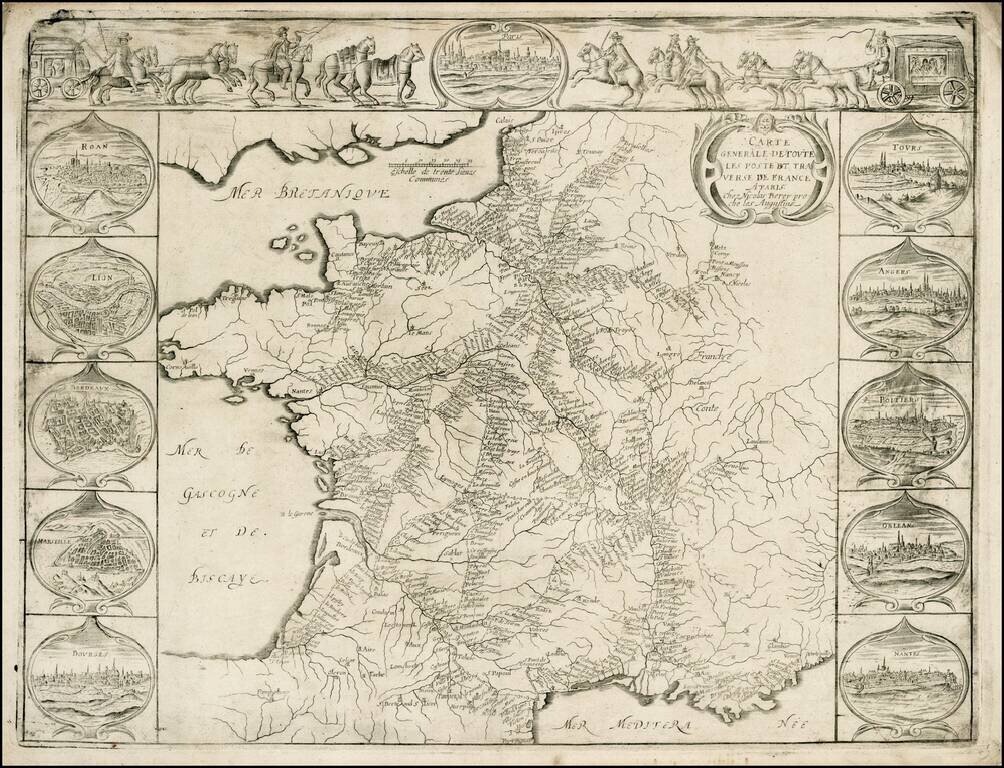
Striking example of Nicholas Berey's rare map of the Postal Routes of France, one of the first printed postal maps of France and one of the earliest European postal maps.
This separately issued map, which appeared at about the same time as Tavernier's map of the French Postal Routes, includes 11 bird's-eye views of the major cities in France and a marvelous early decorative vignette showing two sets of horse drawn coaches, with mounted guards, an illustrative reference to the manner in which the mail was transmitted around France.
If you are a student, write to us in telegram: @antiquemaps and indicate what material you need and for what work you need a map in high detail. We are ready to provide material on special terms. For students only!
![Carte d'Etude [Study Map]](/map/small/66795.jpg)
![Orange [Vauban Style Fortress]](/map/small/62043.jpg)
