
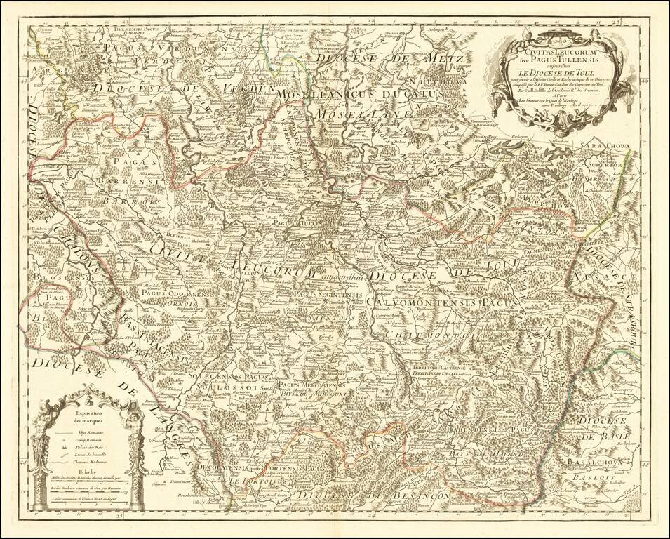
Highly detailed map of the Diocese of Toul, published in Paris by Guillaume De L'Isle. The map is centered on the cities of Nancy and Toul and including Metz, Verdun, S. Dizier, Nas, Neuchataeu, Mircourt, Remiremont, Pagi, etc. Shows towns, castles,...
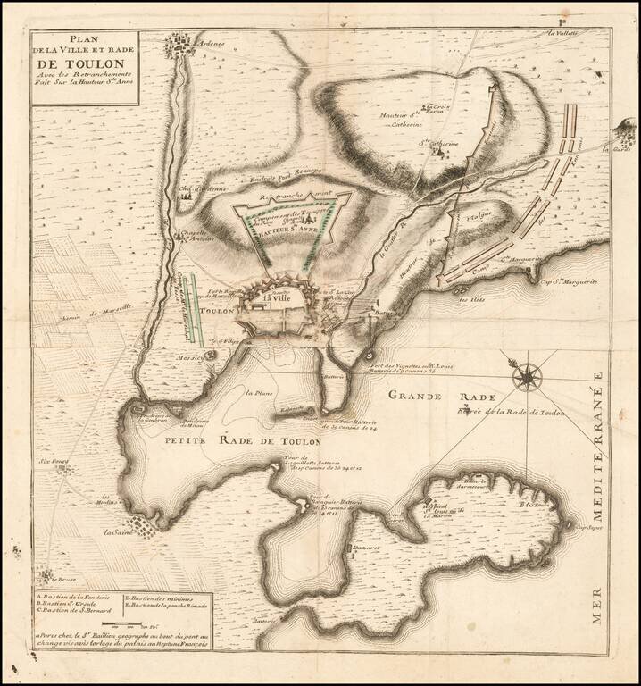
Fine battle plan of Toulon, showing the engagement at the Battle of Toulon in 1707. The map provides an exceptional overview of the engagement, showing fortifications, battery positions and the bombardments from the harbor by various named ships....
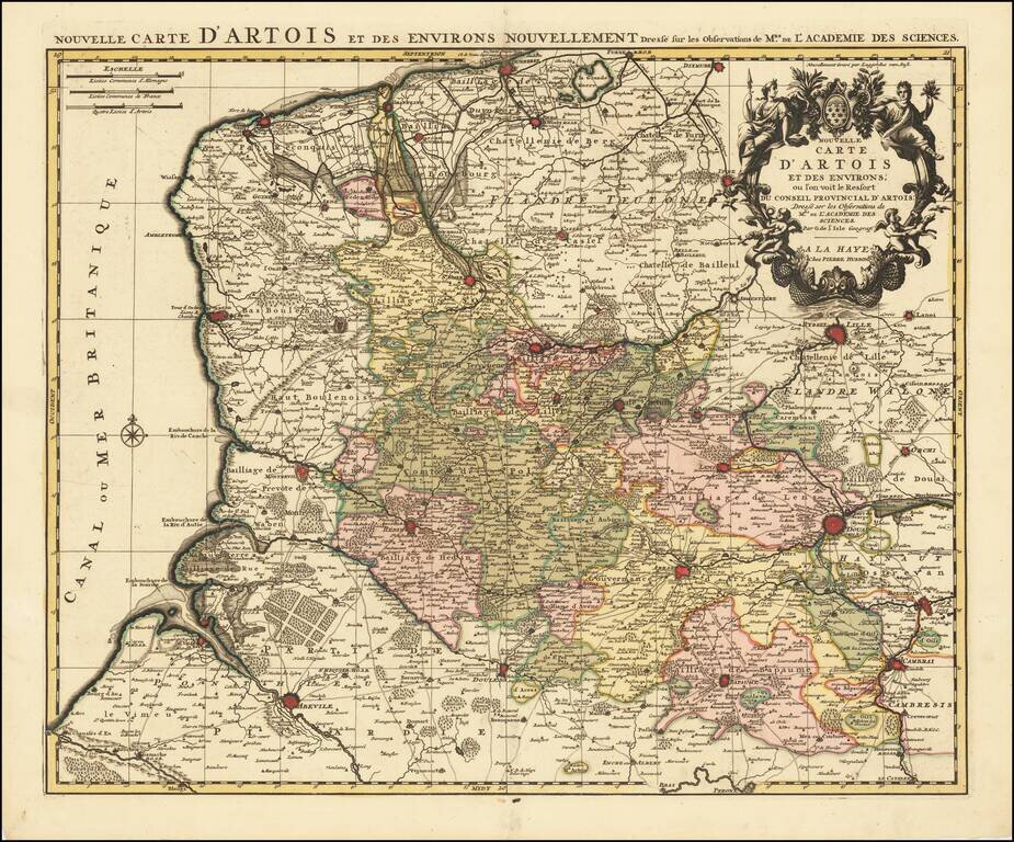
Fine example of Pierre Husson's rare maps of the Artois region of Northern France. Pierre Husson was a publisher in Den Haag. His maps tend to be very rare on the market.
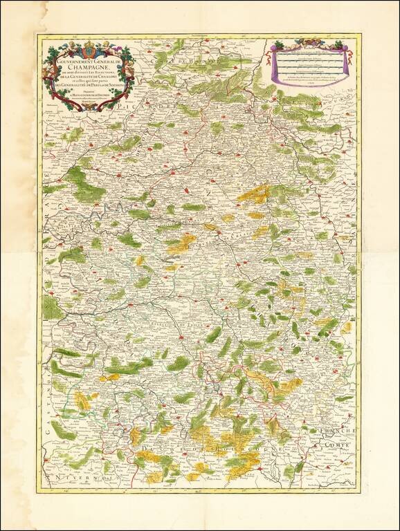
Striking old color example of this two sheet regional map of Champagne and neighboring regions. Extends south to Dijon, Semeur and Cosne, west to Melun, Lagny and Mondidier, north to Bavay and Chuyn and east to Arlon, Hatton Chastel, and Aigremont....
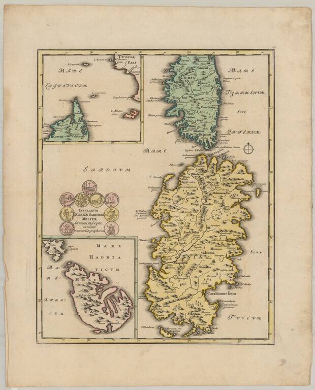
Decorative map of the islands of Corsica, Sardinia, and Malta.
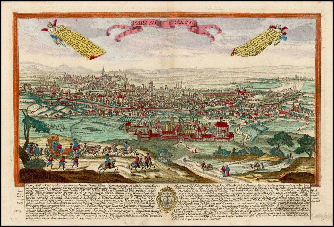
Finely engraved view of Paris, based upon a larger view by Jeremiah Wolff. Leopold's view of Paris was one of a rare series of views, published in Augsburg.
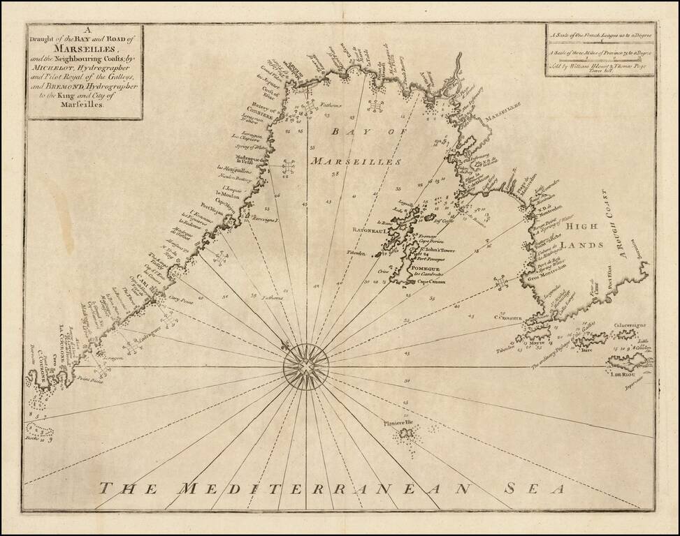
Striking chart of area around the Bay of Marseille, based the chart of the Marseilles region published in Henri Michelot and Laurent Bremond's Carte Generalle dele Mer Mediterranee. The map appeared in Mount & Page's English Pilot, Book III....
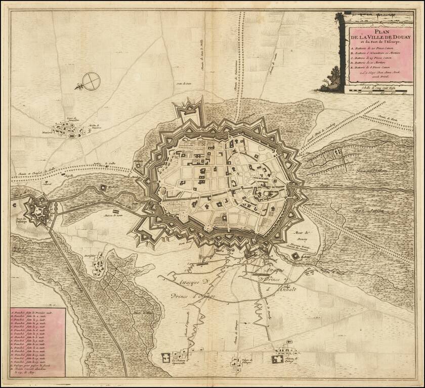
Striking example of Anna Beek's plan of Douay and the neighboring Fort D'Escape. The map focuses on the town fortifications and also includes details of the town plan, and neighboring fields and details.
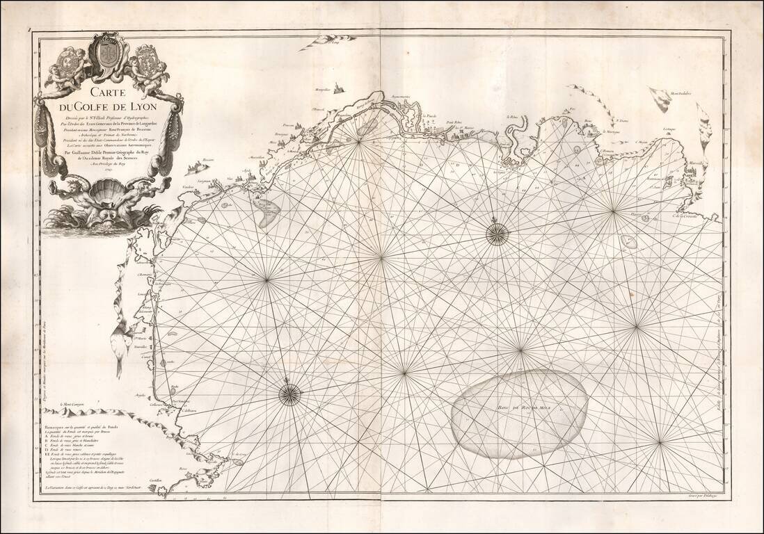
Very rare sea chart of the Gulf of Lyon, published in Paris by De L'Isle in 1725. The chart extends from Roses and the Spanish border in the southwest to Marseilles and Cassis in the northeast, centered on the area of Montpellier
![[Kehl, Riverfront Fortifications in 1726]](/map/small/59629.jpg)
Fortifying Kehl on the Rhine River Finely executed plan of the fortifications at Kehl by G. Drescheribe, Captain of the Artillery and Engineer, in 1726. The fortifications at Kehl were originally constructed by Vauban in 1688. Its strategic...
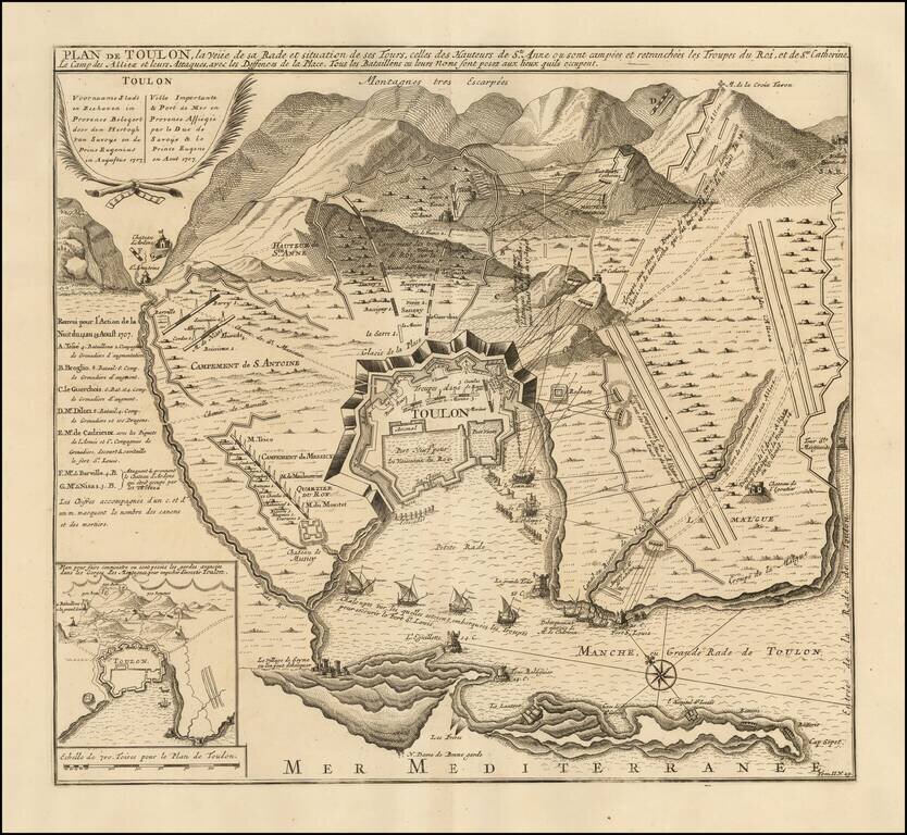
Fine battle plan of Toulon, showing the engagement at the Battle of Toulon in 1707. The map provides an exceptional overview of the engagement, showing fortifications, battery positions and the bombardments from the harbor by various named ships....
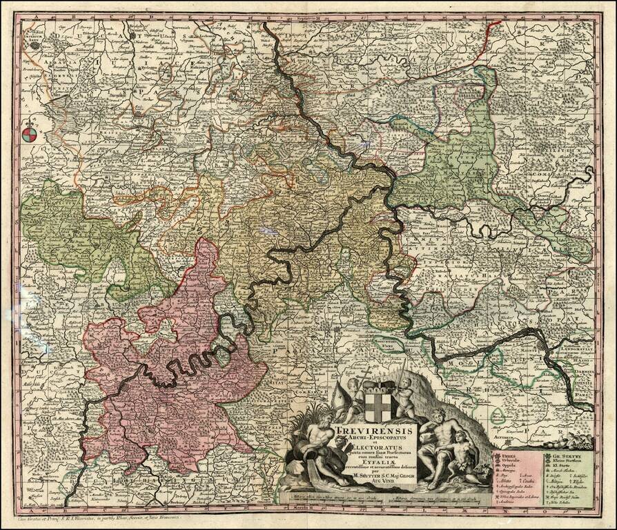
Decorative map of the Moselle & Rhine River Valleys. Includes a decorative cartouche.
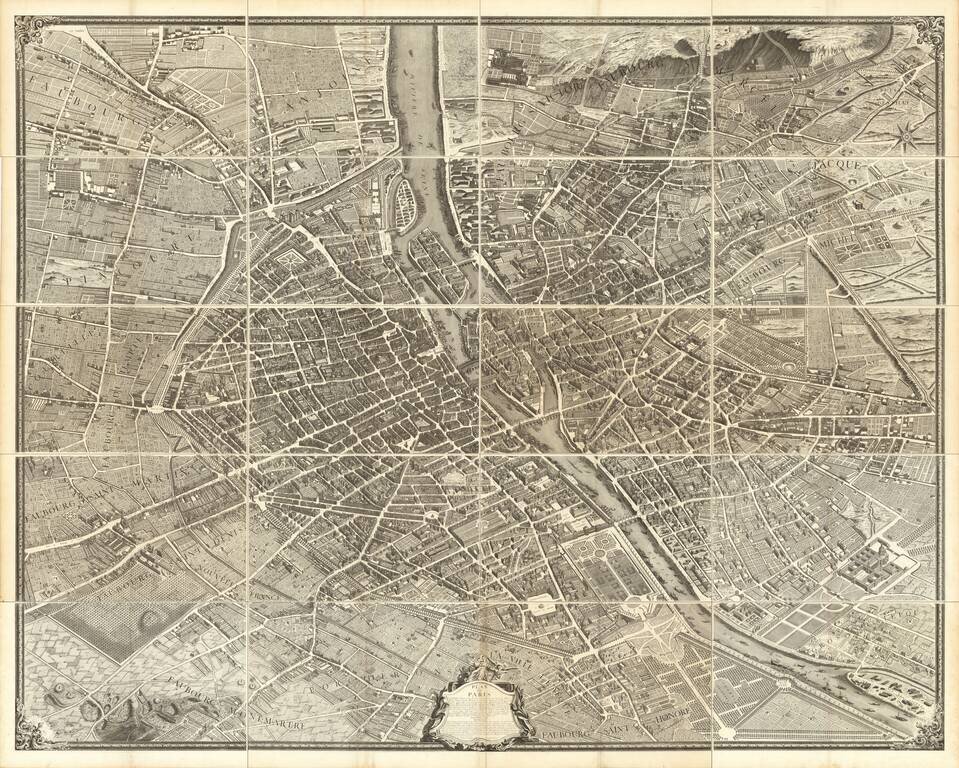
Turgot's Monumental View of Paris, Stretching to Over 10 Feet When Joined. This expansive engraved view of Paris covers the first eleven arrondissements of modern Paris. With a combined width of over ten feet, the joined plan makes for an arresting...
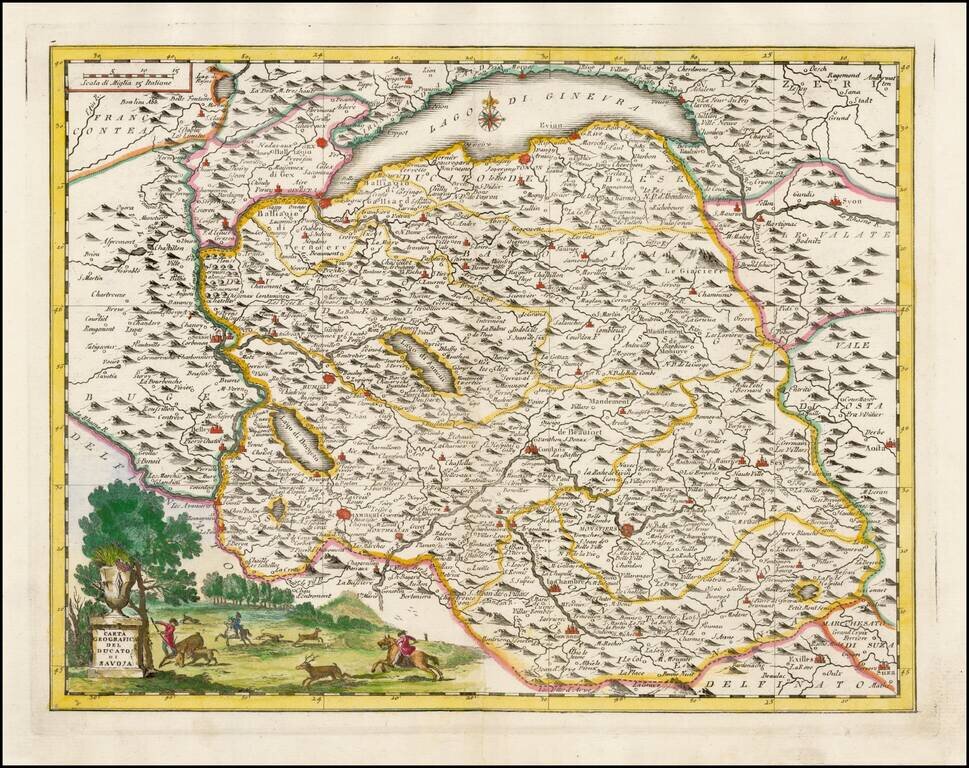
Striking map of the Duchy of Savoye, based upon De L'Ise's map. Includes a decorative cartouche and excellent geographical detail. Includes Lake Geneva. Albrizzi's maps are scarce and beautifully engraved.
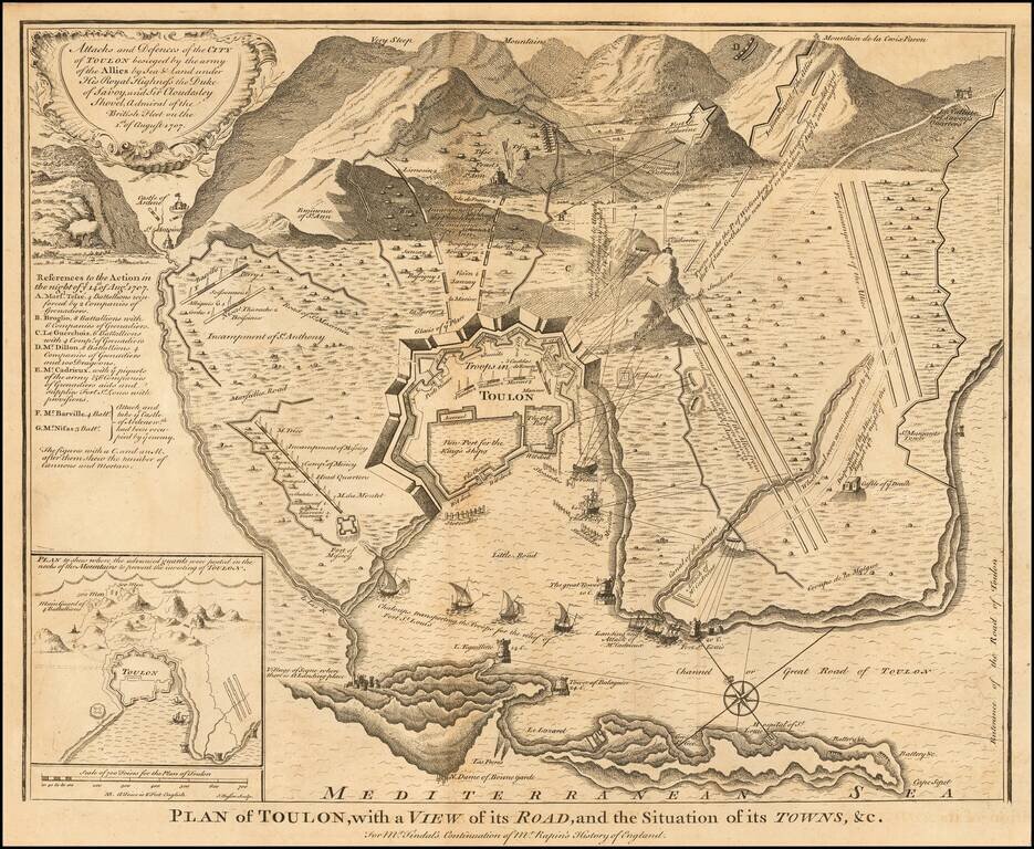
Detailed plan of Toulon, illustrating the fortifications of the town during the War of Spanish Succession. The map shows the action in Toulon the night of August 14, 1707. Siege of Toulon The Battle of Toulon was fought from 2 July 29 to August 21,...
![[Nice, Beaulieu-sur-Mer, Monaco] Carte Particuliere des Environs de Nice, et de Ville-Franche, depuis Ville-neuve en Provence, jusqu'a Monaco. Ou l'on voit la Marche des Armees de France et d'Espagne, leurs passage du Var, et les differentes attaques de](/map/small/62767op.jpg)
Rare map depicting the French Mediterranean coast from Monaco to Ville-neuve and centered on Nice and Beaulieu-sur-Mer, engraved by Guerard. The map illustrates the movements of the Spanish and French Armies during the War of Spanish Succession The...