logo

1640. Description Generalle du Pais et Viconte de Turenne, avec les confins des Provinces qui l'avoifinent Par Sr du Bac

  • Description Generalle du Pais et Viconte de Turenne, avec les confins des Provinces qui l'avoifinent Par Sr du Bac

Description Generalle du Pais et Viconte de Turenne, avec les confins des Provinces qui l'avoifinent Par Sr du Bac information:

Year of creation: 
Resolution size (pixels): 
 2176x1510 px
Disk Size: 
 1.00342MiB
Number of pages: 
 1
Place: 
 Paris
Author: 

Print information. Print size (Width x height in inches):
Printing at 72 dpi 
  30.22 х 20.97
Printing at 150 dpi 
 14.51 х 10.07
Printing at 300 dpi 
 7.25 х 5.03

An example of detailing the file of this map of in a printable high-resolution:

Click to open in high resolution (open in new tab).
Attention! this is just the central piece (central area 960x960 px) of the map file!
This is an example, so that you can see and study the level of detail of a given map. The entire Map will be fully available after payment!

Description Generalle du Pais et Viconte de Turenne, avec les confins des Provinces qui l'avoifinent Par Sr du Bac

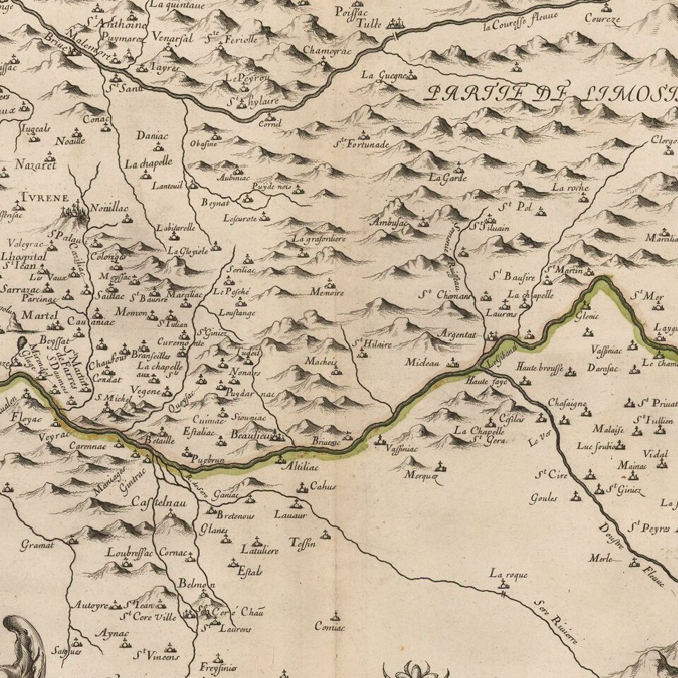
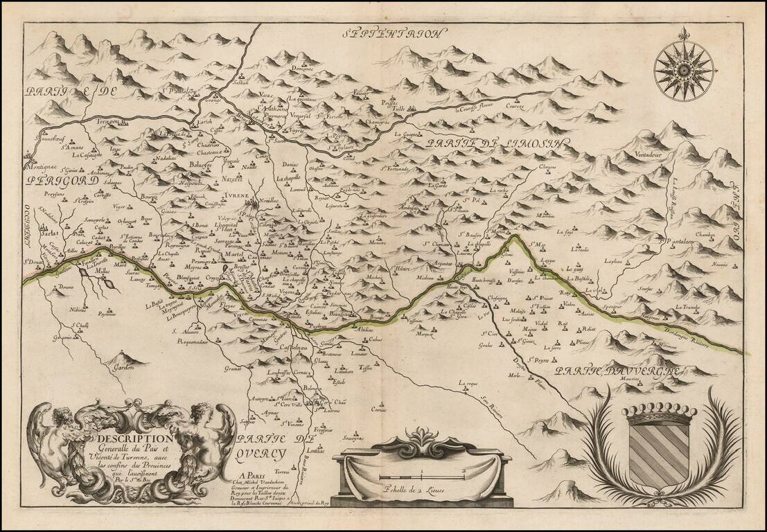
Rare map of the Dordogne River Valley and the Coureze River Valley, published in Paris by Michel Van Lochem.

The map is centered on the Turenne Region, Correze Department in the Limonsin region.


Special conditions for students!

If you are a student, write to us in telegram: @antiquemaps and indicate what material you need and for what work you need a map in high detail. We are ready to provide material on special terms. For students only!

Item information:

Year of creation:
Size:
2176x1510 px
Disk:
1.00342MiB
Number of pages:
1
Place:
Paris
Author:
Michel Van Lochem.
$9.99

Related item