
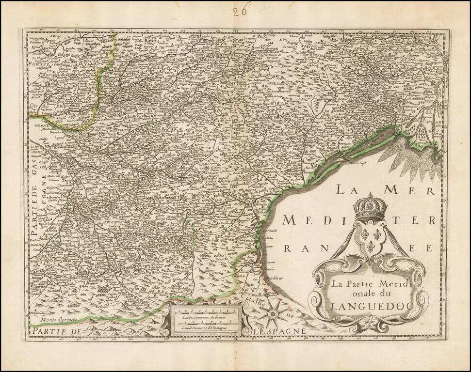
Unrecorded map of the southern part of Languedoc, based upon Henricus Hondius's map of the same region. Our research of the map turns up no source information. The example in the National Library of France is attributed to Hondius, but this is clearly...
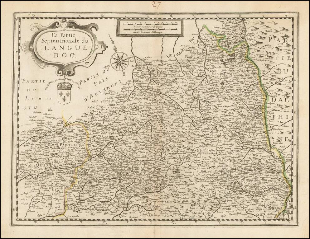
Unrecorded map of the northern part of Languedoc, based upon Henricus Hondius's map of the same region. Our research of the map turns up on source information. The example in the National Library of France is attributed to Hondius, but this is clearly...
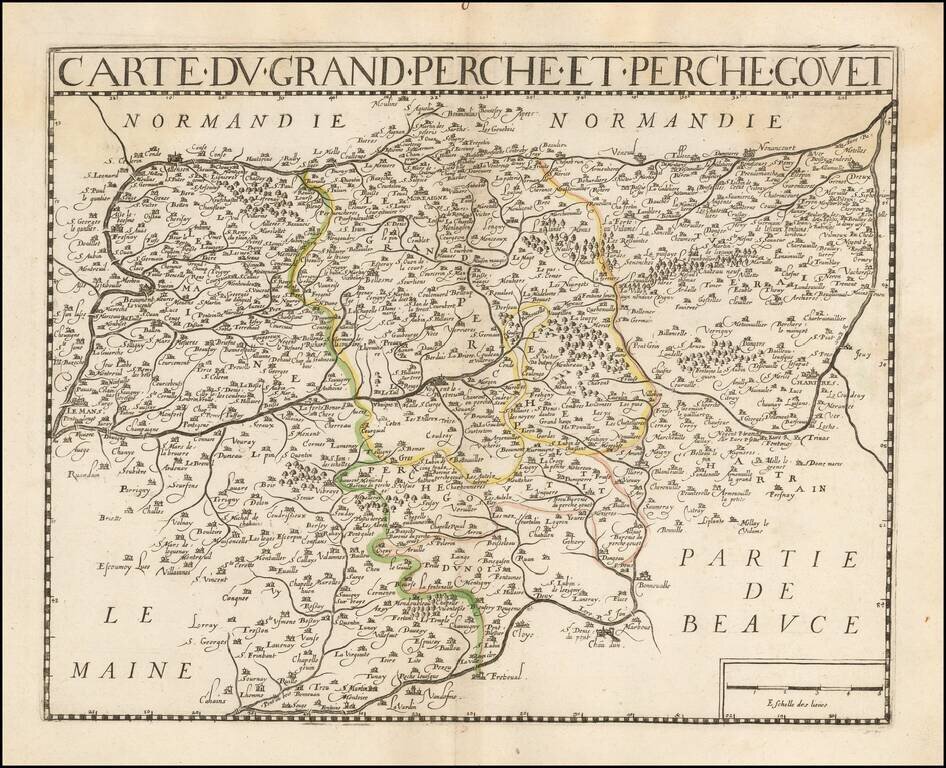
Attractive double-page engraved map of Perche, typifying local French cartography of the early-to-mid 17th century. The map is likely by or after Jean Le Clerc, comprising a later example (Note the removal of the cartouche in the lower left corner,...
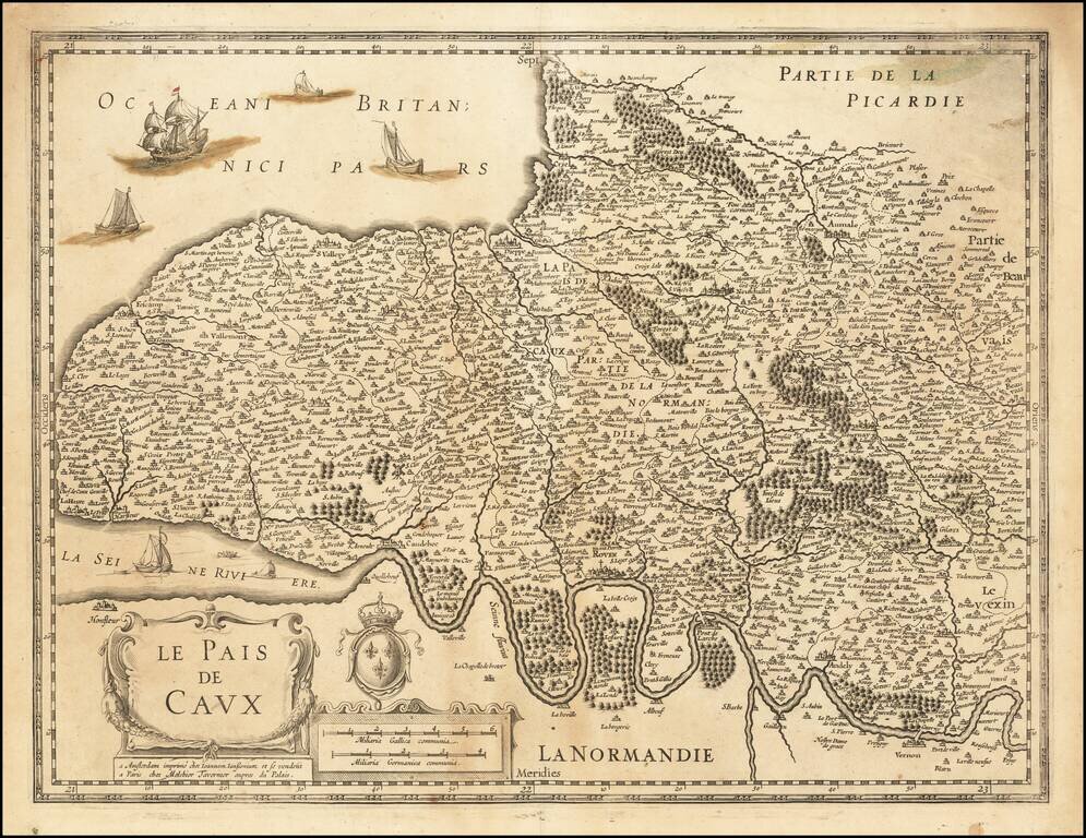
Detailed map of the region, which also bears the name of Melchior Tavernier, the Paris mapmaker and bookseller. Covers the region north of the Seine River to the Atlantic Coast. Include Dieppe, Aumale, Neuschastel, Rouen, etc,
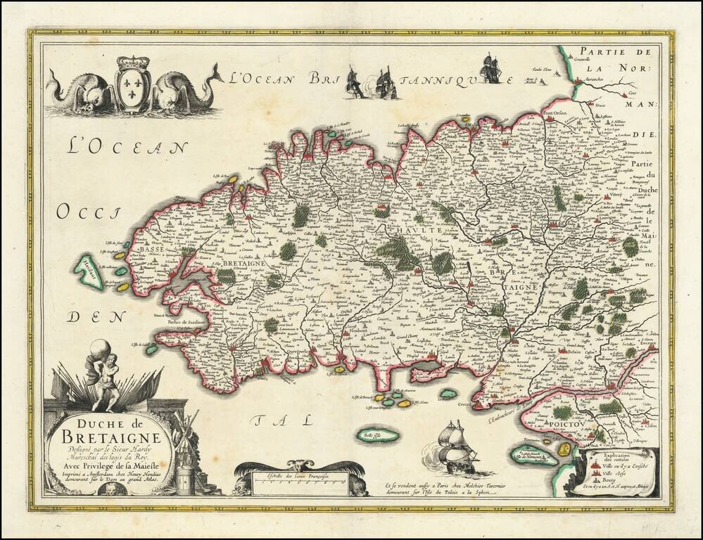
Detailed early map of Bretagne, sold in Paris by Melchior Tavernier.
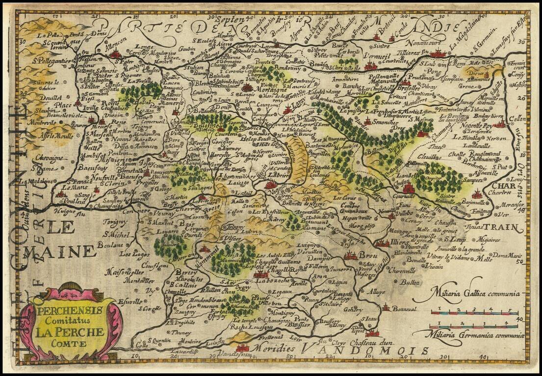
Antique engraved map of the Perche region of central northwestern France. This example comes from an English-language edition of the Mercator-Hondius miniature atlas.
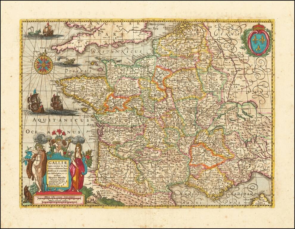
Early Dutch map of France, published in Amsterdam by Henricus Hondius. The map is finely engraved and embellished, including sailing ships, sea monsters, and an elaborate compass rose fill the sea. The royal armorial at upper right is balanced in the...
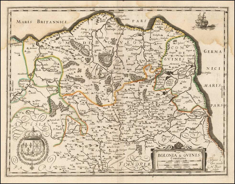
Jean Le Clerc's rare map of the Picardie, including Boulogne-sur-Mer and Calais, and Artois. The map can be found in very rare French composite atlases of the mid-17th century, and in Gabriel Michel de La Rochemaillet's Theatre geographique du...
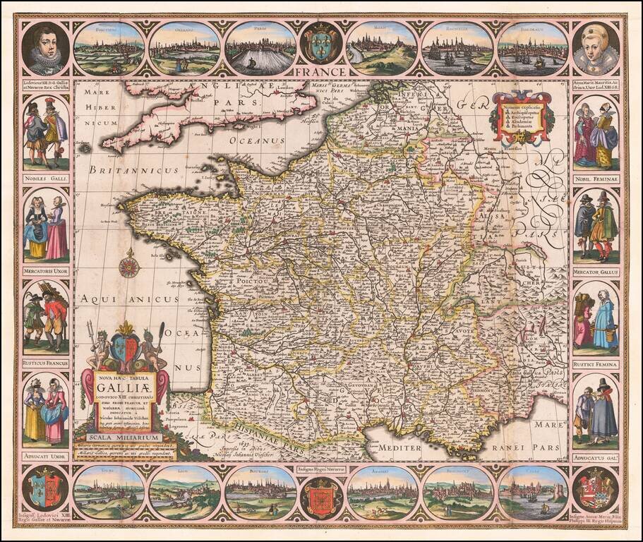
Carte-a-Figures Antique Map of France Highly decorative map of France, surrounded by vignettes of traditional French dress from the early 17th Century, with city views at the top and bottom. Decorative and detailed map of France by one of the best...
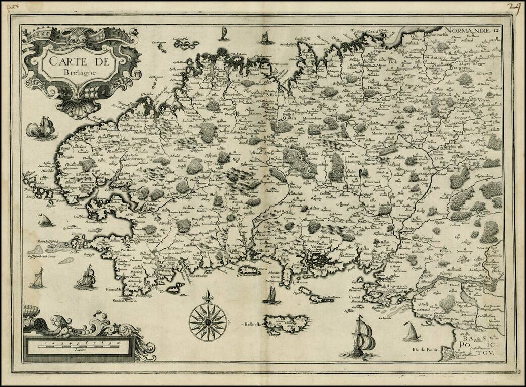
Attractive map of Bretagne, published by Tassin. The map shows sailing vessels in the Ocean and includes title in an ornamental cartouche on the upper left-hand corner.
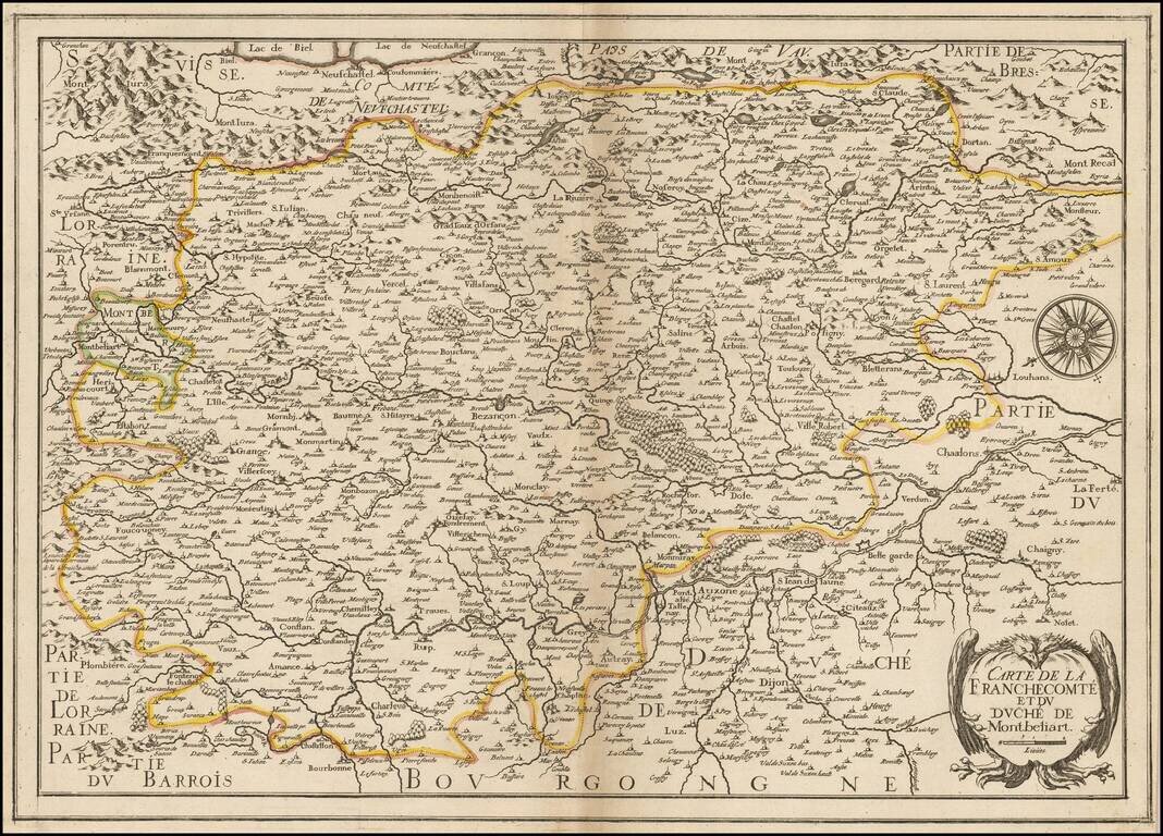
Rare map of Franche Comte and the region to the west of Lake Geneva and the Haute Jura Mountains, oriented with east at the top, published by Christopher Tassin in Paris. The map is centered on Bensancon and shows the Saone River from its source on the...
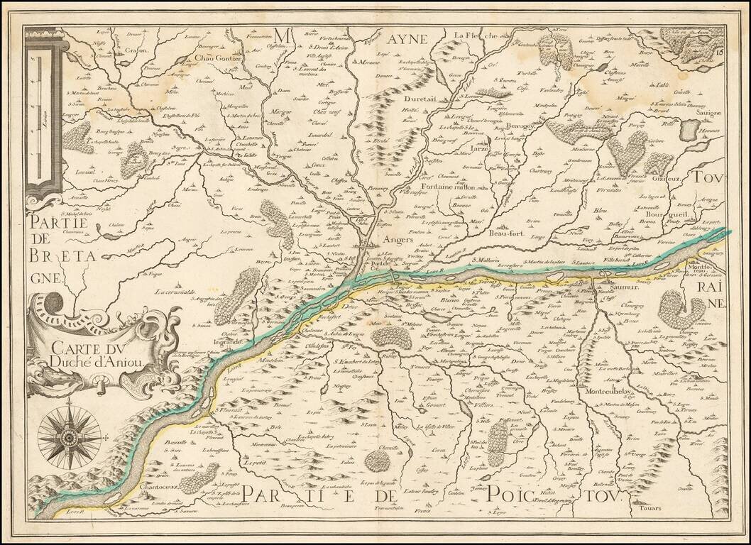
Rare map of the Duchy of Anjou, published in Paris by Tassin. The map is centered on the course of the Loire River.
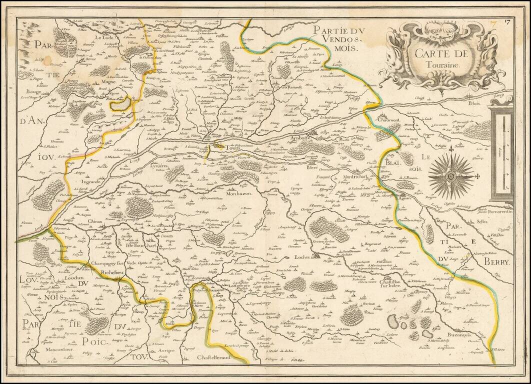
Rare map of the Province of Touraine, published in Paris by Tassin. The map is centered on Tours and the confluence of the Cher River and the Loire River.
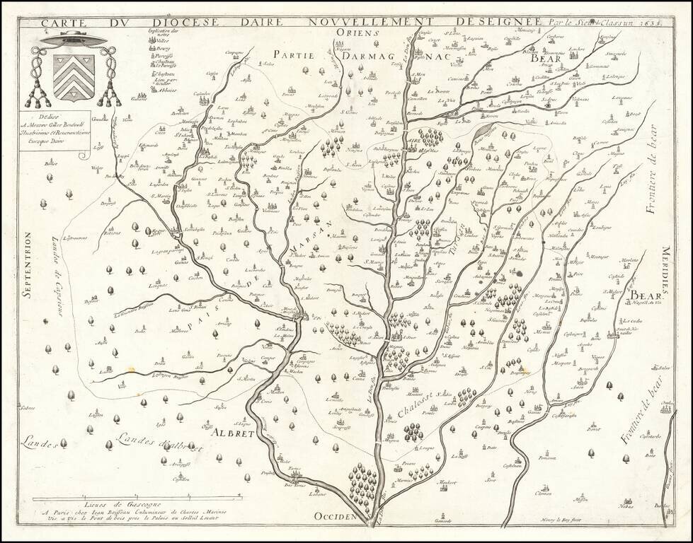
Jean Boisseau's First Map! Rare map of the Diocese of Aire, printed in Paris in 1635. The map is oriented with east at the top, breaking the course of the Leie River and its tributaries. All of Boisseau's maps are rare. As noted in Mapforum.com...
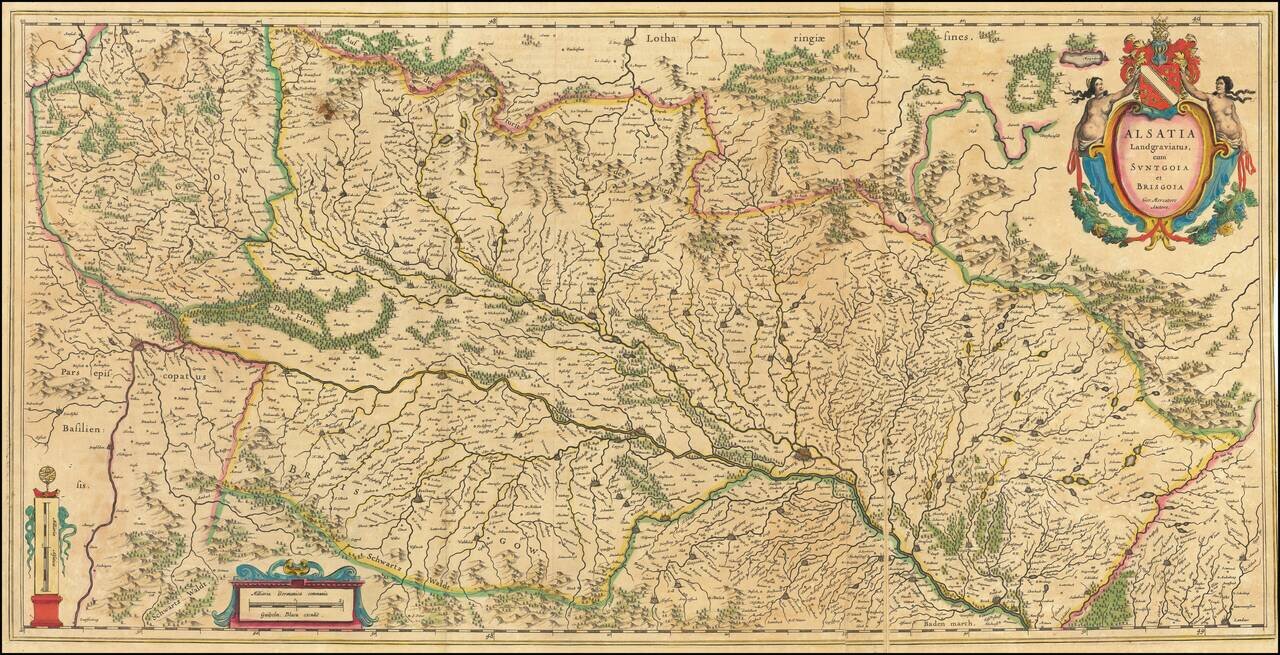
Large antique engraved map of the Alsace Region, focusing on the cities of Basel and Strasbourg. The map was published by Willem Janszoon Blaeu, based on a map by Gerard Mercator. This folding map is larger than the typical double-page folio map that...
![Territorium Argentoratense [engraved by Petrus Kaerius]](/map/small/12164.jpg)
Striking full color example of Jansson's map of the area around Strassbourg, with a plan of the town, decorative cartouche and two coats of arms. One of the view maps engraved by Petrus Kaerius (Peter Van Den Keere) to be offered by Jansson. French...